

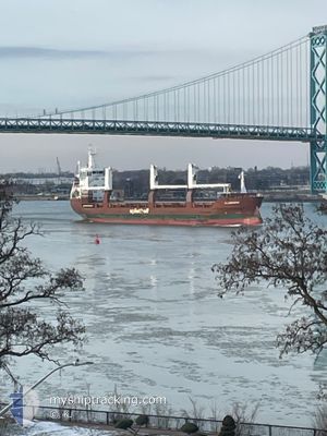
FLEVOGRACHT
General Cargo

Current Trip
| Time Travelled | 3 days |
|---|---|
| Remaining Time | --- |
| Distance Travelled | 1015.46 nm |
| Remaining Distance | --- |
| AVG Speed | 14.3 Knopen |
| MAX Speed | 18.1 Knopen |
| AVG Wind | 9.3 knots |
| MAX Wind | 20 knots |
| MIN Temp | 11.2°C / 52.16°F |
| MAX Temp | 18.7°C / 65.66°F |
| Diepgang | 5.5 M |
| Positie ontvangen | 13 m geleden |
Current Position
| Lengtegraad | --- |
|---|---|
| Breedtegraat | --- |
| Status | Under way using engine |
| Snelheid | 14.7 Knopen |
| Koers | 60.2° |
| Gebied | Aegean Sea |
| Station | T-AIS |
| Positie ontvangen | 13 m geleden |
Information
The current position of FLEVOGRACHT is in Aegean Sea with coordinates 36.88618° / 27.03377° as reported on 2025-03-28 03:16 by AIS to our vessel tracker app. The vessel's current speed is 14.7 Knopen and is heading at the port of GULLUK. The estimated time of arrival as calculated by MyShipTracking vessel tracking app is 2025-03-28 07:00 LT
The vessel FLEVOGRACHT (IMO: 9509956, MMSI: 246620000) is a General Cargo that was built in 2011 ( 14 Jaar oud ). It's sailing under the flag of [NL] Netherlands.
In this page you can find informations about the vessels current position, last detected port calls, and current voyage information. If the vessels is not in coverage by AIS you will find the latest position.
The current position of FLEVOGRACHT is detected by our AIS receivers and we are not responsible for the reliability of the data. The last position was recorded while the vessel was in Coverage by the Ais receivers of our vessel tracking app.
The current draught of FLEVOGRACHT as reported by AIS is 5.5 meters
Weather
| Temperature | 17.2°C / 62.96°F |
|---|---|
| Wind Speed | 20 knots |
| Direction | 174° S |
| Pressure | 1002.7 hPa |
| Humidity | 84.7 % |
| Cloud Coverage | 89 % |


Featured Company
Last Port Calls
| Port | Arrival | Departure | Time In Port |
|---|---|---|---|
| 2025-03-23 00:45 | 2025-03-25 03:10 | 2 d | |
| 2025-03-20 23:32 | 2025-03-22 17:06 | 1 d | |
| 2025-03-06 06:14 | 2025-03-07 21:12 | 1 d | |
| 2025-03-01 09:53 | 2025-03-03 14:53 | 2 d | |
| 2025-02-22 08:05 | 2025-02-28 12:21 | 6 d | |
| 2025-02-18 18:29 | 2025-02-21 16:17 | 2 d | |
| 2025-01-23 19:26 | 2025-01-25 22:10 | 2 d | |
| 2025-01-13 23:33 | 2025-01-14 11:33 | 12 h | |
| 2025-01-09 05:51 | 2025-01-12 20:34 | 3 d |
Most Visited Ports (Last year)
| Port | Arrivals | |
|---|---|---|
| 4 | ||
| 4 | ||
| 2 | ||
| 2 | ||
| 2 | ||
| 2 |
Last Trips
| Origin | Departure | Destination | Arrival | Distance | |
|---|---|---|---|---|---|
| 2025-03-22 18:06 | 2025-03-23 01:45 | 84.35 nm | |||
| 2025-03-07 22:12 | 2025-03-21 00:32 | 3340.54 nm | |||
| 2025-03-03 16:53 | 2025-03-06 07:14 | 748.79 nm | |||
| 2025-02-28 13:21 | 2025-03-01 11:53 | 289.75 nm | |||
| 2025-02-21 18:17 | 2025-02-22 09:05 | 131.51 nm | |||
| 2025-01-25 19:10 | 2025-02-18 20:29 | 5974.49 nm | |||
| 2025-01-14 11:33 | 2025-01-23 16:26 | 2949.17 nm | |||
| 2025-01-12 21:34 | 2025-01-13 23:33 | 351.28 nm | |||
| 2024-12-23 16:24 | 2025-01-09 06:51 | 3200.33 nm |
Events
| Tijd | Evenement | Details | Positie / Bestemming | Info |
|---|---|---|---|---|
| 2025-03-27 15:48 | Wijzig zee gebeid | Greek part of the Aegean Sea Greek part of the Ionian Sea |
36.42695 / 23.69295
Aegean Sea
TRGUL
|
Snelheid: 14.2 kn Koers: 83.1° |
| 2025-03-27 15:48 | Status Changed | Under way using engine Default |
36.42695 / 23.69295
TRGUL
|
Snelheid: 14.2 kn Koers: 84° |
| 2025-03-27 15:48 | Binnenbereik |
36.42695 / 23.69295
Aegean Sea
TRGUL
|
Snelheid: 14.2 kn Koers: 83.1° |
|
| 2025-03-27 00:38 | Status Changed | Default Under way using engine |
36.94649 / 19.53282
TRGUL
|
Snelheid: 13.4 kn Koers: 107.9° |
| 2025-03-27 00:26 | Buitenbereik |
36.96084 / 19.48063
Ionian Sea
TRGUL
|
Snelheid: 13.4 kn Koers: 107.9° |
|
| 2025-03-27 00:22 | Status Changed | Under way using engine Default |
36.96561 / 19.46277
TRGUL
|
Snelheid: 13 kn Koers: 106° |
| 2025-03-27 00:06 | Status Changed | Default Under way using engine |
36.98405 / 19.39138
TRGUL
|
Snelheid: 12.8 kn Koers: 107.8° |
| 2025-03-26 23:44 | Status Changed | Under way using engine Default |
37.00786 / 19.29867
TRGUL
|
Snelheid: 12.5 kn Koers: 107° |
| 2025-03-26 23:19 | Status Changed | Default Under way using engine |
37.03339 / 19.19485
TRGUL
|
Snelheid: 12 kn Koers: 106.8° |
| 2025-03-26 21:33 | Status Changed | Under way using engine Default |
37.13420 / 18.78298
TRGUL
|
Snelheid: 11.3 kn Koers: 108° |