
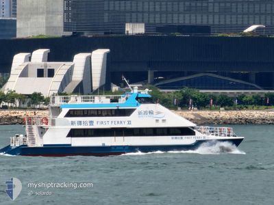
FIRST FERRY XI
High speed craft
Current Trip
HKG
| Time Travelled | 16 h, 31 mins |
|---|---|
| Remaining Time | --- |
| Distance Travelled | 75.21 nm |
| Remaining Distance | --- |
| AVG Speed | 16.7 Knopen |
| MAX Speed | 16.7 Knopen |
| AVG Wind | 9.1 knots |
| MAX Wind | 18.8 knots |
| MIN Temp | 20.2°C / 68.36°F |
| MAX Temp | 21.7°C / 71.06°F |
| Diepgang | 2.2 M |
| Positie ontvangen | 1 h, 32 m geleden |
Current Position
| Lengtegraad | --- |
|---|---|
| Breedtegraat | --- |
| Status | Under way using engine |
| Snelheid | 23.1 Knopen |
| Koers | 21.5° |
| Gebied | South China Sea |
| Station | T-AIS |
| Positie ontvangen | 1 h, 32 m geleden |
Info
Information
The current position of FIRST FERRY XI is in South China Sea with coordinates 22.27520° / 114.03112° as reported on 2025-12-08 15:35 by AIS to our vessel tracker app. The vessel's current speed is 23.1 Knopen
The vessel FIRST FERRY XI (MMSI: 477995033) is a High speed craft It's sailing under the flag of [HK] Hong Kong.
In this page you can find informations about the vessels current position, last detected port calls, and current voyage information. If the vessels is not in coverage by AIS you will find the latest position.
The current position of FIRST FERRY XI is detected by our AIS receivers and we are not responsible for the reliability of the data. The last position was recorded while the vessel was in Coverage by the Ais receivers of our vessel tracking app.
The current draught of FIRST FERRY XI as reported by AIS is 2.2 meters
Weather
| Temperature | 20.2°C / 68.36°F |
|---|---|
| Wind Speed | 17 knots |
| Direction | 81° E |
| Pressure | 1020.3 hPa |
| Humidity | 77.7 % |
| Cloud Coverage | 2 % |
Featured Company
Last Port Calls
| Port | Arrival | Departure | Time In Port |
|---|---|---|---|
| 2025-12-08 08:13 | 2025-12-08 08:37 | 24 m | |
| 2025-12-08 06:15 | 2025-12-08 07:02 | 47 m | |
| 2025-12-07 06:40 | 2025-12-07 08:52 | 2 h | |
| 2025-12-07 04:02 | 2025-12-07 04:26 | 23 m | |
| 2025-12-07 02:44 | 2025-12-07 03:11 | 27 m | |
| 2025-12-06 12:32 | 2025-12-07 01:42 | 13 h | |
| 2025-12-06 10:23 | 2025-12-06 11:21 | 57 m | |
| 2025-12-06 08:36 | 2025-12-06 09:12 | 35 m | |
| 2025-12-06 06:41 | 2025-12-06 07:33 | 52 m | |
| 2025-12-06 04:02 | 2025-12-06 04:26 | 23 m |
Most Visited Ports (Last year)
| Port | Arrivals | |
|---|---|---|
| 367 |
Last Trips
| Origin | Departure | Destination | Arrival | Distance | |
|---|---|---|---|---|---|
| 2025-12-08 07:02 | 2025-12-08 08:13 | 14.50 nm | |||
| 2025-12-07 08:52 | 2025-12-08 06:15 | 79.73 nm | |||
| 2025-12-07 04:26 | 2025-12-07 06:40 | 19.45 nm | |||
| 2025-12-07 03:11 | 2025-12-07 04:02 | 12.73 nm | |||
| 2025-12-07 01:42 | 2025-12-07 02:44 | 16.86 nm | |||
| 2025-12-06 11:21 | 2025-12-06 12:32 | 14.71 nm | |||
| 2025-12-06 09:12 | 2025-12-06 10:23 | 14.49 nm | |||
| 2025-12-06 07:33 | 2025-12-06 08:36 | 15.73 nm | |||
| 2025-12-06 04:26 | 2025-12-06 06:41 | 20.28 nm | |||
| 2025-12-06 03:12 | 2025-12-06 04:02 | 15.73 nm |
Events
| Tijd | Evenement | Details | Positie / Bestemming | Info |
|---|---|---|---|---|
| 2025-12-08 16:06 | Stop beweging | 4.21 nm, South East of CHEK LAP KOK |
22.26531 / 114.00237
HKG
|
Snelheid: Koers: -1° |
| 2025-12-08 15:57 | Start beweging | 5.33 nm, South East of CHEK LAP KOK |
22.26251 / 114.02468
HKG
|
Snelheid: 15.6 kn Koers: 235° |
| 2025-12-08 15:40 | Status Changed | Default Under way using engine |
22.28440 / 114.03714
HKG
|
Snelheid: 23.1 kn Koers: 21.5° |
| 2025-12-08 15:40 | Stop beweging | 5.47 nm, East of CHEK LAP KOK |
22.28440 / 114.03714
HKG
|
Snelheid: 0.3 kn Koers: -1° |
| 2025-12-08 15:35 | Buitenbereik |
22.27520 / 114.03112
South China Sea
|
Snelheid: 23.1 kn Koers: 21.5° |
|
| 2025-12-08 15:34 | Status Changed | Under way using engine Default |
22.26703 / 114.02745
HKG
|
Snelheid: 22.7 kn Koers: 75° |
| 2025-12-08 15:33 | Start beweging | 5.19 nm, South East of CHEK LAP KOK |
22.26104 / 114.02064
HKG
|
Snelheid: 22.7 kn Koers: 75° |
| 2025-12-08 15:24 | Stop beweging | 4.23 nm, South East of CHEK LAP KOK |
22.26493 / 114.00246
HKG
|
Snelheid: Koers: -1° |
| 2025-12-08 15:19 | Status Changed | Default Under way using engine |
22.26480 / 114.00288
HKG
|
Snelheid: 14.7 kn Koers: 305.9° |
| 2025-12-08 15:16 | Status Changed | Under way using engine Default |
22.26269 / 114.01106
HKG
|
Snelheid: 22.5 kn Koers: 54° |