

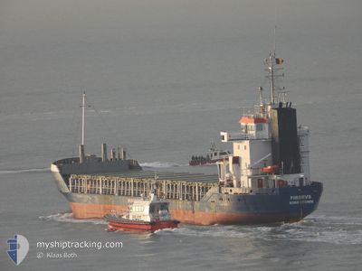
FIRDEVS
General Cargo

Current Trip
| Trip Time | 8 days |
|---|---|
| Trip Distance | 1417.23 nm |
| AVG Speed | 9.1 Knopen |
| MAX Speed | 10.4 Knopen |
| Diepgang | 5.5 M |
| AVG Wind | 17.1 knots |
| MAX Wind | 38 knots |
| MIN Temp | 9°C / 48.2°F |
| MAX Temp | 23.6°C / 74.48°F |
| Positie ontvangen | 1 d geleden |
Current Position
| Lengtegraad | --- |
|---|---|
| Breedtegraat | --- |
| Status | At anchor |
| Snelheid | 0.8 Knopen |
| Koers | 203° |
| Gebied | Adriatic Sea |
| Station | T-AIS |
| Positie ontvangen | 1 d geleden |
Information
The current position of FIRDEVS is in Adriatic Sea with coordinates 44.50473° / 12.47335° as reported on 2025-03-25 04:56 by AIS to our vessel tracker app. The vessel's current speed is 0.8 Knopen and is currently inside the port of RAVENNA.
The vessel FIRDEVS (IMO: 9100140, MMSI: 376386000) is a General Cargo that was built in 1994 ( 31 Jaar oud ). It's sailing under the flag of [VC] St Vincent Grenadines.
In this page you can find informations about the vessels current position, last detected port calls, and current voyage information. If the vessels is not in coverage by AIS you will find the latest position.
The current position of FIRDEVS is detected by our AIS receivers and we are not responsible for the reliability of the data. The last position was recorded while the vessel was in Coverage by the Ais receivers of our vessel tracking app.
The current draught of FIRDEVS as reported by AIS is 5.5 meters
Weather
| Temperature | 12.8°C / 55.04°F |
|---|---|
| Wind Speed | 2 knots |
| Direction | 351° N |
| Pressure | 1012.2 hPa |
| Humidity | 73.3 % |
| Cloud Coverage | 59 % |


Featured Company
Last Port Calls
| Port | Arrival | Departure | Time In Port |
|---|---|---|---|
| 2025-03-25 08:26 | |||
| 2025-03-12 21:26 | 2025-03-16 10:46 | 3 d | |
| 2025-03-08 09:15 | 2025-03-11 16:30 | 3 d | |
| 2025-02-26 15:29 | 2025-02-28 20:20 | 2 d | |
| 2025-02-12 10:53 | 2025-02-19 11:46 | 7 d | |
| 2025-01-31 14:44 | 2025-02-03 19:36 | 3 d | |
| 2025-01-19 15:21 | 2025-01-21 14:52 | 1 d | |
| 2025-01-08 23:09 | 2025-01-12 11:33 | 3 d |
Last Trips
| Origin | Departure | Destination | Arrival | Distance | |
|---|---|---|---|---|---|
| 2025-03-16 10:46 | 2025-03-25 08:26 | 1417.23 nm | |||
| 2025-03-11 16:30 | 2025-03-12 21:26 | 252.44 nm | |||
| 2025-02-28 20:20 | 2025-03-08 09:15 | 305.40 nm | |||
| 2025-02-19 11:46 | 2025-02-26 15:29 | 1258.15 nm | |||
| 2025-02-03 19:36 | 2025-02-12 10:53 | 70.31 nm | |||
| 2025-01-21 14:52 | 2025-01-31 14:44 | 1363.66 nm | |||
| 2025-01-12 11:33 | 2025-01-19 15:21 | 236.48 nm | |||
| 2024-12-26 21:47 | 2025-01-08 23:09 | 2638.15 nm |
Events
| Tijd | Evenement | Details | Positie / Bestemming | Info |
|---|---|---|---|---|
| 2025-03-25 08:09 | Stop beweging |
44.45712 / 12.24957
[IT] RAVENNA
|
Snelheid: Koers: 199° |
|
| 2025-03-25 07:26 | Aankomsthaven |
|
44.49572 / 12.30774
[IT] RAVENNA
|
Snelheid: 7 kn Koers: 252° |
| 2025-03-25 06:09 | Start beweging | 8.27 nm, East of MARINA ROMEA |
44.50226 / 12.46678
ITRAN
|
Snelheid: 6.3 kn Koers: 259° |
| 2025-03-25 05:08 | Status Changed | Default At anchor |
44.50461 / 12.47391
ITRAN
|
Snelheid: 0.8 kn Koers: 203° |
| 2025-03-25 04:56 | Buitenbereik |
44.50473 / 12.47335
Adriatic Sea
|
Snelheid: 0.8 kn Koers: 201.4° |
|
| 2025-03-25 04:47 | Status Changed | At anchor Default |
44.50473 / 12.47316
ITRAN
|
Snelheid: 0.3 kn Koers: 188° |
| 2025-03-25 04:35 | Status Changed | Default At anchor |
44.50478 / 12.47252
ITRAN
|
Snelheid: 0.2 kn Koers: 146° |
| 2025-03-25 04:32 | Status Changed | At anchor Default |
44.50472 / 12.47219
ITRAN
|
Snelheid: 0.3 kn Koers: 140° |
| 2025-03-25 04:29 | Status Changed | Default At anchor |
44.50454 / 12.47204
ITRAN
|
Snelheid: 0.2 kn Koers: 131° |
| 2025-03-25 04:23 | Status Changed | At anchor Default |
44.50425 / 12.47192
ITRAN
|
Snelheid: 0.1 kn Koers: 117° |