
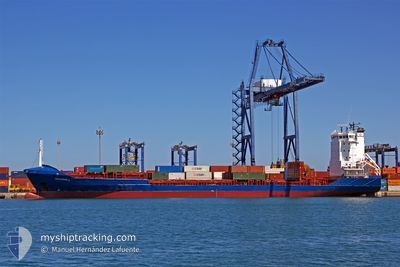
FESCO NOVIK
Container Ship
Current Trip
| Time Travelled | 5 days |
|---|---|
| Remaining Time | --- |
| Distance Travelled | 1499.97 nm |
| Remaining Distance | --- |
| AVG Speed | 12.9 Knopen |
| MAX Speed | 16 Knopen |
| AVG Wind | 12 knots |
| MAX Wind | 23 knots |
| MIN Temp | -16.4°C / 2.48°F |
| MAX Temp | 1.8°C / 35.24°F |
| Diepgang | 7.2 M |
| Positie ontvangen | 3 d geleden |
Current Position
| Lengtegraad | --- |
|---|---|
| Breedtegraat | --- |
| Status | Under way using engine |
| Snelheid | 12.6 Knopen |
| Koers | 86.4° |
| Gebied | North Pacific Ocean |
| Station | T-AIS |
| Positie ontvangen | 3 d geleden |
Information
The current position of FESCO NOVIK is in North Pacific Ocean with coordinates 41.67302° / 141.74264° as reported on 2025-03-08 01:41 by AIS to our vessel tracker app. The vessel's current speed is 12.6 Knopen
The vessel FESCO NOVIK (IMO: 9296987, MMSI: 273329660) is a Container Ship that was built in 2004 ( 21 Jaar oud ). It's sailing under the flag of [RU] Russia.
In this page you can find informations about the vessels current position, last detected port calls, and current voyage information. If the vessels is not in coverage by AIS you will find the latest position.
The current position of FESCO NOVIK is detected by our AIS receivers and we are not responsible for the reliability of the data. The last position was recorded while the vessel was in Coverage by the Ais receivers of our vessel tracking app.
The current draught of FESCO NOVIK as reported by AIS is 7.2 meters
Weather
| Temperature | -17.5°C / 0.5°F |
|---|---|
| Wind Speed | 8 knots |
| Direction | 312° NW |
| Pressure | 1018.5 hPa |
| Humidity | 81.3 % |
| Cloud Coverage | 2 % |
Featured Company
Last Port Calls
| Port | Arrival | Departure | Time In Port |
|---|---|---|---|
| 2025-03-04 12:01 | 2025-03-06 13:33 | 2 d | |
| 2025-02-23 18:56 | 2025-02-25 23:32 | 2 d | |
| 2025-02-16 12:33 | 2025-02-18 11:29 | 1 d | |
| 2025-02-04 22:52 | 2025-02-07 02:45 | 2 d | |
| 2025-01-21 10:40 | 2025-01-24 01:09 | 2 d | |
| 2025-01-13 17:48 | 2025-01-15 10:40 | 1 d |
Most Visited Ports (Last year)
| Port | Arrivals | |
|---|---|---|
| 25 | ||
| 11 | ||
| 11 | ||
| 3 |
Last Trips
| Origin | Departure | Destination | Arrival | Distance | |
|---|---|---|---|---|---|
| 2025-02-26 11:32 | 2025-03-04 22:01 | 1588.20 nm | |||
| 2025-02-18 21:29 | 2025-02-24 06:56 | 1496.76 nm | |||
| 2025-02-07 14:45 | 2025-02-16 22:33 | 1365.30 nm | |||
| 2025-01-24 11:09 | 2025-02-05 10:52 | 1581.00 nm | |||
| 2025-01-15 22:40 | 2025-01-21 20:40 | 1361.40 nm | |||
| 2024-12-27 16:14 | 2025-01-14 05:48 | 2859.13 nm |
Events
| Tijd | Evenement | Details | Positie / Bestemming | Info |
|---|---|---|---|---|
| 2025-03-11 11:33 | Stop beweging | 1.59 nm, West of PETROPAVLOVSK |
53.01044 / 158.58658
RU VVO - RU PKC
|
Snelheid: Koers: 326° |
| 2025-03-08 01:46 | Status Changed | Default Under way using engine |
41.67411 / 141.76695
RU VVO - RU PKC
|
Snelheid: 12.6 kn Koers: 86.4° |
| 2025-03-08 01:41 | Buitenbereik |
41.67302 / 141.74264
North Pacific Ocean
RU VVO - RU PKC
|
Snelheid: 12.6 kn Koers: 86.4° |
|
| 2025-03-08 00:56 | Status Changed | Under way using engine Default |
41.65340 / 141.52132
RU VVO - RU PKC
|
Snelheid: 13.5 kn Koers: 92° |
| 2025-03-08 00:42 | Status Changed | Default Under way using engine |
41.65425 / 141.44864
RU VVO - RU PKC
|
Snelheid: 13.5 kn Koers: 85.3° |
| 2025-03-08 00:32 | Status Changed | Under way using engine Default |
41.65165 / 141.40090
RU VVO - RU PKC
|
Snelheid: 13.1 kn Koers: 85° |
| 2025-03-08 00:30 | Status Changed | Default Under way using engine |
41.65079 / 141.38863
RU VVO - RU PKC
|
Snelheid: 12.9 kn Koers: 86.8° |
| 2025-03-08 00:10 | Wijzig zee gebeid | Japanese part of the North Pacific Ocean Japanese part of the Japan Sea |
41.64529 / 141.29256
North Pacific Ocean
RU VVO - RU PKC
|
Snelheid: 13 kn Koers: 88.8° |
| 2025-03-07 22:12 | Draught Changed | 7.2 7.5 |
41.56209 / 140.76207
RU VVO - RU PKC
|
Snelheid: 13.9 kn Koers: 58.3° |
| 2025-03-07 22:12 | Destination Changed | RU VVO - RU PKC RU PKC - RU VVO |
41.56209 / 140.76207
RU VVO - RU PKC
|
Snelheid: 13.9 kn Koers: 58.3° |