
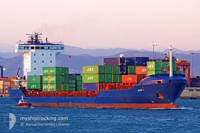
FESCO NAVARIN
Container Ship
Current Trip
| Time Travelled | 3 h, 4 mins |
|---|---|
| Remaining Time | --- |
| Distance Travelled | 3.18 nm |
| Remaining Distance | --- |
| AVG Speed | 10.2 Knopen |
| MAX Speed | 10.5 Knopen |
| AVG Wind | 4.6 knots |
| MAX Wind | 4.7 knots |
| MIN Temp | -2.3°C / 27.86°F |
| MAX Temp | -2.1°C / 28.22°F |
| Diepgang | 7 M |
| Positie ontvangen | 2 h, 36 m geleden |
Current Position
| Lengtegraad | --- |
|---|---|
| Breedtegraat | --- |
| Status | Under way using engine |
| Snelheid | 10.4 Knopen |
| Koers | 292.9° |
| Gebied | Gulf of Finland |
| Station | T-AIS |
| Positie ontvangen | 2 h, 36 m geleden |
Info
Information
The current position of FESCO NAVARIN is in Gulf of Finland with coordinates 59.91763° / 30.02085° as reported on 2025-03-17 21:38 by AIS to our vessel tracker app. The vessel's current speed is 10.4 Knopen
The vessel FESCO NAVARIN (IMO: 9296999, MMSI: 273343170) is a Container Ship that was built in 2004 ( 21 Jaar oud ). It's sailing under the flag of [RU] Russia.
In this page you can find informations about the vessels current position, last detected port calls, and current voyage information. If the vessels is not in coverage by AIS you will find the latest position.
The current position of FESCO NAVARIN is detected by our AIS receivers and we are not responsible for the reliability of the data. The last position was recorded while the vessel was in Coverage by the Ais receivers of our vessel tracking app.
The current draught of FESCO NAVARIN as reported by AIS is 7 meters
Weather
| Temperature | -2.5°C / 27.5°F |
|---|---|
| Wind Speed | 4 knots |
| Direction | 237° WSW |
| Pressure | 1010.2 hPa |
| Humidity | 97.3 % |
| Cloud Coverage | 100 % |
Featured Company
Last Port Calls
| Port | Arrival | Departure | Time In Port |
|---|---|---|---|
| 2025-03-17 07:33 | 2025-03-18 00:10 | 16 h | |
| 2025-03-11 12:36 | 2025-03-11 13:29 | 53 m | |
| 2025-03-10 10:38 | 2025-03-11 11:37 | 1 d | |
| 2025-03-06 23:33 | 2025-03-07 16:20 | 16 h | |
| 2025-03-06 16:43 | |||
| 2025-03-06 15:28 | |||
| 2025-03-04 13:21 | 2025-03-04 15:50 | 2 h | |
| 2025-03-02 06:17 | 2025-03-03 13:10 | 1 d | |
| 2025-02-26 20:37 | 2025-02-28 10:41 | 1 d | |
| 2025-02-24 00:10 |
Most Visited Ports (Last year)
| Port | Arrivals | |
|---|---|---|
| 36 | ||
| 35 | ||
| 9 | ||
| 1 | ||
| 1 | ||
| 1 |
Last Trips
| Origin | Departure | Destination | Arrival | Distance | |
|---|---|---|---|---|---|
| 2025-03-11 13:29 | 2025-03-17 07:33 | 1195.01 nm | |||
| 2025-03-11 11:37 | 2025-03-11 12:36 | 12.00 nm | |||
| 2025-03-07 16:20 | 2025-03-10 10:38 | 623.56 nm | |||
| 2025-03-06 15:28 | 2025-03-06 23:33 | 68.61 nm | |||
| 2025-03-04 15:50 | 2025-03-06 16:43 | 554.64 nm | |||
| 2025-03-03 13:10 | 2025-03-04 13:21 | 34.56 nm | |||
| 2025-02-28 10:41 | 2025-03-02 06:17 | 557.65 nm | |||
| 2025-02-24 00:10 | 2025-02-26 20:37 | 578.93 nm | |||
| 2025-02-17 15:00 | 2025-02-18 11:03 | 95.83 nm | |||
| 2025-02-14 23:33 | 2025-02-17 13:31 | 584.24 nm |
Events
| Tijd | Evenement | Details | Positie / Bestemming | Info |
|---|---|---|---|---|
| 2025-03-17 21:46 | Status Changed | Default Under way using engine |
59.92610 / 29.97759
RU BLT
|
Snelheid: 10.4 kn Koers: 292.9° |
| 2025-03-17 21:38 | Buitenbereik |
59.91763 / 30.02085
Gulf of Finland
RU BLT
|
Snelheid: 10.4 kn Koers: 292.9° |
|
| 2025-03-17 21:33 | Draught Changed | 7 6.4 |
59.91172 / 30.04903
RU BLT
|
Snelheid: 10.2 kn Koers: 298.4° |
| 2025-03-17 21:33 | Destination Changed | RU BLT RU LED |
59.91172 / 30.04903
RU BLT
|
Snelheid: 10.2 kn Koers: 298.4° |
| 2025-03-17 21:33 | ETA Changed | 2025/03/19 05:00 2025/03/17 01:00 |
59.91172 / 30.04903
RU BLT
|
Snelheid: 10.2 kn Koers: 298.4° |
| 2025-03-17 21:13 | Status Changed | Under way using engine Default |
59.89433 / 30.13559
RU LED
|
Snelheid: 6.3 kn Koers: 290° |
| 2025-03-17 21:13 | Binnenbereik |
59.89518 / 30.13090
Gulf of Finland
|
Snelheid: 7.2 kn Koers: 297° |
|
| 2025-03-17 21:10 | Vertrekhaven |
|
59.89228 / 30.14533
RU LED
|
Snelheid: 6.8 kn Koers: 291° |
| 2025-03-17 20:54 | Start beweging |
59.88105 / 30.19390
[RU] ST PETERSBURG
|
Snelheid: 4.7 kn Koers: 286° |
|
| 2025-03-17 15:02 | Stop beweging |
59.87903 / 30.20277
[RU] ST PETERSBURG
|
Snelheid: Koers: 315° |