
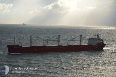
FEDERAL SATSUKI
Bulk Carrier
Current Trip
BRVDC
| Time Travelled | 3 days |
|---|---|
| Remaining Time | --- |
| Distance Travelled | 60.49 nm |
| Remaining Distance | --- |
| AVG Speed | 4.6 Knopen |
| MAX Speed | 8 Knopen |
| AVG Wind | 15.6 knots |
| MAX Wind | 28 knots |
| MIN Temp | -3.8°C / 25.16°F |
| MAX Temp | 3.2°C / 37.76°F |
| Diepgang | 6 M |
| Positie ontvangen | 2024-11-25 17:33 |
Current Position
| Lengtegraad | --- |
|---|---|
| Breedtegraat | --- |
| Status | Under way using engine |
| Snelheid | 14.2 Knopen |
| Koers | 219.1° |
| Gebied | North Atlantic Ocean |
| Station | T-AIS |
| Positie ontvangen | 2024-11-25 17:33 |
Info
Information
The current position of FEDERAL SATSUKI is in North Atlantic Ocean with coordinates 14.97505° / -34.68960° as reported on 2024-11-25 17:33 by AIS to our vessel tracker app. The vessel's current speed is 14.2 Knopen
The vessel FEDERAL SATSUKI (IMO: 9515101, MMSI: 538004642) is a Bulk Carrier that was built in 2012 ( 13 Jaar oud ). It's sailing under the flag of [MH] Marshall Is.
In this page you can find informations about the vessels current position, last detected port calls, and current voyage information. If the vessels is not in coverage by AIS you will find the latest position.
The current position of FEDERAL SATSUKI is detected by our AIS receivers and we are not responsible for the reliability of the data. The last position was recorded while the vessel was in Coverage by the Ais receivers of our vessel tracking app.
The current draught of FEDERAL SATSUKI as reported by AIS is 6 meters
Weather
| Temperature | -2.1°C / 28.22°F |
|---|---|
| Wind Speed | 22 knots |
| Direction | 201° SSW |
| Pressure | 984.6 hPa |
| Humidity | 91.6 % |
| Cloud Coverage | 100 % |
Featured Company
Last Port Calls
| Port | Arrival | Departure | Time In Port |
|---|---|---|---|
| 2024-12-27 20:20 | 2024-12-30 23:18 | 3 d | |
| 2024-12-23 13:00 | 2024-12-24 06:48 | 17 h | |
| 2024-12-17 18:43 | 2024-12-22 23:44 | 5 d | |
| 2024-11-29 19:36 | 2024-12-01 05:58 | 1 d | |
| 2024-11-13 14:33 | 2024-11-19 14:24 | 5 d | |
| 2024-11-01 12:38 | 2024-11-02 04:09 | 15 h |
Most Visited Ports (Last year)
| Port | Arrivals | |
|---|---|---|
| 6 | ||
| 2 | ||
| 2 | ||
| 1 | ||
| 1 | ||
| 1 |
Last Trips
| Origin | Departure | Destination | Arrival | Distance | |
|---|---|---|---|---|---|
| 2024-12-24 01:48 | 2024-12-27 15:20 | 116.44 nm | |||
| 2024-12-22 18:44 | 2024-12-23 08:00 | 19.73 nm | |||
| 2024-12-01 02:58 | 2024-12-17 13:43 | 3491.98 nm | |||
| 2024-11-19 14:24 | 2024-11-29 16:36 | 3358.94 nm | |||
| 2024-11-02 00:09 | 2024-11-13 14:33 | 2932.78 nm | |||
| 2024-10-30 22:24 | 2024-11-01 08:38 | 295.79 nm |
Events
| Tijd | Evenement | Details | Positie / Bestemming | Info |
|---|---|---|---|---|
| 2025-01-03 10:47 | Start beweging | 6.25 nm, East of PORT CARTIER |
50.01935 / -66.62300
BRVDC
|
Snelheid: 3.4 kn Koers: 45° |
| 2025-01-03 10:27 | Stop beweging | 5.89 nm, East of PORT CARTIER |
50.01599 / -66.63296
BRVDC
|
Snelheid: 0.2 kn Koers: 176° |
| 2025-01-03 07:35 | Start beweging | 8.38 nm, East of PORT CARTIER |
50.06641 / -66.57589
BRVDC
|
Snelheid: 3.6 kn Koers: 339° |
| 2025-01-02 23:27 | Stop beweging | 7.61 nm, East of PORT CARTIER |
50.02862 / -66.58748
BRVDC
|
Snelheid: 0.3 kn Koers: 88° |
| 2025-01-02 22:30 | Start beweging | 5.23 nm, East of PORT CARTIER |
50.03545 / -66.64945
BRVDC
|
Snelheid: 3.9 kn Koers: 92° |
| 2025-01-02 21:43 | Stop beweging | 4.81 nm, East of PORT CARTIER |
50.03521 / -66.66028
BRVDC
|
Snelheid: 0.3 kn Koers: 88° |
| 2025-01-02 21:11 | Start beweging | 3.83 nm, East of PORT CARTIER |
50.02885 / -66.68501
BRVDC
|
Snelheid: 3.1 kn Koers: 82° |
| 2025-01-02 13:55 | Stop beweging | 4.49 nm, East of PORT CARTIER |
50.03588 / -66.66861
BRVDC
|
Snelheid: 0.3 kn Koers: 90° |
| 2025-01-02 12:27 | Start beweging | 1.58 nm, East of PORT CARTIER |
50.01799 / -66.74619
BRVDC
|
Snelheid: 3.1 kn Koers: 75° |
| 2024-12-31 18:04 | Stop beweging | 1.49 nm, South East of PORT CARTIER |
50.01739 / -66.74915
BRVDC
|
Snelheid: 0.2 kn Koers: 75° |