
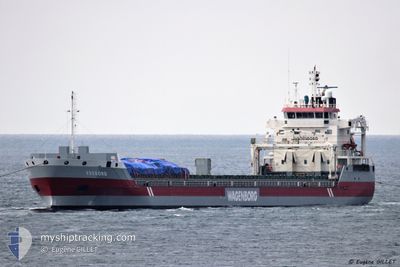
EXEBORG
General Cargo
Current Trip
| Time Travelled | 19 h, 44 mins |
|---|---|
| Remaining Time | 1 day |
| Distance Travelled | 149.75 nm |
| Remaining Distance | 441.28 nm |
| AVG Speed | 11.7 Knopen |
| MAX Speed | 13.2 Knopen |
| AVG Wind | 29.2 knots |
| MAX Wind | 38 knots |
| MIN Temp | 9.6°C / 49.28°F |
| MAX Temp | 13.9°C / 57.02°F |
| Diepgang | 5.1 M |
| Positie ontvangen | 5 h, 58 m geleden |
Current Position
| Lengtegraad | --- |
|---|---|
| Breedtegraat | --- |
| Status | Under way using engine |
| Snelheid | 11.8 Knopen |
| Koers | 217° |
| Gebied | Balearic Sea |
| Station | T-AIS |
| Positie ontvangen | 5 h, 58 m geleden |
Info
Information
The current position of EXEBORG is in Balearic Sea with coordinates 41.37083° / 3.27950° as reported on 2024-12-04 12:44 by AIS to our vessel tracker app. The vessel's current speed is 11.8 Knopen and is heading at the port of ALMERIA. The estimated time of arrival as calculated by MyShipTracking vessel tracking app is 2024-12-06 01:20 LT
The vessel EXEBORG (IMO: 9650482, MMSI: 244750716) is a General Cargo that was built in 2013 ( 11 Jaar oud ). It's sailing under the flag of [NL] Netherlands.
In this page you can find informations about the vessels current position, last detected port calls, and current voyage information. If the vessels is not in coverage by AIS you will find the latest position.
The current position of EXEBORG is detected by our AIS receivers and we are not responsible for the reliability of the data. The last position was recorded while the vessel was in Coverage by the Ais receivers of our vessel tracking app.
The current draught of EXEBORG as reported by AIS is 5.1 meters
Weather
| Temperature | 13.6°C / 56.48°F |
|---|---|
| Wind Speed | 7 knots |
| Direction | 348° NNW |
| Pressure | 1022 hPa |
| Humidity | 63.1 % |
| Cloud Coverage | 3 % |
Featured Company
Last Port Calls
| Port | Arrival | Departure | Time In Port |
|---|---|---|---|
| 2024-12-01 15:24 | 2024-12-03 22:59 | 2 d | |
| 2024-11-19 04:18 | 2024-11-21 00:24 | 1 d | |
| 2024-10-27 10:55 | 2024-10-27 12:21 | 1 h | |
| 2024-10-25 21:21 | 2024-10-25 21:58 | 37 m | |
| 2024-10-23 14:04 | 2024-10-23 15:04 | 59 m | |
| 2024-10-17 21:44 | 2024-10-22 04:59 | 4 d | |
| 2024-10-11 07:01 | 2024-10-11 07:44 | 43 m | |
| 2024-10-06 22:10 | 2024-10-09 23:17 | 3 d | |
| 2024-10-03 10:42 | 2024-10-04 22:19 | 1 d | |
| 2024-10-01 12:34 | 2024-10-03 02:27 | 1 d |
Last Trips
| Origin | Departure | Destination | Arrival | Distance | |
|---|---|---|---|---|---|
| 2024-11-21 01:24 | 2024-12-01 16:24 | 2432.65 nm | |||
| 2024-10-27 08:21 | 2024-11-19 05:18 | 4095.41 nm | |||
| 2024-10-25 17:58 | 2024-10-27 06:55 | 297.60 nm | |||
| 2024-10-23 11:04 | 2024-10-25 17:21 | 524.17 nm | |||
| 2024-10-21 23:59 | 2024-10-23 10:04 | 357.77 nm | |||
| 2024-10-11 03:44 | 2024-10-17 16:44 | 355.23 nm | |||
| 2024-10-09 18:17 | 2024-10-11 03:01 | 370.10 nm | |||
| 2024-10-04 18:19 | 2024-10-06 17:10 | 557.66 nm | |||
| 2024-10-02 22:27 | 2024-10-03 06:42 | 88.12 nm | |||
| 2024-09-30 12:58 | 2024-10-01 08:34 | 161.75 nm |
Events
| Tijd | Evenement | Details | Positie / Bestemming | Info |
|---|---|---|---|---|
| 2024-12-04 12:51 | Status Changed | Default Under way using engine |
41.35300 / 3.26117
ESLEI
|
Snelheid: 11.8 kn Koers: 217° |
| 2024-12-04 12:44 | Buitenbereik |
41.37083 / 3.27950
Balearic Sea
ESLEI
|
Snelheid: 11.8 kn Koers: 217° |
|
| 2024-12-04 12:42 | Status Changed | Under way using engine Default |
41.37717 / 3.28583
ESLEI
|
Snelheid: 11.9 kn Koers: 218° |
| 2024-12-04 12:36 | Status Changed | Default Under way using engine |
41.39183 / 3.30067
ESLEI
|
Snelheid: 11.8 kn Koers: 220° |
| 2024-12-04 11:52 | Wijzig zee gebeid | Spanish part of the Balearic Sea Spanish part of the Mediterranean Sea - Western Basin |
41.50467 / 3.43733
Balearic Sea
ESLEI
|
Snelheid: 12.8 kn Koers: 220° |
| 2024-12-04 09:20 | Gevonden in zee | Spanish part of the Mediterranean Sea - Western Basin |
41.92733 / 3.83067
Mediterranean Sea - Western Basin
ESLEI
|
Snelheid: 10.6 kn Koers: 219° |
| 2024-12-04 09:20 | Binnenbereik |
41.92733 / 3.83067
Mediterranean Sea - Western Basin
ESLEI
|
Snelheid: 10.6 kn Koers: 219° |
|
| 2024-12-04 00:36 | Status Changed | Default Under way using engine |
43.13983 / 5.08633
ESLEI
|
Snelheid: 10.4 kn Koers: 218° |
| 2024-12-04 00:29 | Buitenbereik |
43.15517 / 5.10283
Mediterranean Sea - Western Basin
ESLEI
|
Snelheid: 10.4 kn Koers: 218° |
|
| 2024-12-04 00:23 | Status Changed | Under way using engine Default |
43.16950 / 5.11800
ESLEI
|
Snelheid: 10.2 kn Koers: 219° |