
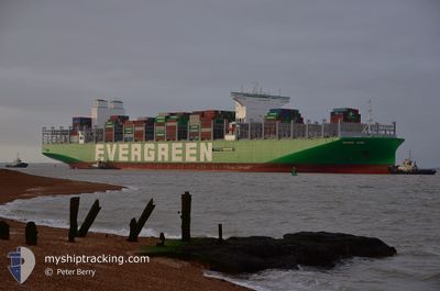
EVER AIM
Cargo D
Current Trip
| Time Travelled | 25 days |
|---|---|
| Remaining Time | 2 days |
| Distance Travelled | 9926.23 nm |
| Remaining Distance | 1690.43 nm |
| AVG Speed | 16.9 Knopen |
| MAX Speed | 21.7 Knopen |
| AVG Wind | 14.6 knots |
| MAX Wind | 36.7 knots |
| MIN Temp | 5.9°C / 42.62°F |
| MAX Temp | 27.8°C / 82.04°F |
| Diepgang | 12 M |
| Positie ontvangen | 6 d geleden |
Current Position
| Lengtegraad | --- |
|---|---|
| Breedtegraat | --- |
| Status | Under way using engine |
| Snelheid | 18.4 Knopen |
| Koers | 110.8° |
| Gebied | South Atlantic Ocean |
| Station | T-AIS |
| Positie ontvangen | 6 d geleden |
Info
Information
The current position of EVER AIM is in South Atlantic Ocean with coordinates -34.82171° / 18.66086° as reported on 2026-01-04 05:21 by AIS to our vessel tracker app. The vessel's current speed is 18.4 Knopen and is heading at the port of COLOMBO. The estimated time of arrival as calculated by MyShipTracking vessel tracking app is 2026-01-13 20:12 LT
The vessel EVER AIM (IMO: 9893917, MMSI: 352980788) is a Cargo D It's sailing under the flag of [PA] Panama.
In this page you can find informations about the vessels current position, last detected port calls, and current voyage information. If the vessels is not in coverage by AIS you will find the latest position.
The current position of EVER AIM is detected by our AIS receivers and we are not responsible for the reliability of the data. The last position was recorded while the vessel was in Coverage by the Ais receivers of our vessel tracking app.
The current draught of EVER AIM as reported by AIS is 12 meters
Weather
| Temperature | 26.4°C / 79.52°F |
|---|---|
| Wind Speed | 15 knots |
| Direction | 329° NNW |
| Pressure | 1011.1 hPa |
| Humidity | 84.9 % |
| Cloud Coverage | 100 % |
Featured Company
Last Port Calls
| Port | Arrival | Departure | Time In Port |
|---|---|---|---|
| 2025-12-14 00:07 | 2025-12-16 14:44 | 2 d | |
| 2025-11-24 06:04 | 2025-11-28 18:10 | 4 d |
Last Trips
| Origin | Departure | Destination | Arrival | Distance | |
|---|---|---|---|---|---|
| 2025-11-28 18:10 | 2025-12-14 00:07 | 525.97 nm | |||
| 2025-10-28 15:40 | 2025-11-24 06:04 | 11858.88 nm |
Events
| Tijd | Evenement | Details | Positie / Bestemming | Info |
|---|---|---|---|---|
| 2026-01-04 05:23 | Status Changed | Default Under way using engine |
-34.82598 / 18.67355
DEHAM > LKCMB
|
Snelheid: 18.4 kn Koers: 110.8° |
| 2026-01-04 05:21 | Buitenbereik |
-34.82171 / 18.66086
South Atlantic Ocean
DEHAM > LKCMB
|
Snelheid: 18.4 kn Koers: 110.8° |
|
| 2026-01-04 05:19 | Status Changed | Under way using engine Default |
-34.81862 / 18.65166
DEHAM > LKCMB
|
Snelheid: 17.8 kn Koers: 110° |
| 2026-01-04 05:19 | Binnenbereik |
-34.81901 / 18.65281
South Atlantic Ocean
DEHAM > LKCMB
|
Snelheid: 18.4 kn Koers: 112.3° |
|
| 2026-01-04 04:23 | Status Changed | Default Under way using engine |
-34.71707 / 18.34135
DEHAM > LKCMB
|
Snelheid: 16.9 kn Koers: 128.2° |
| 2026-01-04 04:17 | Buitenbereik |
-34.69855 / 18.31315
South Atlantic Ocean
DEHAM > LKCMB
|
Snelheid: 16.9 kn Koers: 128.2° |
|
| 2026-01-04 03:53 | Status Changed | Under way using engine Default |
-34.62167 / 18.21881
DEHAM > LKCMB
|
Snelheid: 16.6 kn Koers: 137° |
| 2026-01-04 03:51 | Binnenbereik |
-34.62297 / 18.22039
South Atlantic Ocean
DEHAM > LKCMB
|
Snelheid: 16.6 kn Koers: 134° |
|
| 2026-01-04 02:42 | Status Changed | Default Under way using engine |
-34.39344 / 17.94465
DEHAM > LKCMB
|
Snelheid: 15.8 kn Koers: 129.2° |
| 2026-01-04 02:39 | Buitenbereik |
-34.38374 / 17.93162
South Atlantic Ocean
DEHAM > LKCMB
|
Snelheid: 15.8 kn Koers: 129.2° |