
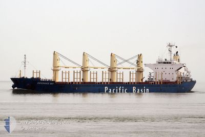
ESPERANCE BAY
Bulk Carrier
Current Trip
ONSAN KOREA
| Time Travelled | 1 day |
|---|---|
| Remaining Time | --- |
| Distance Travelled | 68.68 nm |
| Remaining Distance | --- |
| AVG Speed | 9.8 Knopen |
| MAX Speed | 11.7 Knopen |
| AVG Wind | 11.6 knots |
| MAX Wind | 20 knots |
| MIN Temp | -1.3°C / 29.66°F |
| MAX Temp | 6.4°C / 43.52°F |
| Diepgang | 8.3 M |
| Positie ontvangen | 8 d geleden |
Current Position
| Lengtegraad | --- |
|---|---|
| Breedtegraat | --- |
| Status | Under way using engine |
| Snelheid | 11.8 Knopen |
| Koers | 177.9° |
| Gebied | South China Sea |
| Station | T-AIS |
| Positie ontvangen | 8 d geleden |
Info
Information
The current position of ESPERANCE BAY is in South China Sea with coordinates 22.24102° / 113.79957° as reported on 2025-12-26 05:09 by AIS to our vessel tracker app. The vessel's current speed is 11.8 Knopen
The vessel ESPERANCE BAY (IMO: 9580326, MMSI: 477961200) is a Bulk Carrier that was built in 2010 ( 16 Jaar oud ). It's sailing under the flag of [HK] Hong Kong.
In this page you can find informations about the vessels current position, last detected port calls, and current voyage information. If the vessels is not in coverage by AIS you will find the latest position.
The current position of ESPERANCE BAY is detected by our AIS receivers and we are not responsible for the reliability of the data. The last position was recorded while the vessel was in Coverage by the Ais receivers of our vessel tracking app.
The current draught of ESPERANCE BAY as reported by AIS is 8.3 meters
Weather
| Temperature | 4.5°C / 40.1°F |
|---|---|
| Wind Speed | 8 knots |
| Direction | 288° WNW |
| Pressure | 1023.3 hPa |
| Humidity | 60 % |
| Cloud Coverage | --- |
Featured Company
Last Port Calls
| Port | Arrival | Departure | Time In Port |
|---|---|---|---|
| 2026-01-01 01:30 | 2026-01-02 15:24 | 1 d | |
| 2025-11-30 22:18 | 2025-12-03 19:04 | 2 d | |
| 2025-11-24 15:16 | 2025-11-26 11:19 | 1 d | |
| 2025-11-07 15:32 | 2025-11-08 20:52 | 1 d | |
| 2025-11-04 07:36 | 2025-11-05 19:42 | 1 d |
Last Trips
| Origin | Departure | Destination | Arrival | Distance | |
|---|---|---|---|---|---|
| 2025-12-04 05:34 | 2026-01-01 10:30 | 6169.65 nm | |||
| 2025-11-26 19:19 | 2025-12-01 08:48 | 1314.50 nm | |||
| 2025-11-09 04:52 | 2025-11-24 23:16 | 2628.23 nm | |||
| 2025-11-06 03:42 | 2025-11-07 23:32 | 248.83 nm | |||
| 2025-10-31 10:48 | 2025-11-04 15:36 | 1327.06 nm |
Events
| Tijd | Evenement | Details | Positie / Bestemming | Info |
|---|---|---|---|---|
| 2026-01-03 13:19 | Stop beweging | 15.97 nm, South East of ONSAN |
35.24926 / 129.60873
ONSAN KOREA
|
Snelheid: 0.3 kn Koers: 258° |
| 2026-01-03 10:09 | Start beweging | 15.27 nm, North of IZUMI |
34.91322 / 129.59079
ONSAN KOREA
|
Snelheid: 7.6 kn Koers: 357° |
| 2026-01-03 01:37 | Stop beweging |
35.04461 / 129.48544
ONSAN KOREA
|
Snelheid: 0.2 kn Koers: 205° |
|
| 2026-01-02 15:24 | Vertrekhaven |
|
35.44511 / 129.39272
ONSAN KOREA
|
Snelheid: 7.6 kn Koers: 103° |
| 2026-01-02 15:12 | Start beweging |
35.44851 / 129.36282
[KR] ONSAN
|
Snelheid: 6.6 kn Koers: 41° |
|
| 2026-01-01 01:50 | Stop beweging |
35.44021 / 129.36072
[KR] ONSAN
|
Snelheid: 0.1 kn Koers: 68° |
|
| 2026-01-01 01:30 | Aankomsthaven |
|
35.45170 / 129.36861
[KR] ONSAN
|
Snelheid: 9.4 kn Koers: 281° |
| 2026-01-01 01:06 | Start beweging | 3.22 nm, East of ONSAN |
35.43941 / 129.44255
ONSAN KOREA
|
Snelheid: 7.8 kn Koers: 266° |
| 2025-12-31 00:57 | Stop beweging | 3.97 nm, South East of ULSAN |
35.44010 / 129.45932
ONSAN KOREA
|
Snelheid: 0.3 kn Koers: 270° |
| 2025-12-26 05:09 | Buitenbereik |
22.24102 / 113.79957
South China Sea
ONSAN KOREA
|
Snelheid: 11.8 kn Koers: 177.9° |