

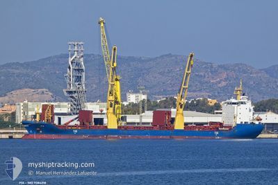
ELLA
General Cargo

Current Trip
| Trip Time | 7 days |
|---|---|
| Trip Distance | 1327.56 nm |
| AVG Speed | 13.3 Knopen |
| MAX Speed | 16.7 Knopen |
| Diepgang | 6.3 M |
| AVG Wind | 12.5 knots |
| MAX Wind | 26 knots |
| MIN Temp | 10°C / 50°F |
| MAX Temp | 20.3°C / 68.54°F |
| Positie ontvangen | 7 d geleden |
Current Position
| Lengtegraad | --- |
|---|---|
| Breedtegraat | --- |
| Status | Under way using engine |
| Snelheid | 13 Knopen |
| Koers | 7.6° |
| Gebied | North Pacific Ocean |
| Station | T-AIS |
| Positie ontvangen | 7 d geleden |
Information
The current position of ELLA is in North Pacific Ocean with coordinates 35.65455° / 141.12978° as reported on 2025-03-23 21:33 by AIS to our vessel tracker app. The vessel's current speed is 13 Knopen and is currently inside the port of ONAHAMA.
The vessel ELLA (IMO: 9384318, MMSI: 305066000) is a General Cargo that was built in 2007 ( 18 Jaar oud ). It's sailing under the flag of [AG] Antigua Barbuda.
In this page you can find informations about the vessels current position, last detected port calls, and current voyage information. If the vessels is not in coverage by AIS you will find the latest position.
The current position of ELLA is detected by our AIS receivers and we are not responsible for the reliability of the data. The last position was recorded while the vessel was in Coverage by the Ais receivers of our vessel tracking app.
The current draught of ELLA as reported by AIS is 6.3 meters
Weather
| Temperature | 1.7°C / 35.06°F |
|---|---|
| Wind Speed | 8 knots |
| Direction | 3° N |
| Pressure | 1027.8 hPa |
| Humidity | 56.5 % |
| Cloud Coverage | 100 % |


Featured Company
Last Port Calls
| Port | Arrival | Departure | Time In Port |
|---|---|---|---|
| 2025-03-28 14:30 | |||
| 2025-03-16 16:23 | 2025-03-20 15:17 | 3 d | |
| 2025-01-31 19:55 | 2025-02-04 22:55 | 4 d | |
| 2025-01-22 17:51 | 2025-01-25 23:35 | 3 d | |
| 2025-01-16 07:22 | 2025-01-19 01:02 | 2 d | |
| 2025-01-06 22:07 | 2025-01-14 20:27 | 7 d | |
| 2025-01-04 00:34 | 2025-01-05 00:58 | 1 d |
Last Trips
| Origin | Departure | Destination | Arrival | Distance | |
|---|---|---|---|---|---|
| 2025-03-20 15:17 | 2025-03-28 14:30 | 1327.56 nm | |||
| 2025-02-04 22:55 | 2025-03-16 16:23 | 10910.78 nm | |||
| 2025-01-25 23:35 | 2025-01-31 19:55 | 901.44 nm | |||
| 2025-01-19 01:02 | 2025-01-22 17:51 | 1142.92 nm | |||
| 2025-01-14 20:27 | 2025-01-16 07:22 | 436.23 nm | |||
| 2025-01-05 00:58 | 2025-01-06 22:07 | 508.02 nm | |||
| 2024-12-12 21:20 | 2025-01-04 00:34 | 5763.40 nm |
Events
| Tijd | Evenement | Details | Positie / Bestemming | Info |
|---|---|---|---|---|
| 2025-03-28 05:50 | Stop beweging |
36.92691 / 140.87326
[JP] ONAHAMA
|
Snelheid: 0.2 kn Koers: 300° |
|
| 2025-03-28 05:30 | Aankomsthaven |
|
36.92363 / 140.88214
[JP] ONAHAMA
|
Snelheid: 4.5 kn Koers: 9° |
| 2025-03-28 04:22 | Start beweging | 3.25 nm, South East of ONAHAMA |
36.88365 / 140.92874
JP ONA
|
Snelheid: 4.4 kn Koers: 247° |
| 2025-03-25 01:36 | Stop beweging | 3.19 nm, South East of ONAHAMA |
36.88667 / 140.93100
JP ONA
|
Snelheid: 0.3 kn Koers: 167° |
| 2025-03-24 23:30 | Start beweging | 20.66 nm, South East of NAKANOSAKU |
36.75016 / 141.29411
JP ONA
|
Snelheid: 4.4 kn Koers: 87° |
| 2025-03-24 11:57 | Stop beweging | 18.43 nm, South East of NAKANOSAKU |
36.70794 / 141.17439
JP ONA
|
Snelheid: 0.3 kn Koers: 255° |
| 2025-03-24 09:38 | Start beweging | 14.31 nm, South East of OTSU |
36.66769 / 141.01015
JP ONA
|
Snelheid: 8.4 kn Koers: 60° |
| 2025-03-24 03:50 | Stop beweging | 16.21 nm, South East of OTSU |
36.66003 / 141.05333
JP ONA
|
Snelheid: 0.3 kn Koers: 314° |
| 2025-03-23 21:46 | Status Changed | Default Under way using engine |
35.70188 / 141.12015
JP ONA
|
Snelheid: 13 kn Koers: 7.6° |
| 2025-03-23 21:33 | Buitenbereik |
35.65455 / 141.12978
North Pacific Ocean
JP ONA
|
Snelheid: 13 kn Koers: 7.6° |