

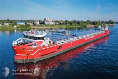
ELLA
Cargo

Current Trip
RUYEY
| Time Travelled | 3 days |
|---|---|
| Remaining Time | --- |
| Distance Travelled | 735.47 nm |
| Remaining Distance | --- |
| AVG Speed | 16 Knopen |
| MAX Speed | 16 Knopen |
| AVG Wind | 12.3 knots |
| MAX Wind | 22 knots |
| MIN Temp | 7.8°C / 46.04°F |
| MAX Temp | 15.4°C / 59.72°F |
| Diepgang | 3.8 M |
| Positie ontvangen | 6 d geleden |
Current Position
| Lengtegraad | --- |
|---|---|
| Breedtegraat | --- |
| Status | At anchor |
| Snelheid | 0.1 Knopen |
| Koers | 222° |
| Gebied | Black Sea |
| Station | T-AIS |
| Positie ontvangen | 6 d geleden |
Information
The current position of ELLA is in Black Sea with coordinates 41.48094° / 31.76987° as reported on 2025-03-25 19:44 by AIS to our vessel tracker app. The vessel's current speed is 0.1 Knopen
The vessel ELLA (IMO: 9894105, MMSI: 273290820) is a Cargo It's sailing under the flag of [RU] Russia.
In this page you can find informations about the vessels current position, last detected port calls, and current voyage information. If the vessels is not in coverage by AIS you will find the latest position.
The current position of ELLA is detected by our AIS receivers and we are not responsible for the reliability of the data. The last position was recorded while the vessel was in Coverage by the Ais receivers of our vessel tracking app.
The current draught of ELLA as reported by AIS is 3.8 meters
Weather
| Temperature | 9.4°C / 48.92°F |
|---|---|
| Wind Speed | 10 knots |
| Direction | 237° WSW |
| Pressure | 1015.9 hPa |
| Humidity | 91.9 % |
| Cloud Coverage | 95 % |


Featured Company
Most Visited Ports (Last year)
| Port | Arrivals | |
|---|---|---|
| 4 | ||
| 2 | ||
| 2 | ||
| 2 | ||
| 2 | ||
| 1 |
Last Trips
| Origin | Departure | Destination | Arrival | Distance | |
|---|---|---|---|---|---|
| 2025-03-15 13:17 | 2025-03-26 13:30 | 472.17 nm | |||
| 2025-01-29 08:43 | 2025-03-11 23:03 | 5585.89 nm |
Events
| Tijd | Evenement | Details | Positie / Bestemming | Info |
|---|---|---|---|---|
| 2025-04-01 05:01 | Stop beweging | 2.37 nm, North West of YEYSK |
46.75256 / 38.22646
RUYEY
|
Snelheid: 0.3 kn Koers: 260° |
| 2025-03-31 22:06 | Start beweging | 4.23 nm, West of YEYSK |
46.71944 / 38.17085
RUYEY
|
Snelheid: 21.3 kn Koers: 274° |
| 2025-03-31 21:48 | Stop beweging | 3.69 nm, North West of YEYSK |
46.77030 / 38.20626
RUYEY
|
Snelheid: Koers: 144° |
| 2025-03-28 17:30 | Vertrekhaven |
|
41.46090 / 31.77279
RUYEY
|
Snelheid: 4.7 kn Koers: 260° |
| 2025-03-28 17:26 | Start beweging |
41.45792 / 31.77980
[TR] ZONGULDAK
|
Snelheid: 4.7 kn Koers: 260° |
|
| 2025-03-26 11:02 | Stop beweging |
41.45385 / 31.78508
[TR] ZONGULDAK
|
Snelheid: Koers: 303° |
|
| 2025-03-26 10:30 | Aankomsthaven |
|
41.45784 / 31.78136
[TR] ZONGULDAK
|
Snelheid: 2.6 kn Koers: 88° |
| 2025-03-26 10:14 | Start beweging | 0.75 nm, North West of ZONGULDAK |
41.46380 / 31.76907
RUYEY
|
Snelheid: 3.9 kn Koers: 165° |
| 2025-03-25 19:56 | Status Changed | Default At anchor |
41.48096 / 31.76978
RUYEY
|
Snelheid: 0.1 kn Koers: 222° |
| 2025-03-25 19:44 | Buitenbereik |
41.48094 / 31.76987
Black Sea
|
Snelheid: 0.1 kn Koers: 242.4° |