
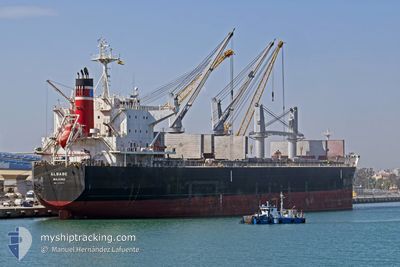
ELBABE
Cargo
Current Trip
| Time Travelled | 1 day |
|---|---|
| Remaining Time | --- |
| Distance Travelled | --- |
| Remaining Distance | --- |
| AVG Speed | --- |
| MAX Speed | --- |
| AVG Wind | --- |
| MAX Wind | --- |
| MIN Temp | --- |
| MAX Temp | --- |
| Diepgang | 7 M |
| Positie ontvangen | 3 d geleden |
Current Position
| Lengtegraad | --- |
|---|---|
| Breedtegraat | --- |
| Status | Under way using engine |
| Snelheid | 1.2 Knopen |
| Koers | 118° |
| Gebied | Gulf of Finland |
| Station | T-AIS |
| Positie ontvangen | 3 d geleden |
Info
Information
The current position of ELBABE is in Gulf of Finland with coordinates 60.04662° / 29.22988° as reported on 2026-01-02 16:41 by AIS to our vessel tracker app. The vessel's current speed is 1.2 Knopen
The vessel ELBABE (IMO: 9725471, MMSI: 538007258) is a Cargo It's sailing under the flag of [MH] Marshall Is.
In this page you can find informations about the vessels current position, last detected port calls, and current voyage information. If the vessels is not in coverage by AIS you will find the latest position.
The current position of ELBABE is detected by our AIS receivers and we are not responsible for the reliability of the data. The last position was recorded while the vessel was in Coverage by the Ais receivers of our vessel tracking app.
The current draught of ELBABE as reported by AIS is 7 meters
Weather
| Temperature | -7.3°C / 18.86°F |
|---|---|
| Wind Speed | 10 knots |
| Direction | 240° WSW |
| Pressure | 1018.8 hPa |
| Humidity | 81.9 % |
| Cloud Coverage | 35 % |
Featured Company
Last Port Calls
| Port | Arrival | Departure | Time In Port |
|---|---|---|---|
| 2026-01-04 22:28 | |||
| 2025-12-22 13:55 | 2025-12-22 14:42 | 46 m | |
| 2025-12-18 04:41 | 2025-12-22 11:46 | 4 d | |
| 2025-12-18 01:23 | 2025-12-18 03:00 | 1 h | |
| 2025-11-20 23:21 | 2025-11-25 21:45 | 4 d | |
| 2025-11-20 20:21 | 2025-11-20 21:25 | 1 h | |
| 2025-11-02 08:57 | 2025-11-09 15:07 | 7 d |
Most Visited Ports (Last year)
| Port | Arrivals | |
|---|---|---|
| 3 | ||
| 2 | ||
| 2 | ||
| 2 | ||
| 2 | ||
| 2 |
Last Trips
| Origin | Departure | Destination | Arrival | Distance | |
|---|---|---|---|---|---|
| 2025-12-22 11:46 | 2025-12-22 13:55 | 9.07 nm | |||
| 2025-12-18 03:00 | 2025-12-18 04:41 | 7.18 nm | |||
| 2025-11-25 21:45 | 2025-12-18 01:23 | 5415.16 nm | |||
| 2025-11-20 21:25 | 2025-11-20 23:21 | 10.75 nm | |||
| 2025-11-09 15:07 | 2025-11-20 20:21 | 2468.16 nm |
Events
| Tijd | Evenement | Details | Positie / Bestemming | Info |
|---|---|---|---|---|
| 2026-01-04 19:28 | Vertrekhaven |
|
59.94926 / 29.52528
RU LED
|
Snelheid: Koers: 91° |
| 2026-01-02 16:45 | Status Changed | Default Under way using engine |
60.04630 / 29.23477
RU LED
|
Snelheid: 1.2 kn Koers: 118° |
| 2026-01-02 16:41 | Buitenbereik |
60.04662 / 29.22988
Gulf of Finland
RU LED
|
Snelheid: 1.2 kn Koers: 157.8° |
|
| 2026-01-02 16:06 | Status Changed | Under way using engine Default |
60.07157 / 29.29446
RU LED
|
Snelheid: 2.9 kn Koers: 79° |
| 2026-01-02 16:01 | Status Changed | Default Under way using engine |
60.06921 / 29.28769
RU LED
|
Snelheid: 3.8 kn Koers: 64° |
| 2026-01-02 15:49 | Status Changed | Under way using engine Default |
60.06004 / 29.27048
RU LED
|
Snelheid: 4.9 kn Koers: 63° |
| 2026-01-02 15:36 | Status Changed | Default Under way using engine |
60.04928 / 29.24840
RU LED
|
Snelheid: 5.9 kn Koers: 25.9° |
| 2026-01-02 15:22 | Status Changed | Under way using engine Default |
60.02893 / 29.22320
RU LED
|
Snelheid: 9.1 kn Koers: 91° |
| 2026-01-02 15:20 | Status Changed | Default Under way using engine |
60.02737 / 29.21554
RU LED
|
Snelheid: 9.5 kn Koers: 90.9° |
| 2026-01-02 10:23 | Draught Changed | 7 6.9 |
60.09768 / 27.49683
RU LED
|
Snelheid: 11.9 kn Koers: 57.5° |