
EILTANK 49
Tanker
Current Trip
| Time Travelled | 1 day |
|---|---|
| Remaining Time | --- |
| Distance Travelled | 84.69 nm |
| Remaining Distance | --- |
| AVG Speed | 5.2 Knopen |
| MAX Speed | 7.3 Knopen |
| AVG Wind | 3.8 knots |
| MAX Wind | 6 knots |
| MIN Temp | 11.6°C / 52.88°F |
| MAX Temp | 19.2°C / 66.56°F |
| Diepgang | 2.8 M |
| Positie ontvangen | 2 h, 38 m geleden |
Current Position
| Lengtegraad | --- |
|---|---|
| Breedtegraat | --- |
| Status | Under way using engine |
| Snelheid | 4.5 Knopen |
| Koers | 138.1° |
| Gebied | North Sea |
| Station | T-AIS |
| Positie ontvangen | 2 h, 38 m geleden |
Info
Information
The current position of EILTANK 49 is in North Sea with coordinates 50.46653° / 7.35412° as reported on 2024-10-27 15:12 by AIS to our vessel tracker app. The vessel's current speed is 4.5 Knopen
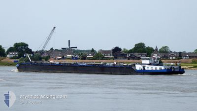
The vessel EILTANK 49 (MMSI: 211484440) is a Tanker It's sailing under the flag of [DE] Germany.
In this page you can find informations about the vessels current position, last detected port calls, and current voyage information. If the vessels is not in coverage by AIS you will find the latest position.
The current position of EILTANK 49 is detected by our AIS receivers and we are not responsible for the reliability of the data. The last position was recorded while the vessel was in Coverage by the Ais receivers of our vessel tracking app.
The current draught of EILTANK 49 as reported by AIS is 2.8 meters
Weather
| Temperature | 13.8°C / 56.84°F |
|---|---|
| Wind Speed | 3 knots |
| Direction | 16° NNE |
| Pressure | 1022.8 hPa |
| Humidity | 90.8 % |
| Cloud Coverage | 95 % |
Featured Company
Last Port Calls
| Port | Arrival | Departure | Time In Port |
|---|---|---|---|
| 2024-10-26 08:37 | 2024-10-26 10:42 | 2 h | |
| 2024-10-22 07:29 | 2024-10-22 10:43 | 3 h | |
| 2024-10-21 15:44 | 2024-10-22 03:21 | 11 h | |
| 2024-10-18 04:14 | 2024-10-20 05:29 | 2 d | |
| 2024-10-16 10:08 | 2024-10-17 11:44 | 1 d | |
| 2024-10-15 06:29 | 2024-10-15 06:33 | 3 m | |
| 2024-10-14 05:28 | 2024-10-15 04:53 | 23 h | |
| 2024-10-13 20:07 | 2024-10-14 03:38 | 7 h | |
| 2024-10-10 17:26 | 2024-10-10 18:19 | 52 m | |
| 2024-10-10 06:41 | 2024-10-10 08:07 | 1 h |
Most Visited Ports (Last year)
| Port | Arrivals | |
|---|---|---|
| 35 | ||
| 27 | ||
| 21 | ||
| 19 | ||
| 13 | ||
| 12 |
Last Trips
| Origin | Departure | Destination | Arrival | Distance | |
|---|---|---|---|---|---|
| 2024-10-22 12:43 | 2024-10-26 10:37 | 5.48 nm | |||
| 2024-10-22 05:21 | 2024-10-22 09:29 | 44.06 nm | |||
| 2024-10-20 07:29 | 2024-10-21 17:44 | 162.21 nm | |||
| 2024-10-17 13:44 | 2024-10-18 06:14 | 34.84 nm | |||
| 2024-10-15 08:33 | 2024-10-16 12:08 | 99.59 nm | |||
| 2024-10-14 05:38 | 2024-10-14 07:28 | 1.86 nm | |||
| 2024-10-10 20:19 | 2024-10-13 22:07 | 309.77 nm | |||
| 2024-10-10 10:07 | 2024-10-10 19:26 | 43.63 nm | |||
| 2024-10-09 15:32 | 2024-10-10 08:41 | 94.96 nm | |||
| 2024-10-07 01:59 | 2024-10-09 03:19 | 121.21 nm |
Events
| Tijd | Evenement | Details | Positie / Bestemming | Info |
|---|---|---|---|---|
| 2024-10-27 15:12 | Buitenbereik |
50.46653 / 7.35412
North Sea
BENDORF
|
Snelheid: 4.5 kn Koers: 138.1° |
|
| 2024-10-27 06:14 | Start beweging | 2.59 nm, North West of LEVERKUSEN |
51.05154 / 6.92668
BENDORF
|
Snelheid: 4.6 kn Koers: 131° |
| 2024-10-27 06:13 | Status Changed | Under way using engine Moored |
51.05255 / 6.92469
BENDORF
|
Snelheid: 1.6 kn Koers: 511° |
| 2024-10-26 18:25 | Status Changed | Moored Under way using engine |
51.05230 / 6.92469
BENDORF
|
Snelheid: 0.4 kn Koers: 511° |
| 2024-10-26 18:21 | Status Changed | Under way using engine Moored |
51.05279 / 6.92392
BENDORF
|
Snelheid: 1.6 kn Koers: 511° |
| 2024-10-26 18:00 | Status Changed | Moored Under way using engine |
51.05279 / 6.92436
BENDORF
|
Snelheid: 0.6 kn Koers: 511° |
| 2024-10-26 17:58 | Stop beweging | 2.71 nm, North West of LEVERKUSEN |
51.05269 / 6.92404
BENDORF
|
Snelheid: 0.1 kn Koers: 511° |
| 2024-10-26 10:42 | Vertrekhaven |
|
51.40380 / 6.74492
BENDORF
|
Snelheid: 5.5 kn Koers: 177.3° |
| 2024-10-26 09:41 | Start beweging |
51.45080 / 6.77411
[DE] DUISBURG
|
Snelheid: 3.3 kn Koers: 250° |
|
| 2024-10-26 09:39 | Status Changed | Under way using engine Moored |
51.45107 / 6.77573
[DE] DUISBURG
|
Snelheid: 1.1 kn Koers: 511° |