
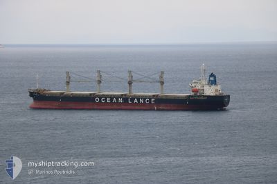
EFFICIENCY OL
Bulk Carrier
Current Trip
PRAIAMOLE
| Time Travelled | 8 days |
|---|---|
| Remaining Time | --- |
| Distance Travelled | 2147.45 nm |
| Remaining Distance | --- |
| AVG Speed | 11.1 Knopen |
| MAX Speed | 14.4 Knopen |
| AVG Wind | 16.7 knots |
| MAX Wind | 32 knots |
| MIN Temp | 12.2°C / 53.96°F |
| MAX Temp | 21.7°C / 71.06°F |
| Diepgang | 8.3 M |
| Positie ontvangen | 1 d geleden |
Current Position
| Lengtegraad | -15.32322° |
|---|---|
| Breedtegraat | 27.49740° |
| Status | Under way sailing |
| Snelheid | 12.7 Knopen |
| Koers | 207° |
| Gebied | North Atlantic Ocean |
| Station | T-AIS |
| Positie ontvangen | 1 d geleden |
Info
Information
The current position of EFFICIENCY OL is in North Atlantic Ocean with coordinates 27.49740° / -15.32322° as reported on 2024-06-04 19:15 by AIS to our vessel tracker app. The vessel's current speed is 12.7 Knopen
The vessel EFFICIENCY OL (IMO: 9491666, MMSI: 372967000) is a Bulk Carrier that was built in 2010 ( 14 Jaar oud ). It's sailing under the flag of [PA] Panama.
In this page you can find informations about the vessels current position, last detected port calls, and current voyage information. If the vessels is not in coverage by AIS you will find the latest position.
The current position of EFFICIENCY OL is detected by our AIS receivers and we are not responsible for the reliability of the data. The last position was recorded while the vessel was in Coverage by the Ais receivers of our vessel tracking app.
The current draught of EFFICIENCY OL as reported by AIS is 8.3 meters
Weather
| Temperature | 20.8°C / 69.44°F |
|---|---|
| Wind Speed | 14 knots |
| Direction | 27° NNE |
| Pressure | 1015.8 hPa |
| Humidity | 84.4 % |
| Cloud Coverage | 6 % |
Featured Company
Last Port Calls
| Port | Arrival | Departure | Time In Port |
|---|---|---|---|
| 2024-05-25 21:42 | 2024-05-28 16:06 | 2 d | |
| 2024-05-10 05:34 | 2024-05-23 12:51 | 13 d | |
| 2024-04-06 16:06 | 2024-04-14 10:20 | 7 d |
Last Trips
| Origin | Departure | Destination | Arrival | Distance | |
|---|---|---|---|---|---|
| 2024-05-23 12:51 | 2024-05-25 21:42 | 649.51 nm | |||
| 2024-04-14 10:20 | 2024-05-10 05:34 | 3186.42 nm | |||
| 2024-03-20 01:08 | 2024-04-06 16:06 | 4513.11 nm |
Events
| Tijd | Evenement | Details | Positie / Bestemming | Info |
|---|---|---|---|---|
| 2024-06-04 19:22 | Status Changed | Default Under way sailing |
27.47693 / -15.33508
PRAIAMOLE
|
Snelheid: 12.7 kn Koers: 207° |
| 2024-06-04 19:15 | Status Changed | Under way sailing Default |
27.49740 / -15.32322
PRAIAMOLE
|
Snelheid: 12.7 kn Koers: 207° |
| 2024-06-04 19:15 | Buitenbereik |
27.49740 / -15.32322
North Atlantic Ocean
PRAIAMOLE
|
Snelheid: 12.7 kn Koers: 207° |
|
| 2024-06-04 18:58 | Status Changed | Default Under way sailing |
27.55362 / -15.29053
PRAIAMOLE
|
Snelheid: 13.5 kn Koers: 208° |
| 2024-06-04 16:46 | Destination Changed | PRAIAMOLE LAS PALMAS |
28.04082 / -15.27325
PRAIAMOLE
|
Snelheid: 13.2 kn Koers: 133° |
| 2024-06-04 16:46 | ETA Changed | 2024/06/16 12:00 2025/03/06 19:00 |
28.04082 / -15.27325
PRAIAMOLE
|
Snelheid: 13.2 kn Koers: 133° |
| 2024-06-04 16:46 | Status Changed | Under way sailing At anchor |
28.04082 / -15.27325
LAS PALMAS
|
Snelheid: 13.2 kn Koers: 133° |
| 2024-06-04 16:06 | Start beweging | 1.84 nm, South East of LAS PALMAS |
28.10112 / -15.39690
LAS PALMAS
|
Snelheid: 3.2 kn Koers: 73° |
| 2024-06-04 15:59 | Status Changed | At anchor Default |
28.09855 / -15.39598
LAS PALMAS
|
Snelheid: 0.1 kn Koers: 322° |
| 2024-06-04 15:53 | Status Changed | Default At anchor |
28.09830 / -15.39565
LAS PALMAS
|
Snelheid: 0.3 kn Koers: 358° |