
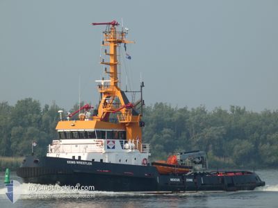
EEMS WRESTLER
Tug
Current Trip
| Time Travelled | 11 days |
|---|---|
| Remaining Time | 6 mins |
| Distance Travelled | 1248.83 nm |
| Remaining Distance | 6.05 nm |
| AVG Speed | 5.9 Knopen |
| MAX Speed | 13 Knopen |
| AVG Wind | 10.5 knots |
| MAX Wind | 29 knots |
| MIN Temp | 10.8°C / 51.44°F |
| MAX Temp | 23.7°C / 74.66°F |
| Diepgang | 3.6 M |
| Positie ontvangen | 19 h, 47 m geleden |
Current Position
| Lengtegraad | 14.83290° |
|---|---|
| Breedtegraat | 35.93216° |
| Status | At anchor |
| Snelheid | 0.1 Knopen |
| Koers | 82° |
| Gebied | Mediterranean Sea - Eastern Basin |
| Station | T-AIS |
| Positie ontvangen | 19 h, 47 m geleden |
Info
Information
The current position of EEMS WRESTLER is in Mediterranean Sea - Eastern Basin with coordinates 35.93216° / 14.83290° as reported on 2024-04-26 19:04 by AIS to our vessel tracker app. The vessel's current speed is 0.1 Knopen and is heading at the port of VALLETTA. The estimated time of arrival as calculated by MyShipTracking vessel tracking app is 2024-04-27 14:58 LT
The vessel EEMS WRESTLER (IMO: 8843549, MMSI: 245199000) is a Tug that was built in 1990 ( 34 Jaar oud ). It's sailing under the flag of [NL] Netherlands.
In this page you can find informations about the vessels current position, last detected port calls, and current voyage information. If the vessels is not in coverage by AIS you will find the latest position.
The current position of EEMS WRESTLER is detected by our AIS receivers and we are not responsible for the reliability of the data. The last position was recorded while the vessel was in Coverage by the Ais receivers of our vessel tracking app.
The current draught of EEMS WRESTLER as reported by AIS is 3.6 meters
Weather
| Temperature | 16.6°C / 61.88°F |
|---|---|
| Wind Speed | 16 knots |
| Direction | 92° E |
| Pressure | 1014.8 hPa |
| Humidity | 81.7 % |
| Cloud Coverage | 6 % |
Featured Company
Last Port Calls
| Port | Arrival | Departure | Time In Port |
|---|---|---|---|
| 2024-04-12 03:55 | 2024-04-16 06:16 | 4 d | |
| 2024-03-21 17:52 | 2024-03-25 08:07 | 3 d | |
| 2024-03-21 10:23 | 2024-03-21 16:44 | 6 h | |
| 2024-03-15 20:37 | 2024-03-18 17:59 | 2 d | |
| 2024-02-28 18:36 | 2024-03-12 08:39 | 12 d | |
| 2024-02-22 16:52 | 2024-02-28 08:13 | 5 d | |
| 2024-02-19 13:31 |
Last Trips
| Origin | Departure | Destination | Arrival | Distance | |
|---|---|---|---|---|---|
| 2024-03-25 09:07 | 2024-04-12 06:55 | 2225.37 nm | |||
| 2024-03-21 17:44 | 2024-03-21 18:52 | 4.34 nm | |||
| 2024-03-18 18:59 | 2024-03-21 11:23 | 590.78 nm | |||
| 2024-03-12 08:39 | 2024-03-15 21:37 | 642.40 nm | |||
| 2024-02-28 08:13 | 2024-02-28 18:36 | 88.06 nm | |||
| 2024-02-19 13:31 | 2024-02-22 16:52 | 709.70 nm |
Events
| Tijd | Evenement | Details | Positie / Bestemming | Info |
|---|---|---|---|---|
| 2024-04-27 10:26 | Start beweging | 14.99 nm, East of VALLETTA |
35.92813 / 14.82799
MT MLA
|
Snelheid: 7.6 kn Koers: 273° |
| 2024-04-26 19:13 | Status Changed | Default At anchor |
35.93212 / 14.83291
MT MLA
|
Snelheid: 0.1 kn Koers: 82° |
| 2024-04-26 19:04 | Status Changed | At anchor Default |
35.93216 / 14.83290
MT MLA
|
Snelheid: 0.3 kn Koers: 73° |
| 2024-04-26 19:04 | Binnenbereik |
35.93216 / 14.83290
Mediterranean Sea - Eastern Basin
|
Snelheid: 0.1 kn Koers: 157° |
|
| 2024-04-26 19:04 | Buitenbereik |
35.93216 / 14.83290
Mediterranean Sea - Eastern Basin
|
Snelheid: 0.1 kn Koers: 157° |
|
| 2024-04-26 13:54 | Stop beweging | 15.32 nm, East of VALLETTA |
35.93243 / 14.83409
MT MLA
|
Snelheid: 0.1 kn Koers: 78° |
| 2024-04-26 13:45 | Start beweging | 14.14 nm, East of VALLETTA |
35.92443 / 14.81093
MT MLA
|
Snelheid: 8.9 kn Koers: 65° |
| 2024-04-26 13:18 | Stop beweging | 13.58 nm, East of VALLETTA |
35.92210 / 14.79967
MT MLA
|
Snelheid: 0.1 kn Koers: 100° |
| 2024-04-26 12:41 | Status Changed | Default Under way using engine |
35.93549 / 14.78013
MT MLA
|
Snelheid: 9.5 kn Koers: 129.8° |
| 2024-04-26 12:38 | Buitenbereik |
35.93934 / 14.77453
Mediterranean Sea - Eastern Basin
MT MLA
|
Snelheid: 9.5 kn Koers: 129.8° |