
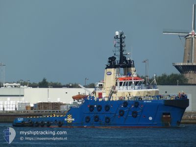
EDT AEOLUS
Tug
Current Trip
| Time Travelled | 4 days |
|---|---|
| Remaining Time | 1 day |
| Distance Travelled | 995.26 nm |
| Remaining Distance | 300.83 nm |
| AVG Speed | 9.7 Knopen |
| MAX Speed | 11.8 Knopen |
| AVG Wind | 6.9 knots |
| MAX Wind | 24.6 knots |
| MIN Temp | 12.8°C / 55.04°F |
| MAX Temp | 20.9°C / 69.62°F |
| Diepgang | 5.4 M |
| Positie ontvangen | 1 m geleden |
Current Position
| Lengtegraad | 27.54481° |
|---|---|
| Breedtegraat | 35.14144° |
| Status | Under way using engine |
| Snelheid | 9.3 Knopen |
| Koers | 95.9° |
| Gebied | Mediterranean Sea - Eastern Basin |
| Station | T-AIS |
| Positie ontvangen | 1 m geleden |
Info
Information
The current position of EDT AEOLUS is in Mediterranean Sea - Eastern Basin with coordinates 35.14144° / 27.54481° as reported on 2024-05-02 00:32 by AIS to our vessel tracker app. The vessel's current speed is 9.3 Knopen and is heading at the port of LIMASSOL. The estimated time of arrival as calculated by MyShipTracking vessel tracking app is 2024-05-03 07:30 LT
The vessel EDT AEOLUS (IMO: 9476006, MMSI: 636022681) is a Tug that was built in 2011 ( 13 Jaar oud ). It's sailing under the flag of [LR] Liberia.
In this page you can find informations about the vessels current position, last detected port calls, and current voyage information. If the vessels is not in coverage by AIS you will find the latest position.
The current position of EDT AEOLUS is detected by our AIS receivers and we are not responsible for the reliability of the data. The last position was recorded while the vessel was in Coverage by the Ais receivers of our vessel tracking app.
The current draught of EDT AEOLUS as reported by AIS is 5.4 meters
Weather
| Temperature | 18.2°C / 64.76°F |
|---|---|
| Wind Speed | 15 knots |
| Direction | 310° NW |
| Pressure | 1010.9 hPa |
| Humidity | 80 % |
| Cloud Coverage | 36 % |
Featured Company
Most Visited Ports (Last year)
| Port | Arrivals | |
|---|---|---|
| 3 | ||
| 3 | ||
| 2 | ||
| 2 | ||
| 2 | ||
| 2 |
Events
| Tijd | Evenement | Details | Positie / Bestemming | Info |
|---|---|---|---|---|
| 2024-05-02 00:06 | Status Changed | Under way using engine Default |
35.14961 / 27.46292
CYLMS
|
Snelheid: 9.3 kn Koers: 95° |
| 2024-05-02 00:06 | Binnenbereik |
35.14961 / 27.46292
Mediterranean Sea - Eastern Basin
CYLMS
|
Snelheid: 9.4 kn Koers: 95.9° |
|
| 2024-05-01 22:41 | Status Changed | Default Under way using engine |
35.17758 / 27.19268
CYLMS
|
Snelheid: 9.4 kn Koers: 100.4° |
| 2024-05-01 22:39 | Buitenbereik |
35.17819 / 27.18782
Mediterranean Sea - Eastern Basin
CYLMS
|
Snelheid: 9.4 kn Koers: 100.4° |
|
| 2024-05-01 19:26 | Wijzig zee gebeid | Greek part of the Mediterranean Sea - Eastern Basin Greek part of the Aegean Sea |
35.32459 / 26.60143
Mediterranean Sea - Eastern Basin
CYLMS
|
Snelheid: 9.9 kn Koers: 112.6° |
| 2024-05-01 16:54 | Status Changed | Under way using engine Default |
35.49542 / 26.14727
CYLMS
|
Snelheid: 9.5 kn Koers: 115° |
| 2024-05-01 16:28 | Status Changed | Default Under way using engine |
35.52479 / 26.07193
CYLMS
|
Snelheid: 9.6 kn Koers: 116.3° |
| 2024-05-01 16:15 | Status Changed | Under way using engine Default |
35.53966 / 26.03164
CYLMS
|
Snelheid: 9.8 kn Koers: 113° |
| 2024-05-01 16:06 | Status Changed | Default Under way using engine |
35.54926 / 26.00555
CYLMS
|
Snelheid: 9.7 kn Koers: 114.4° |
| 2024-05-01 15:50 | Status Changed | Under way using engine Default |
35.56722 / 25.95724
CYLMS
|
Snelheid: 9.8 kn Koers: 114° |