

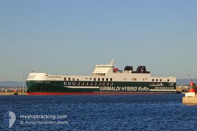
ECO MEDITERRANEA
Cargo D

Current Trip
| Trip Time | 3 h, 29 mins |
|---|---|
| Trip Distance | 46.85 nm |
| AVG Speed | 15.5 Knopen |
| MAX Speed | 21.4 Knopen |
| Diepgang | 6.7 M |
| AVG Wind | 4.5 knots |
| MAX Wind | 6 knots |
| MIN Temp | 9°C / 48.2°F |
| MAX Temp | 11.4°C / 52.52°F |
| Positie ontvangen | Nu |
Current Position
| Lengtegraad | --- |
|---|---|
| Breedtegraat | --- |
| Status | Moored |
| Snelheid | |
| Koers | 39° |
| Gebied | Sea of Marmara |
| Station | T-AIS |
| Positie ontvangen | Nu |
Information
The current position of ECO MEDITERRANEA is in Sea of Marmara with coordinates 40.41834° / 29.11807° as reported on 2025-02-27 15:25 by AIS to our vessel tracker app. The vessel's current speed is 0 Knopen and is currently inside the port of GEMLIK.
The vessel ECO MEDITERRANEA (IMO: 9859595, MMSI: 247383900) is a Cargo D It's sailing under the flag of [IT] Italy.
In this page you can find informations about the vessels current position, last detected port calls, and current voyage information. If the vessels is not in coverage by AIS you will find the latest position.
The current position of ECO MEDITERRANEA is detected by our AIS receivers and we are not responsible for the reliability of the data. The last position was recorded while the vessel was in Coverage by the Ais receivers of our vessel tracking app.
The current draught of ECO MEDITERRANEA as reported by AIS is 6.7 meters
Weather
| Temperature | 10.1°C / 50.18°F |
|---|---|
| Wind Speed | 5 knots |
| Direction | 69° ENE |
| Pressure | 1020 hPa |
| Humidity | 74.6 % |
| Cloud Coverage | 100 % |


Featured Company
Last Port Calls
| Port | Arrival | Departure | Time In Port |
|---|---|---|---|
| 2025-02-27 13:19 | |||
| 2025-02-26 19:37 | 2025-02-27 09:50 | 14 h | |
| 2025-02-25 08:09 | 2025-02-25 12:15 | 4 h | |
| 2025-02-23 13:17 | 2025-02-24 01:45 | 12 h | |
| 2025-02-20 18:13 | 2025-02-21 02:50 | 8 h | |
| 2025-02-20 03:10 | 2025-02-20 15:21 | 12 h | |
| 2025-02-18 15:23 | 2025-02-18 19:25 | 4 h | |
| 2025-02-16 11:45 | 2025-02-17 08:51 | 21 h | |
| 2025-02-13 14:49 | 2025-02-14 00:48 | 9 h | |
| 2025-02-12 22:22 | 2025-02-13 12:00 | 13 h |
Last Trips
| Origin | Departure | Destination | Arrival | Distance | |
|---|---|---|---|---|---|
| 2025-02-27 12:50 | 2025-02-27 16:19 | 46.85 nm | |||
| 2025-02-25 14:15 | 2025-02-26 22:37 | 606.53 nm | |||
| 2025-02-24 02:45 | 2025-02-25 10:09 | 633.96 nm | |||
| 2025-02-21 05:50 | 2025-02-23 14:17 | 1185.65 nm | |||
| 2025-02-20 18:21 | 2025-02-20 21:13 | 45.68 nm | |||
| 2025-02-18 21:25 | 2025-02-20 06:10 | 605.10 nm | |||
| 2025-02-17 09:51 | 2025-02-18 17:23 | 632.85 nm | |||
| 2025-02-14 03:48 | 2025-02-16 12:45 | 1185.24 nm | |||
| 2025-02-13 15:00 | 2025-02-13 17:49 | 46.74 nm | |||
| 2025-02-11 14:55 | 2025-02-13 01:22 | 604.05 nm |
Events
| Tijd | Evenement | Details | Positie / Bestemming | Info |
|---|---|---|---|---|
| 2025-02-27 14:31 | Status Changed | Moored Default |
40.41835 / 29.11808
[TR] GEMLIK
|
Snelheid: Koers: 39° |
| 2025-02-27 14:28 | Status Changed | Default Moored |
40.41833 / 29.11805
[TR] GEMLIK
|
Snelheid: Koers: 39° |
| 2025-02-27 13:55 | Status Changed | Moored Default |
40.41837 / 29.11807
[TR] GEMLIK
|
Snelheid: Koers: 39° |
| 2025-02-27 13:52 | Status Changed | Default Moored |
40.41834 / 29.11806
[TR] GEMLIK
|
Snelheid: Koers: 39° |
| 2025-02-27 13:37 | Stop beweging |
40.41837 / 29.11805
[TR] GEMLIK
|
Snelheid: 0.2 kn Koers: 50° |
|
| 2025-02-27 13:20 | Status Changed | Moored Under way using engine |
40.42159 / 29.11535
[TR] GEMLIK
|
Snelheid: 4.5 kn Koers: 100° |
| 2025-02-27 13:19 | Aankomsthaven |
|
40.42180 / 29.11433
[TR] GEMLIK
|
Snelheid: 5.1 kn Koers: 109.5° |
| 2025-02-27 12:11 | Status Changed | Under way using engine Default |
40.43585 / 28.88936
TRIST>TRGEM
|
Snelheid: 12.8 kn Koers: 91° |
| 2025-02-27 11:54 | Status Changed | Default Under way using engine |
40.45931 / 28.79567
TRIST>TRGEM
|
Snelheid: 20.5 kn Koers: 119.8° |
| 2025-02-27 09:50 | Vertrekhaven |
|
40.95637 / 28.68010
TRIST>TRGEM
|
Snelheid: 5.5 kn Koers: 170° |