
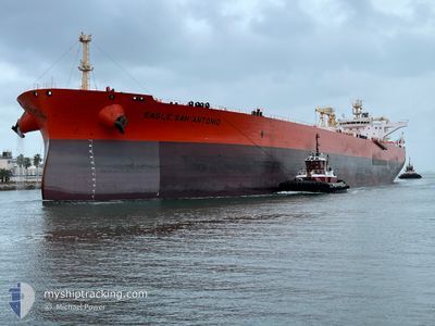
EAGLE SAN ANTONIO
Tanker
Current Trip
CCLZ
| Time Travelled | 6 days |
|---|---|
| Remaining Time | --- |
| Distance Travelled | 446.70 nm |
| Remaining Distance | --- |
| AVG Speed | 9.1 Knopen |
| MAX Speed | 15.3 Knopen |
| AVG Wind | 11.1 knots |
| MAX Wind | 23 knots |
| MIN Temp | 23.8°C / 74.84°F |
| MAX Temp | 30°C / 86°F |
| Diepgang | 13.2 M |
| Positie ontvangen | 1 d geleden |
Current Position
| Lengtegraad | -96.66330° |
|---|---|
| Breedtegraat | 27.83121° |
| Status | Under way using engine |
| Snelheid | 15 Knopen |
| Koers | 270.5° |
| Gebied | Gulf of Mexico |
| Station | T-AIS |
| Positie ontvangen | 1 d geleden |
Info
Information
The current position of EAGLE SAN ANTONIO is in Gulf of Mexico with coordinates 27.83121° / -96.66330° as reported on 2024-05-16 01:53 by AIS to our vessel tracker app. The vessel's current speed is 15 Knopen
The vessel EAGLE SAN ANTONIO (IMO: 959482200, MMSI: 566453000) is a Tanker It's sailing under the flag of [SG] Singapore.
In this page you can find informations about the vessels current position, last detected port calls, and current voyage information. If the vessels is not in coverage by AIS you will find the latest position.
The current position of EAGLE SAN ANTONIO is detected by our AIS receivers and we are not responsible for the reliability of the data. The last position was recorded while the vessel was in Coverage by the Ais receivers of our vessel tracking app.
The current draught of EAGLE SAN ANTONIO as reported by AIS is 13.2 meters
Weather
| Temperature | 27°C / 80.6°F |
|---|---|
| Wind Speed | 12 knots |
| Direction | 19° NNE |
| Pressure | 1006.9 hPa |
| Humidity | 70.5 % |
| Cloud Coverage | 62 % |
Featured Company
Last Port Calls
| Port | Arrival | Departure | Time In Port |
|---|---|---|---|
| 2024-05-07 16:04 | 2024-05-10 22:29 | 3 d | |
| 2024-04-30 16:47 | 2024-05-02 17:22 | 2 d | |
| 2024-04-18 16:39 | 2024-04-20 13:13 | 1 d | |
| 2024-04-13 19:12 | 2024-04-13 20:00 | 48 m | |
| 2024-04-08 13:11 | 2024-04-09 18:57 | 1 d | |
| 2024-03-31 22:09 | 2024-04-02 21:44 | 1 d | |
| 2024-03-26 17:13 | 2024-03-28 17:20 | 2 d | |
| 2024-03-12 13:47 | 2024-03-12 14:39 | 51 m | |
| 2024-03-03 07:27 | 2024-03-06 06:38 | 2 d |
Most Visited Ports (Last year)
| Port | Arrivals | |
|---|---|---|
| 17 | ||
| 12 | ||
| 3 | ||
| 1 | ||
| 1 |
Last Trips
| Origin | Departure | Destination | Arrival | Distance | |
|---|---|---|---|---|---|
| 2024-05-02 12:22 | 2024-05-07 11:04 | 478.25 nm | |||
| 2024-04-20 08:13 | 2024-04-30 11:47 | 553.33 nm | |||
| 2024-04-13 15:00 | 2024-04-18 11:39 | 307.10 nm | |||
| 2024-04-09 13:57 | 2024-04-13 14:12 | 380.49 nm | |||
| 2024-04-02 16:44 | 2024-04-08 08:11 | 198.49 nm | |||
| 2024-03-28 12:20 | 2024-03-31 17:09 | 201.35 nm | |||
| 2024-03-12 09:39 | 2024-03-26 12:13 | 285.09 nm | |||
| 2024-03-06 00:38 | 2024-03-12 08:47 | 95.69 nm | |||
| 2024-02-27 12:01 | 2024-03-03 01:27 | 272.33 nm |
Events
| Tijd | Evenement | Details | Positie / Bestemming | Info |
|---|---|---|---|---|
| 2024-05-17 19:46 | Start beweging | 4.03 nm, West of CORPUS CHRISTI |
27.81660 / -97.45885
CCLZ
|
Snelheid: 3.9 kn Koers: 67° |
| 2024-05-16 14:15 | Stop beweging | 4.33 nm, West of CORPUS CHRISTI |
27.81613 / -97.46436
CCLZ
|
Snelheid: 0.3 kn Koers: 93° |
| 2024-05-16 10:15 | Start beweging | 6.31 nm, East of PORT ARANSAS |
27.81012 / -96.95382
CCLZ
|
Snelheid: 5.4 kn Koers: 271° |
| 2024-05-16 10:03 | Stop beweging | 6.58 nm, East of PORT ARANSAS |
27.80988 / -96.94861
CCLZ
|
Snelheid: 0.3 kn Koers: 265° |
| 2024-05-16 09:43 | Start beweging | 6.76 nm, East of PORT ARANSAS |
27.82381 / -96.94157
CCLZ
|
Snelheid: 3.9 kn Koers: 180° |
| 2024-05-16 03:30 | Stop beweging | 6.59 nm, East of PORT ARANSAS |
27.82994 / -96.94395
CCLZ
|
Snelheid: 0.3 kn Koers: 108° |
| 2024-05-16 01:58 | Status Changed | Default Under way using engine |
27.83160 / -96.69015
CCLZ
|
Snelheid: 15 kn Koers: 270.5° |
| 2024-05-16 01:53 | Status Changed | Under way using engine Default |
27.83121 / -96.66330
CCLZ
|
Snelheid: 14.9 kn Koers: 271° |
| 2024-05-16 01:53 | Buitenbereik |
27.83121 / -96.66330
Gulf of Mexico
|
Snelheid: 15 kn Koers: 270.5° |
|
| 2024-05-16 01:47 | Status Changed | Default Under way using engine |
27.83078 / -96.63470
CCLZ
|
Snelheid: 14.9 kn Koers: 271° |