
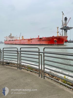
EAGLE BARCELONA
Tanker
Current Trip
| Time Travelled | 5 days |
|---|---|
| Remaining Time | 1 day |
| Distance Travelled | 1196.14 nm |
| Remaining Distance | 317.94 nm |
| AVG Speed | 12.1 Knopen |
| MAX Speed | 14.5 Knopen |
| AVG Wind | 14.3 knots |
| MAX Wind | 23 knots |
| MIN Temp | 11.5°C / 52.7°F |
| MAX Temp | 17.6°C / 63.68°F |
| Diepgang | 8.8 M |
| Positie ontvangen | 1 d geleden |
Current Position
| Lengtegraad | -7.15728° |
|---|---|
| Breedtegraat | 35.97056° |
| Status | Under way using engine |
| Snelheid | 1.3 Knopen |
| Koers | 76° |
| Gebied | North Atlantic Ocean |
| Station | T-AIS |
| Positie ontvangen | 1 d geleden |
Info
Information
The current position of EAGLE BARCELONA is in North Atlantic Ocean with coordinates 35.97056° / -7.15728° as reported on 2024-05-19 04:09 by AIS to our vessel tracker app. The vessel's current speed is 1.3 Knopen and is heading at the port of ARZEW. The estimated time of arrival as calculated by MyShipTracking vessel tracking app is 2024-05-21 15:03 LT
The vessel EAGLE BARCELONA (IMO: 9795048, MMSI: 563045300) is a Tanker It's sailing under the flag of [SG] Singapore.
In this page you can find informations about the vessels current position, last detected port calls, and current voyage information. If the vessels is not in coverage by AIS you will find the latest position.
The current position of EAGLE BARCELONA is detected by our AIS receivers and we are not responsible for the reliability of the data. The last position was recorded while the vessel was in Coverage by the Ais receivers of our vessel tracking app.
The current draught of EAGLE BARCELONA as reported by AIS is 8.8 meters
Weather
| Temperature | 17°C / 62.6°F |
|---|---|
| Wind Speed | 9 knots |
| Direction | 292° WNW |
| Pressure | 1017.4 hPa |
| Humidity | 70 % |
| Cloud Coverage | 19 % |
Featured Company
Last Port Calls
| Port | Arrival | Departure | Time In Port |
|---|---|---|---|
| 2024-05-13 00:54 | 2024-05-15 03:15 | 2 d | |
| 2024-04-13 16:24 | 2024-04-14 23:02 | 1 d | |
| 2024-03-14 16:16 | 2024-03-17 19:49 | 3 d |
Last Trips
| Origin | Departure | Destination | Arrival | Distance | |
|---|---|---|---|---|---|
| 2024-04-14 23:02 | 2024-05-13 00:54 | 5445.91 nm | |||
| 2024-03-17 19:49 | 2024-04-13 16:24 | 5603.17 nm | |||
| 2024-02-25 18:38 | 2024-03-14 16:16 | 5135.65 nm |
Events
| Tijd | Evenement | Details | Positie / Bestemming | Info |
|---|---|---|---|---|
| 2024-05-19 04:18 | Status Changed | Default Under way using engine |
35.96784 / -7.15447
DZAZW
|
Snelheid: 1.3 kn Koers: 76° |
| 2024-05-19 04:09 | Buitenbereik |
35.97056 / -7.15728
North Atlantic Ocean
DZAZW
|
Snelheid: 1.3 kn Koers: 138.4° |
|
| 2024-05-19 03:55 | Status Changed | Under way using engine Default |
35.97443 / -7.16146
DZAZW
|
Snelheid: 1.4 kn Koers: 74° |
| 2024-05-19 03:45 | Status Changed | Default Under way using engine |
35.97698 / -7.16437
DZAZW
|
Snelheid: 1.3 kn Koers: 73° |
| 2024-05-19 03:23 | Status Changed | Under way using engine Default |
35.98247 / -7.17158
DZAZW
|
Snelheid: 1.4 kn Koers: 71° |
| 2024-05-19 03:10 | Status Changed | Default Under way using engine |
35.98593 / -7.17584
DZAZW
|
Snelheid: 1.4 kn Koers: 72° |
| 2024-05-19 02:57 | Status Changed | Under way using engine Default |
35.98931 / -7.18021
DZAZW
|
Snelheid: 1.5 kn Koers: 67° |
| 2024-05-19 02:42 | Binnenbereik |
35.98931 / -7.18021
North Atlantic Ocean
DZAZW
|
Snelheid: 1.4 kn Koers: 129.9° |
|
| 2024-05-19 01:25 | Status Changed | Default Under way using engine |
36.00996 / -7.22168
DZAZW
|
Snelheid: 1.7 kn Koers: 60° |
| 2024-05-19 01:19 | Buitenbereik |
36.01116 / -7.22455
North Atlantic Ocean
DZAZW
|
Snelheid: 1.7 kn Koers: 116° |