
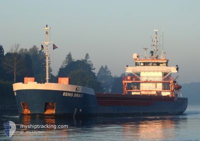
EEMS DRAIT
General Cargo
Current Trip
| Time Travelled | 4 h, 34 mins |
|---|---|
| Remaining Time | 2 days |
| Distance Travelled | 37.13 nm |
| Remaining Distance | 590.34 nm |
| AVG Speed | 8.8 Knopen |
| MAX Speed | 10 Knopen |
| AVG Wind | 15.6 knots |
| MAX Wind | 18.8 knots |
| MIN Temp | 10.9°C / 51.62°F |
| MAX Temp | 11.6°C / 52.88°F |
| Diepgang | 5.5 M |
| Positie ontvangen | 1 m geleden |
Current Position
| Lengtegraad | -5.34652° |
|---|---|
| Breedtegraat | 54.28748° |
| Status | Under way using engine |
| Snelheid | 8.9 Knopen |
| Koers | 186.7° |
| Gebied | Irish Sea and St. George's Channel |
| Station | T-AIS |
| Positie ontvangen | 1 m geleden |
Info
Information
The current position of EEMS DRAIT is in Irish Sea and St. George's Channel with coordinates 54.28748° / -5.34652° as reported on 2024-05-13 22:59 by AIS to our vessel tracker app. The vessel's current speed is 8.9 Knopen and is heading at the port of ERITH. The estimated time of arrival as calculated by MyShipTracking vessel tracking app is 2024-05-16 17:21 LT
The vessel EEMS DRAIT (IMO: 9195688, MMSI: 244096000) is a General Cargo that was built in 2000 ( 24 Jaar oud ). It's sailing under the flag of [NL] Netherlands.
In this page you can find informations about the vessels current position, last detected port calls, and current voyage information. If the vessels is not in coverage by AIS you will find the latest position.
The current position of EEMS DRAIT is detected by our AIS receivers and we are not responsible for the reliability of the data. The last position was recorded while the vessel was in Coverage by the Ais receivers of our vessel tracking app.
The current draught of EEMS DRAIT as reported by AIS is 5.5 meters
Weather
| Temperature | 11.3°C / 52.34°F |
|---|---|
| Wind Speed | 16 knots |
| Direction | 143° SE |
| Pressure | 998.6 hPa |
| Humidity | 98.8 % |
| Cloud Coverage | 100 % |
Featured Company
Last Port Calls
| Port | Arrival | Departure | Time In Port |
|---|---|---|---|
| 2024-05-11 12:55 | 2024-05-13 18:26 | 2 d | |
| 2024-05-08 10:38 | 2024-05-10 23:24 | 2 d | |
| 2024-04-29 04:14 | 2024-05-04 18:36 | 5 d | |
| 2024-04-23 09:56 | 2024-04-24 16:20 | 1 d | |
| 2024-04-20 12:15 | 2024-04-22 22:17 | 2 d | |
| 2024-04-14 01:57 | 2024-04-17 05:37 | 3 d | |
| 2024-04-11 23:45 | 2024-04-13 00:58 | 1 d | |
| 2024-04-01 19:18 | 2024-04-06 10:33 | 4 d | |
| 2024-03-27 00:55 | 2024-03-28 23:27 | 1 d | |
| 2024-03-18 07:22 | 2024-03-21 14:46 | 3 d |
Most Visited Ports (Last year)
| Port | Arrivals | |
|---|---|---|
| 13 | ||
| 11 | ||
| 8 | ||
| 7 | ||
| 6 | ||
| 6 |
Last Trips
| Origin | Departure | Destination | Arrival | Distance | |
|---|---|---|---|---|---|
| 2024-05-11 00:24 | 2024-05-11 13:55 | 142.54 nm | |||
| 2024-05-04 20:36 | 2024-05-08 11:38 | 788.98 nm | |||
| 2024-04-24 18:20 | 2024-04-29 06:14 | 924.99 nm | |||
| 2024-04-23 00:17 | 2024-04-23 11:56 | 97.87 nm | |||
| 2024-04-17 06:37 | 2024-04-20 14:15 | 654.82 nm | |||
| 2024-04-13 01:58 | 2024-04-14 02:57 | 11.31 nm | |||
| 2024-04-06 12:33 | 2024-04-12 00:45 | 953.56 nm | |||
| 2024-03-28 23:27 | 2024-04-01 21:18 | 775.16 nm | |||
| 2024-03-21 15:46 | 2024-03-27 00:55 | 744.38 nm | |||
| 2024-03-13 15:32 | 2024-03-18 08:22 | 896.19 nm |
Events
| Tijd | Evenement | Details | Positie / Bestemming | Info |
|---|---|---|---|---|
| 2024-05-13 22:06 | Gevonden in zee | United Kingdom part of the Irish Sea and St. George's Channel |
54.41951 / -5.32709
Irish Sea and St. George's Channel
GBERI
|
Snelheid: 9.3 kn Koers: 164.9° |
| 2024-05-13 22:06 | Status Changed | Under way using engine Default |
54.41951 / -5.32709
GBERI
|
Snelheid: 9.4 kn Koers: 164° |
| 2024-05-13 22:03 | Status Changed | Default Under way using engine |
54.42812 / -5.33091
GBERI
|
Snelheid: 9 kn Koers: 165.5° |
| 2024-05-13 21:44 | Status Changed | Under way using engine Default |
54.47415 / -5.35165
GBERI
|
Snelheid: 9.1 kn Koers: 164° |
| 2024-05-13 21:19 | Status Changed | Default Under way using engine |
54.53474 / -5.37787
GBERI
|
Snelheid: 8.8 kn Koers: 164° |
| 2024-05-13 21:12 | Status Changed | Under way using engine Default |
54.54931 / -5.38460
GBERI
|
Snelheid: 8.6 kn Koers: 163° |
| 2024-05-13 21:10 | Status Changed | Default Under way using engine |
54.55396 / -5.38706
GBERI
|
Snelheid: 8.6 kn Koers: 163.3° |
| 2024-05-13 20:38 | Status Changed | Under way using engine Default |
54.62857 / -5.42137
GBERI
|
Snelheid: 8.4 kn Koers: 166° |
| 2024-05-13 20:35 | Status Changed | Default Under way using engine |
54.63580 / -5.42434
GBERI
|
Snelheid: 8.4 kn Koers: 155.4° |
| 2024-05-13 20:21 | Status Changed | Under way using engine Default |
54.66488 / -5.44339
GBERI
|
Snelheid: 8.4 kn Koers: 158° |