
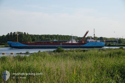
DOUWENT
General Cargo
Current Trip
| Time Travelled | 12 h, 43 mins |
|---|---|
| Remaining Time | 9 h, 35 mins |
| Distance Travelled | 108.66 nm |
| Remaining Distance | 86.17 nm |
| AVG Speed | 8.4 Knopen |
| MAX Speed | 10.6 Knopen |
| AVG Wind | 10.4 knots |
| MAX Wind | 15.9 knots |
| MIN Temp | 3.6°C / 38.48°F |
| MAX Temp | 7.5°C / 45.5°F |
| Diepgang | 2.7 M |
| Positie ontvangen | 3 h, 38 m geleden |
Current Position
| Lengtegraad | 1.79249° |
|---|---|
| Breedtegraat | 52.77023° |
| Status | Under way using engine |
| Snelheid | 7.6 Knopen |
| Koers | 133.4° |
| Gebied | North Sea |
| Station | T-AIS |
| Positie ontvangen | 3 h, 38 m geleden |
Info
Information
The current position of DOUWENT is in North Sea with coordinates 52.77023° / 1.79249° as reported on 2024-04-26 04:13 by AIS to our vessel tracker app. The vessel's current speed is 7.6 Knopen and is heading at the port of AMSTERDAM. The estimated time of arrival as calculated by MyShipTracking vessel tracking app is 2024-04-26 17:26 LT
The vessel DOUWENT (IMO: 8703139, MMSI: 636016022) is a General Cargo that was built in 1987 ( 37 Jaar oud ). It's sailing under the flag of [LR] Liberia.
In this page you can find informations about the vessels current position, last detected port calls, and current voyage information. If the vessels is not in coverage by AIS you will find the latest position.
The current position of DOUWENT is detected by our AIS receivers and we are not responsible for the reliability of the data. The last position was recorded while the vessel was in Coverage by the Ais receivers of our vessel tracking app.
The current draught of DOUWENT as reported by AIS is 2.7 meters
Weather
| Temperature | 7.5°C / 45.5°F |
|---|---|
| Wind Speed | 9 knots |
| Direction | 346° NNW |
| Pressure | 1002.7 hPa |
| Humidity | 64.4 % |
| Cloud Coverage | 100 % |
Featured Company
Last Port Calls
| Port | Arrival | Departure | Time In Port |
|---|---|---|---|
| 2024-04-24 17:46 | 2024-04-25 19:08 | 1 d | |
| 2024-04-22 23:22 | 2024-04-22 23:51 | 29 m | |
| 2024-04-22 08:53 | 2024-04-22 22:18 | 13 h | |
| 2024-04-19 14:02 | 2024-04-21 04:56 | 1 d | |
| 2024-04-18 13:12 | 2024-04-18 14:07 | 55 m | |
| 2024-04-17 15:37 | 2024-04-18 12:09 | 20 h | |
| 2024-04-13 20:40 | 2024-04-16 10:51 | 2 d | |
| 2024-04-12 21:19 | 2024-04-12 21:41 | 22 m | |
| 2024-04-11 17:48 | 2024-04-12 20:16 | 1 d | |
| 2024-04-09 05:35 | 2024-04-10 18:53 | 1 d |
Most Visited Ports (Last year)
| Port | Arrivals | |
|---|---|---|
| 63 | ||
| 61 | ||
| 55 | ||
| 2 | ||
| 1 | ||
| 1 |
Last Trips
| Origin | Departure | Destination | Arrival | Distance | |
|---|---|---|---|---|---|
| 2024-04-23 01:51 | 2024-04-24 18:46 | 181.58 nm | |||
| 2024-04-23 00:18 | 2024-04-23 01:22 | 6.03 nm | |||
| 2024-04-21 05:56 | 2024-04-22 10:53 | 192.80 nm | |||
| 2024-04-18 16:07 | 2024-04-19 15:02 | 173.14 nm | |||
| 2024-04-18 14:09 | 2024-04-18 15:12 | 7.34 nm | |||
| 2024-04-16 11:51 | 2024-04-17 17:37 | 192.27 nm | |||
| 2024-04-12 23:41 | 2024-04-13 21:40 | 181.93 nm | |||
| 2024-04-12 22:16 | 2024-04-12 23:19 | 8.21 nm | |||
| 2024-04-10 19:53 | 2024-04-11 19:48 | 193.37 nm | |||
| 2024-04-07 18:10 | 2024-04-09 06:35 | 182.93 nm |
Events
| Tijd | Evenement | Details | Positie / Bestemming | Info |
|---|---|---|---|---|
| 2024-04-26 04:20 | Status Changed | Default Under way using engine |
52.76048 / 1.81247
NLAMS
|
Snelheid: 7.6 kn Koers: 133.4° |
| 2024-04-26 04:13 | Buitenbereik |
52.77023 / 1.79250
North Sea
NLAMS
|
Snelheid: 7.6 kn Koers: 133.4° |
|
| 2024-04-26 03:58 | Status Changed | Under way using engine Default |
52.79009 / 1.75059
NLAMS
|
Snelheid: 7.7 kn Koers: 128° |
| 2024-04-26 03:56 | Status Changed | Default Under way using engine |
52.79181 / 1.74686
NLAMS
|
Snelheid: 7.8 kn Koers: 124.4° |
| 2024-04-25 23:47 | Draught Changed | 2.7 3.7 |
53.05357 / 1.04122
NLAMS
|
Snelheid: 8.8 kn Koers: 112.1° |
| 2024-04-25 23:47 | Destination Changed | NLAMS GBBOS |
53.05357 / 1.04122
NLAMS
|
Snelheid: 8.8 kn Koers: 112.1° |
| 2024-04-25 23:47 | ETA Changed | 2024/04/26 18:00 2024/04/23 22:30 |
53.05357 / 1.04122
NLAMS
|
Snelheid: 8.8 kn Koers: 112.1° |
| 2024-04-25 23:27 | Status Changed | Under way using engine Default |
53.07077 / .96914
GBBOS
|
Snelheid: 9 kn Koers: 112° |
| 2024-04-25 23:27 | Binnenbereik |
53.07077 / .96914
North Sea
|
Snelheid: 8.8 kn Koers: 109° |
|
| 2024-04-25 19:08 | Vertrekhaven |
|
52.95557 / .00415
GBBOS
|
Snelheid: 5.9 kn Koers: 141° |