
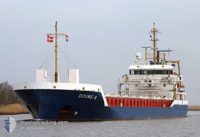
DOUWE-S
General Cargo
Current Trip
| Time Travelled | 15 days |
|---|---|
| Remaining Time | --- |
| Distance Travelled | 3990.04 nm |
| Remaining Distance | --- |
| AVG Speed | 11.3 Knopen |
| MAX Speed | 15.4 Knopen |
| AVG Wind | 11.8 knots |
| MAX Wind | 36 knots |
| MIN Temp | 7.7°C / 45.86°F |
| MAX Temp | 20.2°C / 68.36°F |
| Diepgang | 3.8 M |
| Positie ontvangen | 8 d geleden |
Current Position
| Lengtegraad | --- |
|---|---|
| Breedtegraat | --- |
| Status | Under way using engine |
| Snelheid | 11 Knopen |
| Koers | 235.5° |
| Gebied | Gulf of St-Lawrence |
| Station | T-AIS |
| Positie ontvangen | 8 d geleden |
Info
Information
The current position of DOUWE-S is in Gulf of St-Lawrence with coordinates 51.32934° / -57.05907° as reported on 2024-09-27 11:10 by AIS to our vessel tracker app. The vessel's current speed is 11 Knopen
The vessel DOUWE-S (IMO: 9467225, MMSI: 244956000) is a General Cargo that was built in 2011 ( 13 Jaar oud ). It's sailing under the flag of [NL] Netherlands.
In this page you can find informations about the vessels current position, last detected port calls, and current voyage information. If the vessels is not in coverage by AIS you will find the latest position.
The current position of DOUWE-S is detected by our AIS receivers and we are not responsible for the reliability of the data. The last position was recorded while the vessel was in Coverage by the Ais receivers of our vessel tracking app.
The current draught of DOUWE-S as reported by AIS is 3.8 meters
Weather
| Temperature | 19.9°C / 67.82°F |
|---|---|
| Wind Speed | 9 knots |
| Direction | 340° NNW |
| Pressure | 1018.4 hPa |
| Humidity | 63.1 % |
| Cloud Coverage | 75 % |
Featured Company
Last Port Calls
| Port | Arrival | Departure | Time In Port |
|---|---|---|---|
| 2024-09-19 17:43 | 2024-09-20 17:11 | 23 h | |
| 2024-09-07 15:46 | 2024-09-09 15:14 | 1 d | |
| 2024-08-28 19:36 | 2024-08-29 20:35 | 1 d | |
| 2024-08-19 02:29 | 2024-08-21 17:20 | 2 d | |
| 2024-08-15 14:04 | 2024-08-16 11:32 | 21 h | |
| 2024-08-13 10:09 | 2024-08-14 17:45 | 1 d | |
| 2024-08-05 19:29 | 2024-08-06 17:36 | 22 h |
Last Trips
| Origin | Departure | Destination | Arrival | Distance | |
|---|---|---|---|---|---|
| 2024-09-09 12:14 | 2024-09-19 18:43 | 2437.94 nm | |||
| 2024-08-29 21:35 | 2024-09-07 12:46 | 2334.66 nm | |||
| 2024-08-21 19:20 | 2024-08-28 20:36 | 830.67 nm | |||
| 2024-08-16 13:32 | 2024-08-19 04:29 | 433.52 nm | |||
| 2024-08-14 19:45 | 2024-08-15 16:04 | 233.81 nm | |||
| 2024-08-06 19:36 | 2024-08-13 12:09 | 1418.47 nm | |||
| 2024-07-29 21:21 | 2024-08-05 21:29 | 476.82 nm |
Events
| Tijd | Evenement | Details | Positie / Bestemming | Info |
|---|---|---|---|---|
| 2024-09-30 16:55 | Start beweging | 18.35 nm, South West of TROIS-PISTOLES |
47.93067 / -69.52470
CAHAL
|
Snelheid: 8.1 kn Koers: 294° |
| 2024-09-29 18:11 | Stop beweging | 18.15 nm, South West of TROIS-PISTOLES |
47.92795 / -69.51421
CAHAL
|
Snelheid: 0.2 kn Koers: 4° |
| 2024-09-27 11:18 | Status Changed | Default Under way using engine |
51.31669 / -57.08908
CAHAL
|
Snelheid: 11 kn Koers: 235.5° |
| 2024-09-27 11:10 | Gevonden in zee | Canadian part of the Gulf of St-Lawrence |
51.32934 / -57.05907
Gulf of St-Lawrence
CAHAL
|
Snelheid: 11 kn Koers: 235.5° |
| 2024-09-27 11:10 | Status Changed | Under way using engine Default |
51.32934 / -57.05907
CAHAL
|
Snelheid: 11.5 kn Koers: 238° |
| 2024-09-27 11:10 | Binnenbereik |
51.32934 / -57.05907
Gulf of St-Lawrence
CAHAL
|
Snelheid: 11 kn Koers: 235.5° |
|
| 2024-09-27 11:10 | Buitenbereik |
51.32934 / -57.05907
Gulf of St-Lawrence
CAHAL
|
Snelheid: 11 kn Koers: 235.5° |