
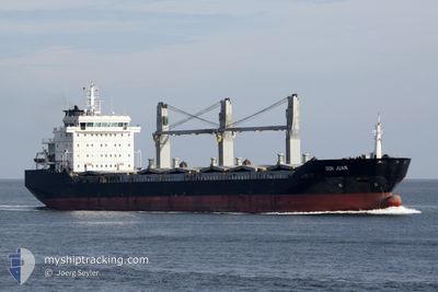
DON JUAN
Bulk Carrier
Current Trip
| Time Travelled | 2 days |
|---|---|
| Remaining Time | --- |
| Distance Travelled | 616.94 nm |
| Remaining Distance | --- |
| AVG Speed | 12 Knopen |
| MAX Speed | 13.4 Knopen |
| AVG Wind | 8.6 knots |
| MAX Wind | 21 knots |
| MIN Temp | 19.6°C / 67.28°F |
| MAX Temp | 23.8°C / 74.84°F |
| Diepgang | 5.8 M |
| Positie ontvangen | 17 h, 9 m geleden |
Current Position
| Lengtegraad | -9.20814° |
|---|---|
| Breedtegraat | 36.80157° |
| Status | Under way using engine |
| Snelheid | 11.5 Knopen |
| Koers | 314.5° |
| Gebied | North Atlantic Ocean |
| Station | T-AIS |
| Positie ontvangen | 17 h, 9 m geleden |
Info
Information
The current position of DON JUAN is in North Atlantic Ocean with coordinates 36.80157° / -9.20814° as reported on 2024-09-17 03:29 by AIS to our vessel tracker app. The vessel's current speed is 11.5 Knopen and is heading at the port of GIJON. The estimated time of arrival as calculated by MyShipTracking vessel tracking app is 2024-09-19 14:00 LT
The vessel DON JUAN (IMO: 9394222, MMSI: 255805740) is a Bulk Carrier that was built in 2007 ( 17 Jaar oud ). It's sailing under the flag of [PT] Portugal.
In this page you can find informations about the vessels current position, last detected port calls, and current voyage information. If the vessels is not in coverage by AIS you will find the latest position.
The current position of DON JUAN is detected by our AIS receivers and we are not responsible for the reliability of the data. The last position was recorded while the vessel was in Coverage by the Ais receivers of our vessel tracking app.
The current draught of DON JUAN as reported by AIS is 5.8 meters
Weather
| Temperature | 19.9°C / 67.82°F |
|---|---|
| Wind Speed | 6 knots |
| Direction | 292° WNW |
| Pressure | 1010.5 hPa |
| Humidity | 75.4 % |
| Cloud Coverage | 7 % |
Featured Company
Last Port Calls
| Port | Arrival | Departure | Time In Port |
|---|---|---|---|
| 2024-09-12 04:45 | 2024-09-14 23:37 | 2 d | |
| 2024-09-08 17:46 | 2024-09-11 06:52 | 2 d | |
| 2024-09-02 12:34 | 2024-09-04 21:19 | 2 d | |
| 2024-08-29 17:59 | 2024-08-29 18:43 | 44 m | |
| 2024-08-17 16:32 | 2024-08-26 17:21 | 9 d | |
| 2024-08-11 06:35 | 2024-08-13 18:17 | 2 d | |
| 2024-08-04 12:19 | 2024-08-06 23:30 | 2 d | |
| 2024-07-27 10:40 | 2024-07-31 15:50 | 4 d | |
| 2024-07-22 01:25 | 2024-07-23 17:47 | 1 d | |
| 2024-07-18 15:28 | 2024-07-20 18:00 | 2 d |
Most Visited Ports (Last year)
| Port | Arrivals | |
|---|---|---|
| 8 | ||
| 7 | ||
| 4 | ||
| 4 | ||
| 3 | ||
| 3 |
Last Trips
| Origin | Departure | Destination | Arrival | Distance | |
|---|---|---|---|---|---|
| 2024-09-11 08:52 | 2024-09-12 06:45 | 238.36 nm | |||
| 2024-09-04 22:19 | 2024-09-08 19:46 | 934.07 nm | |||
| 2024-08-29 20:43 | 2024-09-02 13:34 | 738.02 nm | |||
| 2024-08-26 18:21 | 2024-08-29 19:59 | 709.93 nm | |||
| 2024-08-13 20:17 | 2024-08-17 17:32 | 1024.38 nm | |||
| 2024-08-07 00:30 | 2024-08-11 08:35 | 1066.58 nm | |||
| 2024-07-31 17:50 | 2024-08-04 13:19 | 856.99 nm | |||
| 2024-07-23 19:47 | 2024-07-27 12:40 | 168.25 nm | |||
| 2024-07-20 20:00 | 2024-07-22 03:25 | 279.58 nm | |||
| 2024-07-17 14:31 | 2024-07-18 17:28 | 289.11 nm |
Events
| Tijd | Evenement | Details | Positie / Bestemming | Info |
|---|---|---|---|---|
| 2024-09-17 03:29 | Buitenbereik |
36.80157 / -9.20814
North Atlantic Ocean
ES GIJ
|
Snelheid: 11.5 kn Koers: 314.5° |
|
| 2024-09-16 21:10 | Status Changed | Under way using engine Default |
36.40514 / -7.77859
ES GIJ
|
Snelheid: 11.7 kn Koers: 291° |
| 2024-09-16 20:59 | Status Changed | Default Under way using engine |
36.39182 / -7.73492
ES GIJ
|
Snelheid: 11.8 kn Koers: 290° |
| 2024-09-16 20:54 | Status Changed | Under way using engine Default |
36.38571 / -7.71479
ES GIJ
|
Snelheid: 11.8 kn Koers: 290° |
| 2024-09-16 20:03 | Status Changed | Default Under way using engine |
36.32922 / -7.52512
ES GIJ
|
Snelheid: 11.7 kn Koers: 295° |
| 2024-09-16 19:41 | Wijzig zee gebeid | Portuguese part of the North Atlantic Ocean Spanish part of the North Atlantic Ocean |
36.29964 / -7.44332
North Atlantic Ocean
ES GIJ
|
Snelheid: 11.6 kn Koers: 294.6° |
| 2024-09-16 17:45 | Status Changed | Under way using engine Default |
36.16355 / -7.00107
ES GIJ
|
Snelheid: 12.1 kn Koers: 289° |
| 2024-09-16 17:39 | Status Changed | Default Under way using engine |
36.15684 / -6.97671
ES GIJ
|
Snelheid: 12.2 kn Koers: 288.8° |
| 2024-09-16 17:20 | Status Changed | Under way using engine Default |
36.13656 / -6.90287
ES GIJ
|
Snelheid: 12 kn Koers: 289° |
| 2024-09-16 17:18 | Status Changed | Default Under way using engine |
36.13466 / -6.89631
ES GIJ
|
Snelheid: 11.9 kn Koers: 289.9° |