
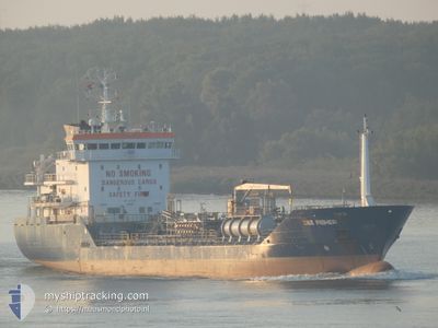
DEE FISHER
Oil/Chemical Tanker
Current Trip
| Time Travelled | 1 day |
|---|---|
| Remaining Time | 15 h, 16 mins |
| Distance Travelled | 267.81 nm |
| Remaining Distance | 157.81 nm |
| AVG Speed | 9.2 Knopen |
| MAX Speed | 12 Knopen |
| AVG Wind | 11.7 knots |
| MAX Wind | 17.6 knots |
| MIN Temp | 8.8°C / 47.84°F |
| MAX Temp | 12.6°C / 54.68°F |
| Diepgang | 4.7 M |
| Positie ontvangen | Nu |
Current Position
| Lengtegraad | 15.25216° |
|---|---|
| Breedtegraat | 54.66700° |
| Status | Under way using engine |
| Snelheid | 9.9 Knopen |
| Koers | 81.8° |
| Gebied | Baltic Sea |
| Station | T-AIS |
| Positie ontvangen | Nu |
Info
Information
The current position of DEE FISHER is in Baltic Sea with coordinates 54.66700° / 15.25216° as reported on 2024-05-13 05:25 by AIS to our vessel tracker app. The vessel's current speed is 9.9 Knopen and is heading at the port of GDYNIA. The estimated time of arrival as calculated by MyShipTracking vessel tracking app is 2024-05-13 20:42 LT
The vessel DEE FISHER (IMO: 9318216, MMSI: 210431000) is a Oil/Chemical Tanker that was built in 2006 ( 18 Jaar oud ). It's sailing under the flag of [CY] Cyprus.
In this page you can find informations about the vessels current position, last detected port calls, and current voyage information. If the vessels is not in coverage by AIS you will find the latest position.
The current position of DEE FISHER is detected by our AIS receivers and we are not responsible for the reliability of the data. The last position was recorded while the vessel was in Coverage by the Ais receivers of our vessel tracking app.
The current draught of DEE FISHER as reported by AIS is 4.7 meters
Weather
| Temperature | 9.3°C / 48.74°F |
|---|---|
| Wind Speed | 9 knots |
| Direction | 131° SE |
| Pressure | 1022.5 hPa |
| Humidity | 72.6 % |
| Cloud Coverage | 10 % |
Featured Company
Last Port Calls
| Port | Arrival | Departure | Time In Port |
|---|---|---|---|
| 2024-05-11 23:54 | 2024-05-12 00:42 | 48 m | |
| 2024-05-11 14:30 | 2024-05-11 23:52 | 9 h | |
| 2024-05-08 14:20 | 2024-05-09 11:16 | 20 h | |
| 2024-05-05 23:18 | 2024-05-06 19:17 | 19 h | |
| 2024-05-03 21:08 | 2024-05-04 22:42 | 1 d | |
| 2024-04-28 16:17 | 2024-04-29 10:31 | 18 h | |
| 2024-04-26 14:46 | 2024-04-27 15:27 | 1 d | |
| 2024-04-21 14:28 | 2024-04-22 11:28 | 21 h | |
| 2024-04-18 00:03 | 2024-04-19 00:45 | 1 d | |
| 2024-04-14 18:49 | 2024-04-15 19:36 | 1 d |
Last Trips
| Origin | Departure | Destination | Arrival | Distance | |
|---|---|---|---|---|---|
| 2024-05-12 01:52 | 2024-05-12 01:54 | 0.81 nm | |||
| 2024-05-09 13:16 | 2024-05-11 16:30 | 454.35 nm | |||
| 2024-05-06 20:17 | 2024-05-08 16:20 | 163.61 nm | |||
| 2024-05-04 23:42 | 2024-05-06 00:18 | 229.12 nm | |||
| 2024-04-29 11:31 | 2024-05-03 22:08 | 261.26 nm | |||
| 2024-04-27 16:27 | 2024-04-28 17:17 | 222.32 nm | |||
| 2024-04-22 12:28 | 2024-04-26 15:46 | 273.77 nm | |||
| 2024-04-19 02:45 | 2024-04-21 15:28 | 388.09 nm | |||
| 2024-04-15 20:36 | 2024-04-18 02:03 | 227.57 nm | |||
| 2024-04-13 13:24 | 2024-04-14 19:49 | 213.46 nm |
Events
| Tijd | Evenement | Details | Positie / Bestemming | Info |
|---|---|---|---|---|
| 2024-05-13 04:02 | Wijzig zee gebeid | Polish part of the Baltic Sea Danish part of the Kattegat |
54.63374 / 14.86032
Baltic Sea
|
Snelheid: 10.1 kn Koers: 80.9° |
| 2024-05-13 02:50 | Gevonden in zee | Danish part of the Kattegat |
54.60395 / 14.51878
Kattegat
|
Snelheid: 10 kn Koers: 83.1° |
| 2024-05-12 18:49 | ETA Changed | 2025/04/13 21:00 2024/05/13 20:00 |
54.62021 / 12.41945
PLGDY
|
Snelheid: 8.9 kn Koers: 54.9° |
| 2024-05-12 16:50 | Wijzig zee gebeid | German part of the Baltic Sea Danish part of the Baltic Sea |
54.40814 / 12.10918
Baltic Sea
PLGDY
|
Snelheid: 8.8 kn Koers: 92.5° |
| 2024-05-12 13:59 | Gevonden in zee | Danish part of the Baltic Sea |
54.50165 / 11.44260
Baltic Sea
PLGDY
|
Snelheid: 8.6 kn Koers: 115.7° |
| 2024-05-12 11:59 | Gevonden in zee | German part of the Baltic Sea |
54.63875 / 11.01461
Baltic Sea
PLGDY
|
Snelheid: 8.8 kn Koers: 127.1° |
| 2024-05-12 10:59 | Wijzig zee gebeid | Danish part of the Baltic Sea Danish part of the Kattegat |
54.74136 / 10.86726
Baltic Sea
PLGDY
|
Snelheid: 8.8 kn Koers: 174.8° |
| 2024-05-12 06:52 | ETA Changed | 2024/05/13 20:00 2024/05/13 16:00 |
55.31762 / 11.02755
PLGDY
|
Snelheid: 9.6 kn Koers: 182.8° |
| 2024-05-12 00:42 | Vertrekhaven |
|
55.55368 / 9.76063
PLGDY
|
Snelheid: 6.4 kn Koers: 114° |
| 2024-05-12 00:37 | Start beweging |
55.55714 / 9.74652
[DK] FREDERICIA
|
Snelheid: 4.2 kn Koers: 113° |