
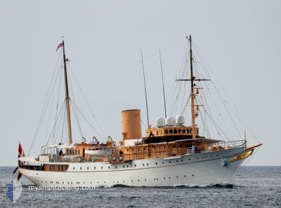
DANNEBROG
Military ops
Current Trip
| Time Travelled | 1 day |
|---|---|
| Remaining Time | 39 mins |
| Distance Travelled | 403.48 nm |
| Remaining Distance | 9.64 nm |
| AVG Speed | 10 Knopen |
| MAX Speed | 13.3 Knopen |
| AVG Wind | 15.2 knots |
| MAX Wind | 22 knots |
| MIN Temp | 1.3°C / 34.34°F |
| MAX Temp | 13.4°C / 56.12°F |
| Diepgang | 4 M |
| Positie ontvangen | Nu |
Current Position
| Lengtegraad | 12.69981° |
|---|---|
| Breedtegraat | 55.60618° |
| Status | Under way using engine |
| Snelheid | 9.2 Knopen |
| Koers | 353.4° |
| Gebied | Kattegat |
| Station | T-AIS |
| Positie ontvangen | Nu |
Info
Information
The current position of DANNEBROG is in Kattegat with coordinates 55.60618° / 12.69981° as reported on 2024-05-10 05:22 by AIS to our vessel tracker app. The vessel's current speed is 9.2 Knopen and is heading at the port of COPENHAGEN. The estimated time of arrival as calculated by MyShipTracking vessel tracking app is 2024-05-10 06:01 LT
The vessel DANNEBROG (IMO: 4537661, MMSI: 219517000) is a Military ops It's sailing under the flag of [DK] Denmark.
In this page you can find informations about the vessels current position, last detected port calls, and current voyage information. If the vessels is not in coverage by AIS you will find the latest position.
The current position of DANNEBROG is detected by our AIS receivers and we are not responsible for the reliability of the data. The last position was recorded while the vessel was in Coverage by the Ais receivers of our vessel tracking app.
The current draught of DANNEBROG as reported by AIS is 4 meters
Weather
| Temperature | 10°C / 50°F |
|---|---|
| Wind Speed | 11 knots |
| Direction | 270° W |
| Pressure | 1020.7 hPa |
| Humidity | 93.6 % |
| Cloud Coverage | 90 % |
Featured Company
Last Port Calls
| Port | Arrival | Departure | Time In Port |
|---|---|---|---|
| 2024-05-06 07:53 | 2024-05-08 08:26 | 2 d | |
| 2024-05-02 16:44 | 2024-05-03 17:15 | 1 d | |
| 2024-05-02 13:21 | 2024-05-02 14:47 | 1 h | |
| 2024-04-27 10:36 | 2024-05-02 11:11 | 5 d | |
| 2024-04-26 11:30 | 2024-04-26 13:23 | 1 h | |
| 2024-04-26 07:32 | 2024-04-26 08:31 | 58 m | |
| 2024-04-24 11:46 | 2024-04-25 08:14 | 20 h | |
| 2024-04-15 06:50 | 2024-04-17 08:18 | 2 d | |
| 2024-03-19 17:28 | 2024-04-11 14:07 | 22 d | |
| 2024-03-19 08:13 |
Most Visited Ports (Last year)
| Port | Arrivals | |
|---|---|---|
| 15 | ||
| 6 | ||
| 3 | ||
| 2 | ||
| 2 | ||
| 2 |
Last Trips
| Origin | Departure | Destination | Arrival | Distance | |
|---|---|---|---|---|---|
| 2024-05-03 19:15 | 2024-05-06 09:53 | 453.62 nm | |||
| 2024-05-02 16:47 | 2024-05-02 18:44 | 21.40 nm | |||
| 2024-05-02 13:11 | 2024-05-02 15:21 | 22.00 nm | |||
| 2024-04-26 15:23 | 2024-04-27 12:36 | 42.90 nm | |||
| 2024-04-26 10:31 | 2024-04-26 13:30 | 26.23 nm | |||
| 2024-04-25 10:14 | 2024-04-26 09:32 | 153.47 nm | |||
| 2024-04-17 10:18 | 2024-04-24 13:46 | 677.36 nm | |||
| 2024-04-11 16:07 | 2024-04-15 08:50 | 648.99 nm | |||
| 2024-03-19 09:13 | 2024-03-19 18:28 | 80.17 nm |
Events
| Tijd | Evenement | Details | Positie / Bestemming | Info |
|---|---|---|---|---|
| 2024-05-10 04:41 | Wijzig zee gebeid | Danish part of the Kattegat Swedish part of the Kattegat |
55.49315 / 12.71091
Kattegat
|
Snelheid: 9.3 kn Koers: 3.5° |
| 2024-05-10 03:32 | Wijzig zee gebeid | Swedish part of the Kattegat Swedish part of the Baltic Sea |
55.33897 / 12.66619
Kattegat
|
Snelheid: 8.1 kn Koers: 13.2° |
| 2024-05-09 18:13 | Gevonden in zee | Swedish part of the Baltic Sea |
55.48821 / 14.72654
Baltic Sea
|
Snelheid: 8.7 kn Koers: 244.2° |
| 2024-05-09 15:55 | Wijzig zee gebeid | Danish part of the Kattegat Swedish part of the Baltic Sea |
55.64242 / 15.24893
Kattegat
|
Snelheid: 7.9 kn Koers: 239.8° |
| 2024-05-09 12:06 | Start beweging | 12.63 nm, South East of EKENABBEN |
55.95602 / 15.90698
HOME
|
Snelheid: 3.4 kn Koers: 322° |
| 2024-05-09 11:46 | Stop beweging | 12.58 nm, South East of EKENABBEN |
55.95362 / 15.90074
HOME
|
Snelheid: 0.3 kn Koers: 242° |
| 2024-05-09 07:51 | Binnenbereik |
56.49048 / 16.28954
Baltic Sea
|
Snelheid: 8.3 kn Koers: 191.3° |
|
| 2024-05-09 03:45 | Buitenbereik |
57.01643 / 16.67476
Baltic Sea
|
Snelheid: 8.6 kn Koers: 206.6° |
|
| 2024-05-08 23:56 | Binnenbereik |
57.53328 / 16.98415
Baltic Sea
|
Snelheid: 8.6 kn Koers: 198.2° |
|
| 2024-05-08 20:19 | Buitenbereik |
58.02287 / 17.29288
Baltic Sea
|
Snelheid: 9 kn Koers: 199.3° |