

CT BARNSTON
Towing

Current Trip
RAMSEY
| Time Travelled | 32 mins |
|---|---|
| Remaining Time | --- |
| Distance Travelled | 0.63 nm |
| Remaining Distance | --- |
| AVG Speed | --- |
| MAX Speed | --- |
| AVG Wind | 7.5 knots |
| MAX Wind | 8 knots |
| MIN Temp | 7.4°C / 45.32°F |
| MAX Temp | 7.5°C / 45.5°F |
| Diepgang | 8.8 M |
| Positie ontvangen | 16 h, 29 m geleden |
Current Position
| Lengtegraad | --- |
|---|---|
| Breedtegraat | --- |
| Status | Towing Astern |
| Snelheid | 4.2 Knopen |
| Koers | 304° |
| Gebied | Irish Sea and St. George's Channel |
| Station | T-AIS |
| Positie ontvangen | 16 h, 29 m geleden |
Information
The current position of CT BARNSTON is in Irish Sea and St. George's Channel with coordinates 53.72182° / -3.50216° as reported on 2025-02-27 20:42 by AIS to our vessel tracker app. The vessel's current speed is 4.2 Knopen
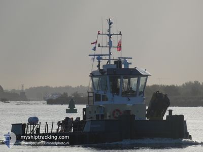
The vessel CT BARNSTON (IMO: 99678938, MMSI: 232043206) is a Towing It's sailing under the flag of [GB] United Kingdom.
In this page you can find informations about the vessels current position, last detected port calls, and current voyage information. If the vessels is not in coverage by AIS you will find the latest position.
The current position of CT BARNSTON is detected by our AIS receivers and we are not responsible for the reliability of the data. The last position was recorded while the vessel was in Coverage by the Ais receivers of our vessel tracking app.
The current draught of CT BARNSTON as reported by AIS is 8.8 meters
Weather
| Temperature | 7.5°C / 45.5°F |
|---|---|
| Wind Speed | 8 knots |
| Direction | 194° SSW |
| Pressure | 1028.3 hPa |
| Humidity | 78.9 % |
| Cloud Coverage | 7 % |


Featured Company
Last Port Calls
| Port | Arrival | Departure | Time In Port |
|---|---|---|---|
| 2025-02-28 09:43 | 2025-02-28 12:39 | 2 h | |
| 2025-02-26 11:55 | 2025-02-27 13:48 | 1 d | |
| 2025-02-22 11:08 | 2025-02-26 10:52 | 3 d | |
| 2025-02-19 18:51 | 2025-02-22 07:58 | 2 d | |
| 2025-02-16 21:57 | 2025-02-19 12:51 | 2 d | |
| 2025-02-15 09:02 | 2025-02-16 16:15 | 1 d | |
| 2025-02-12 14:44 | 2025-02-15 02:06 | 2 d | |
| 2025-02-12 05:55 | 2025-02-12 07:26 | 1 h | |
| 2025-02-11 09:24 | 2025-02-11 23:33 | 14 h | |
| 2025-02-09 00:29 | 2025-02-11 08:42 | 2 d |
Most Visited Ports (Last year)
| Port | Arrivals | |
|---|---|---|
| 48 | ||
| 42 | ||
| 40 | ||
| 26 | ||
| 23 | ||
| 15 |
Last Trips
| Origin | Departure | Destination | Arrival | Distance | |
|---|---|---|---|---|---|
| 2025-02-27 13:48 | 2025-02-28 09:43 | 82.55 nm | |||
| 2025-02-26 10:52 | 2025-02-26 11:55 | 6.74 nm | |||
| 2025-02-22 07:58 | 2025-02-22 11:08 | 24.75 nm | |||
| 2025-02-19 12:51 | 2025-02-19 18:51 | 41.76 nm | |||
| 2025-02-16 16:15 | 2025-02-16 21:57 | 48.05 nm | |||
| 2025-02-15 02:06 | 2025-02-15 09:02 | 47.72 nm | |||
| 2025-02-12 07:26 | 2025-02-12 14:44 | 38.89 nm | |||
| 2025-02-11 23:33 | 2025-02-12 05:55 | 41.06 nm | |||
| 2025-02-11 08:42 | 2025-02-11 09:24 | 6.96 nm | |||
| 2025-02-08 18:35 | 2025-02-09 00:29 | 36.40 nm |
Events
| Tijd | Evenement | Details | Positie / Bestemming | Info |
|---|---|---|---|---|
| 2025-02-28 12:39 | Vertrekhaven |
|
54.32441 / -4.36294
RAMSEY
|
Snelheid: 4.1 kn Koers: 86° |
| 2025-02-28 12:35 | Start beweging |
54.32429 / -4.37038
[IM] RAMSEY
|
Snelheid: 4.1 kn Koers: 86° |
|
| 2025-02-28 09:55 | Stop beweging |
54.32358 / -4.38004
[IM] RAMSEY
|
Snelheid: 0.1 kn Koers: 292° |
|
| 2025-02-28 09:43 | Aankomsthaven |
|
54.32434 / -4.37214
[IM] RAMSEY
|
Snelheid: 4.1 kn Koers: 244° |
| 2025-02-28 09:40 | Start beweging | 0.58 nm, East of RAMSEY |
54.32568 / -4.36559
RAMSEY
|
Snelheid: 4.1 kn Koers: 244° |
| 2025-02-28 06:04 | Stop beweging | 2.55 nm, East of RAMSEY |
54.31680 / -4.30914
RAMSEY
|
Snelheid: 0.2 kn Koers: 30° |
| 2025-02-27 20:47 | Status Changed | Default Towing Astern |
53.72731 / -3.50866
RAMSEY
|
Snelheid: 4.2 kn Koers: 304° |
| 2025-02-27 20:42 | Buitenbereik |
53.72182 / -3.50216
Irish Sea and St. George's Channel
RAMSEY
|
Snelheid: 4.2 kn Koers: 325.3° |
|
| 2025-02-27 20:28 | Status Changed | Towing Astern Default |
53.70911 / -3.48628
RAMSEY
|
Snelheid: 3.8 kn Koers: 304° |
| 2025-02-27 20:27 | Status Changed | Default Towing Astern |
53.70863 / -3.48574
RAMSEY
|
Snelheid: 3.8 kn Koers: 306° |