
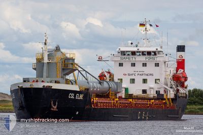
CSL ELBE
Self Discharging Bulk Carrier
Current Trip
| Time Travelled | 3 days |
|---|---|
| Remaining Time | 18 h, 17 mins |
| Distance Travelled | 691.91 nm |
| Remaining Distance | 185.18 nm |
| AVG Speed | 10.4 Knopen |
| MAX Speed | 12.6 Knopen |
| AVG Wind | 9.8 knots |
| MAX Wind | 21.9 knots |
| MIN Temp | 2.6°C / 36.68°F |
| MAX Temp | 7.1°C / 44.78°F |
| Diepgang | 8.4 M |
| Positie ontvangen | 2 m geleden |
Current Position
| Lengtegraad | 11.36561° |
|---|---|
| Breedtegraat | 64.93000° |
| Status | Under way using engine |
| Snelheid | 10.2 Knopen |
| Koers | 198.9° |
| Gebied | Norwegian Sea |
| Station | T-AIS |
| Positie ontvangen | 2 m geleden |
Info
Information
The current position of CSL ELBE is in Norwegian Sea with coordinates 64.93000° / 11.36561° as reported on 2024-04-28 20:36 by AIS to our vessel tracker app. The vessel's current speed is 10.2 Knopen and is heading at the port of ELNESVAGEN. The estimated time of arrival as calculated by MyShipTracking vessel tracking app is 2024-04-29 14:56 LT
The vessel CSL ELBE (IMO: 8001024, MMSI: 256038000) is a Self Discharging Bulk Carrier that was built in 1982 ( 42 Jaar oud ). It's sailing under the flag of [MT] Malta.
In this page you can find informations about the vessels current position, last detected port calls, and current voyage information. If the vessels is not in coverage by AIS you will find the latest position.
The current position of CSL ELBE is detected by our AIS receivers and we are not responsible for the reliability of the data. The last position was recorded while the vessel was in Coverage by the Ais receivers of our vessel tracking app.
The current draught of CSL ELBE as reported by AIS is 8.4 meters
Weather
| Temperature | 6.1°C / 42.98°F |
|---|---|
| Wind Speed | 15 knots |
| Direction | 97° E |
| Pressure | 1016.5 hPa |
| Humidity | 70.5 % |
| Cloud Coverage | 1 % |
Featured Company
Last Port Calls
| Port | Arrival | Departure | Time In Port |
|---|---|---|---|
| 2024-04-25 15:53 |
Last Trips
| Origin | Departure | Destination | Arrival | Distance |
|---|
Events
| Tijd | Evenement | Details | Positie / Bestemming | Info |
|---|---|---|---|---|
| 2024-04-28 20:26 | ETA Changed | 2024/04/29 18:00 2024/04/29 08:00 |
64.96091 / 11.39217
ELNESVAGEN
|
Snelheid: 10.1 kn Koers: 199.8° |
| 2024-04-28 18:59 | ETA Changed | 2024/04/29 08:00 2024/04/28 08:00 |
65.10629 / 11.81419
ELNESVAGEN
|
Snelheid: 10 kn Koers: 215.1° |
| 2024-04-28 17:03 | Draught Changed | 8.4 5.5 |
65.30626 / 12.33569
ELNESVAGEN
|
Snelheid: 5.7 kn Koers: 233° |
| 2024-04-28 17:03 | Destination Changed | ELNESVAGEN LESSREMAN |
65.30626 / 12.33569
ELNESVAGEN
|
Snelheid: 5.7 kn Koers: 233° |
| 2024-04-28 17:00 | Status Changed | Under way using engine Not under command |
65.30881 / 12.34217
LESSREMAN
|
Snelheid: 5.7 kn Koers: 222.8° |
| 2024-04-28 16:56 | Status Changed | Not under command Moored |
65.31402 / 12.35339
LESSREMAN
|
Snelheid: 5.8 kn Koers: 224° |
| 2024-04-28 16:47 | Status Changed | Moored Default |
65.32519 / 12.37627
LESSREMAN
|
Snelheid: 6.6 kn Koers: 217° |
| 2024-04-28 16:31 | Binnenbereik |
65.32519 / 12.37627
Norwegian Sea
|
Snelheid: 6.1 kn Koers: 217.1° |
|
| 2024-04-28 07:02 | Stop beweging | 9.49 nm, South East of BRONNOYSUND |
65.36437 / 12.47740
LESSREMAN
|
Snelheid: Koers: 265° |
| 2024-04-28 05:56 | Buitenbereik |
65.32845 / 12.38017
Norwegian Sea
LESSREMAN
|
Snelheid: 10.5 kn Koers: 36.8° |