
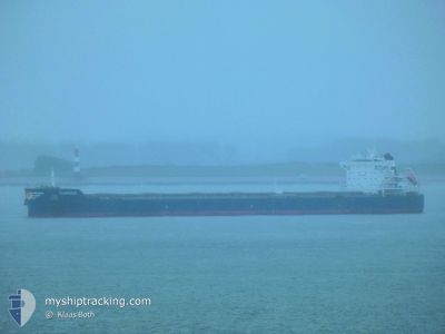
CORINNA
Bulk Carrier
Current Trip
| Time Travelled | 28 days |
|---|---|
| Remaining Time | --- |
| Distance Travelled | 6345.70 nm |
| Remaining Distance | --- |
| AVG Speed | 11.4 Knopen |
| MAX Speed | 11.4 Knopen |
| AVG Wind | 10.9 knots |
| MAX Wind | 29.8 knots |
| MIN Temp | 10.1°C / 50.18°F |
| MAX Temp | 31.7°C / 89.06°F |
| Diepgang | 14.9 M |
| Positie ontvangen | 1 m geleden |
Current Position
| Lengtegraad | 10.72350° |
|---|---|
| Breedtegraat | 57.66333° |
| Status | At anchor |
| Snelheid | |
| Koers | 36° |
| Gebied | Kattegat |
| Station | T-AIS |
| Positie ontvangen | 1 m geleden |
Info
Information
The current position of CORINNA is in Kattegat with coordinates 57.66333° / 10.72350° as reported on 2024-06-03 14:10 by AIS to our vessel tracker app. The vessel's current speed is 0 Knopen
The vessel CORINNA (IMO: 9593842, MMSI: 241267000) is a Bulk Carrier that was built in 2013 ( 11 Jaar oud ). It's sailing under the flag of [GR] Greece.
In this page you can find informations about the vessels current position, last detected port calls, and current voyage information. If the vessels is not in coverage by AIS you will find the latest position.
The current position of CORINNA is detected by our AIS receivers and we are not responsible for the reliability of the data. The last position was recorded while the vessel was in Coverage by the Ais receivers of our vessel tracking app.
The current draught of CORINNA as reported by AIS is 14.9 meters
Weather
| Temperature | 14.5°C / 58.1°F |
|---|---|
| Wind Speed | 26 knots |
| Direction | 258° WSW |
| Pressure | 1008.5 hPa |
| Humidity | 74.7 % |
| Cloud Coverage | 66 % |
Featured Company
Last Port Calls
| Port | Arrival | Departure | Time In Port |
|---|---|---|---|
| 2024-05-09 05:22 | 2024-05-09 14:40 | 9 h | |
| 2024-04-18 03:20 | 2024-05-06 04:51 | 18 d |
Most Visited Ports (Last year)
| Port | Arrivals | |
|---|---|---|
| 5 | ||
| 1 | ||
| 1 | ||
| 1 | ||
| 1 | ||
| 1 |
Last Trips
| Origin | Departure | Destination | Arrival | Distance | |
|---|---|---|---|---|---|
| 2024-05-06 04:51 | 2024-05-09 05:22 | 636.53 nm | |||
| 2024-03-19 04:24 | 2024-04-18 03:20 | 1558.63 nm |
Events
| Tijd | Evenement | Details | Positie / Bestemming | Info |
|---|---|---|---|---|
| 2024-06-03 09:22 | Stop beweging | 5.14 nm, South East of SKAGEN |
57.66633 / 10.72933
DK SKA
|
Snelheid: 0.3 kn Koers: 232° |
| 2024-06-03 09:00 | Status Changed | At anchor Constrained by her draught |
57.66417 / 10.72850
DK SKA
|
Snelheid: 0.5 kn Koers: 286° |
| 2024-06-03 05:35 | Wijzig zee gebeid | Danish part of the Kattegat Swedish part of the Kattegat |
57.43822 / 11.40843
Kattegat
DK SKA
|
Snelheid: 10.3 kn Koers: 321° |
| 2024-06-03 03:20 | Wijzig zee gebeid | Swedish part of the Kattegat Danish part of the Kattegat |
57.09733 / 11.68067
Kattegat
DK SKA
|
Snelheid: 10.5 kn Koers: 340° |
| 2024-06-02 10:35 | Wijzig zee gebeid | Danish part of the Kattegat Danish part of the Baltic Sea |
54.73850 / 10.78217
Kattegat
DK SKA
|
Snelheid: 8.9 kn Koers: 24° |
| 2024-06-02 09:55 | ETA Changed | 2024/06/03 06:30 2024/06/03 10:00 |
54.65552 / 10.83845
DK SKA
|
Snelheid: 9.6 kn Koers: 300° |
| 2024-06-02 09:40 | Wijzig zee gebeid | Danish part of the Baltic Sea German part of the Baltic Sea |
54.63567 / 10.89633
Baltic Sea
DK SKA
|
Snelheid: 9.5 kn Koers: 301° |
| 2024-06-02 09:34 | ETA Changed | 2024/06/03 10:00 2024/06/02 18:00 |
54.62717 / 10.92083
DK SKA
|
Snelheid: 9.4 kn Koers: 301° |
| 2024-06-02 09:02 | Status Changed | Constrained by her draught Under way using engine |
54.59850 / 11.05183
DK SKA
|
Snelheid: 9.4 kn Koers: 267° |
| 2024-06-02 07:47 | Wijzig zee gebeid | German part of the Baltic Sea Danish part of the Baltic Sea |
54.54823 / 11.35771
Baltic Sea
DK SKA
|
Snelheid: 9.3 kn Koers: 295° |