
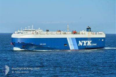
CORAL LEADER
Vehicles Carrier
Current Trip
| Time Travelled | 1 day |
|---|---|
| Remaining Time | --- |
| Distance Travelled | 327.86 nm |
| Remaining Distance | --- |
| AVG Speed | 13.9 Knopen |
| MAX Speed | 19.1 Knopen |
| AVG Wind | 7.9 knots |
| MAX Wind | 12.4 knots |
| MIN Temp | 12.8°C / 55.04°F |
| MAX Temp | 22.9°C / 73.22°F |
| Diepgang | 8.2 M |
| Positie ontvangen | 2 m geleden |
Current Position
| Lengtegraad | --- |
|---|---|
| Breedtegraat | --- |
| Status | Under way using engine |
| Snelheid | 18.6 Knopen |
| Koers | 208.4° |
| Gebied | Aegean Sea |
| Station | T-AIS |
| Positie ontvangen | 2 m geleden |
Info
Information
The current position of CORAL LEADER is in Aegean Sea with coordinates 39.21516° / 25.37408° as reported on 2024-10-02 19:04 by AIS to our vessel tracker app. The vessel's current speed is 18.6 Knopen and is heading at the port of VLISSINGEN. The estimated time of arrival as calculated by MyShipTracking vessel tracking app is 2024-10-09 08:00 LT
The vessel CORAL LEADER (IMO: 9318486, MMSI: 308038000) is a Vehicles Carrier that was built in 2006 ( 18 Jaar oud ). It's sailing under the flag of [BS] Bahamas.
In this page you can find informations about the vessels current position, last detected port calls, and current voyage information. If the vessels is not in coverage by AIS you will find the latest position.
The current position of CORAL LEADER is detected by our AIS receivers and we are not responsible for the reliability of the data. The last position was recorded while the vessel was in Coverage by the Ais receivers of our vessel tracking app.
The current draught of CORAL LEADER as reported by AIS is 8.2 meters
Weather
| Temperature | 21.3°C / 70.34°F |
|---|---|
| Wind Speed | 8 knots |
| Direction | 37° NE |
| Pressure | 1013.8 hPa |
| Humidity | 53.5 % |
| Cloud Coverage | --- |
Featured Company
Last Port Calls
| Port | Arrival | Departure | Time In Port |
|---|---|---|---|
| 2024-09-30 08:42 | 2024-10-01 18:23 | 1 d | |
| 2024-09-26 17:29 | 2024-09-27 04:15 | 10 h | |
| 2024-09-23 05:19 | 2024-09-24 06:59 | 1 d | |
| 2024-09-20 14:41 | 2024-09-21 11:46 | 21 h | |
| 2024-09-17 18:44 | 2024-09-18 03:18 | 8 h | |
| 2024-09-14 03:29 | 2024-09-15 01:26 | 21 h | |
| 2024-09-10 02:37 | 2024-09-11 15:52 | 1 d | |
| 2024-09-09 11:25 | 2024-09-09 21:34 | 10 h | |
| 2024-08-30 09:54 | 2024-08-31 18:37 | 1 d | |
| 2024-08-09 07:37 | 2024-08-26 12:51 | 17 d |
Last Trips
| Origin | Departure | Destination | Arrival | Distance | |
|---|---|---|---|---|---|
| 2024-09-27 07:15 | 2024-09-30 11:42 | 407.54 nm | |||
| 2024-09-24 08:59 | 2024-09-26 20:29 | 981.11 nm | |||
| 2024-09-21 13:46 | 2024-09-23 07:19 | 577.83 nm | |||
| 2024-09-18 05:18 | 2024-09-20 16:41 | 975.21 nm | |||
| 2024-09-15 02:26 | 2024-09-17 20:44 | 746.36 nm | |||
| 2024-09-11 17:52 | 2024-09-14 04:29 | 600.71 nm | |||
| 2024-09-09 23:34 | 2024-09-10 04:37 | 67.69 nm | |||
| 2024-08-31 21:37 | 2024-09-09 13:25 | 3219.93 nm | |||
| 2024-08-26 15:51 | 2024-08-30 12:54 | 68.41 nm | |||
| 2024-08-07 14:37 | 2024-08-09 10:37 | 43.28 nm |
Events
| Tijd | Evenement | Details | Positie / Bestemming | Info |
|---|---|---|---|---|
| 2024-10-02 17:19 | Status Changed | Under way using engine Default |
39.69692 / 25.67460
TRAUT=>NLVLI
|
Snelheid: 18.4 kn Koers: 204° |
| 2024-10-02 17:09 | Status Changed | Default Under way using engine |
39.74297 / 25.70054
TRAUT=>NLVLI
|
Snelheid: 18.4 kn Koers: 204.7° |
| 2024-10-02 17:05 | Wijzig zee gebeid | Greek part of the Aegean Sea Turkish part of the Aegean Sea |
39.76193 / 25.71196
Aegean Sea
TRAUT=>NLVLI
|
Snelheid: 18.5 kn Koers: 205.2° |
| 2024-10-02 17:05 | Status Changed | Under way using engine Default |
39.76333 / 25.71282
TRAUT=>NLVLI
|
Snelheid: 18.7 kn Koers: 205° |
| 2024-10-02 17:01 | Status Changed | Default Under way using engine |
39.78163 / 25.72407
TRAUT=>NLVLI
|
Snelheid: 18.9 kn Koers: 207.9° |
| 2024-10-02 16:58 | Status Changed | Under way using engine Default |
39.79647 / 25.73345
TRAUT=>NLVLI
|
Snelheid: 19.2 kn Koers: 225° |
| 2024-10-02 16:24 | Status Changed | Default Under way using engine |
39.93944 / 25.86524
TRAUT=>NLVLI
|
Snelheid: 18.7 kn Koers: 224.3° |
| 2024-10-02 16:20 | Status Changed | Under way using engine Default |
39.95465 / 25.88481
TRAUT=>NLVLI
|
Snelheid: 18.5 kn Koers: 229° |
| 2024-10-02 15:52 | Status Changed | Default Under way using engine |
40.01934 / 26.04108
TRAUT=>NLVLI
|
Snelheid: 18.4 kn Koers: 267.9° |
| 2024-10-02 15:36 | Wijzig zee gebeid | Turkish part of the Aegean Sea Turkish part of the Sea of Marmara |
40.02196 / 26.13761
Aegean Sea
TRAUT=>NLVLI
|
Snelheid: 15.6 kn Koers: 268° |