
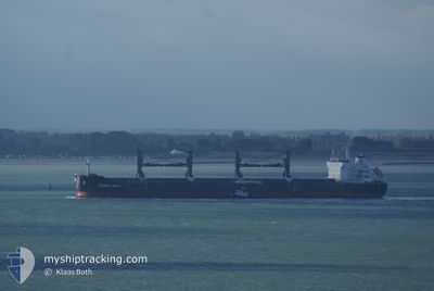
COMMON SPIRIT
Bulk Carrier
Current Trip
| Time Travelled | 13 days |
|---|---|
| Remaining Time | 4 days |
| Distance Travelled | 3789.79 nm |
| Remaining Distance | 1036.13 nm |
| AVG Speed | 11.3 Knopen |
| MAX Speed | 14.3 Knopen |
| AVG Wind | 10.3 knots |
| MAX Wind | 22.8 knots |
| MIN Temp | 11.1°C / 51.98°F |
| MAX Temp | 29.4°C / 84.92°F |
| Diepgang | 9.9 M |
| Positie ontvangen | 1 m geleden |
Current Position
| Lengtegraad | -23.88863° |
|---|---|
| Breedtegraat | 12.90663° |
| Status | Under way using engine |
| Snelheid | 9.7 Knopen |
| Koers | 28.3° |
| Gebied | North Atlantic Ocean |
| Station | T-AIS |
| Positie ontvangen | 1 m geleden |
Info
Information
The current position of COMMON SPIRIT is in North Atlantic Ocean with coordinates 12.90663° / -23.88863° as reported on 2024-05-01 17:28 by AIS to our vessel tracker app. The vessel's current speed is 9.7 Knopen and is heading at the port of LAS PALMAS. The estimated time of arrival as calculated by MyShipTracking vessel tracking app is 2024-05-06 01:05 LT
The vessel COMMON SPIRIT (IMO: 9594717, MMSI: 241143000) is a Bulk Carrier that was built in 2011 ( 13 Jaar oud ). It's sailing under the flag of [GR] Greece.
In this page you can find informations about the vessels current position, last detected port calls, and current voyage information. If the vessels is not in coverage by AIS you will find the latest position.
The current position of COMMON SPIRIT is detected by our AIS receivers and we are not responsible for the reliability of the data. The last position was recorded while the vessel was in Coverage by the Ais receivers of our vessel tracking app.
The current draught of COMMON SPIRIT as reported by AIS is 9.9 meters
Weather
| Temperature | 23.8°C / 74.84°F |
|---|---|
| Wind Speed | 18 knots |
| Direction | 34° NE |
| Pressure | 1010.5 hPa |
| Humidity | 82.7 % |
| Cloud Coverage | 1 % |
Featured Company
Last Port Calls
| Port | Arrival | Departure | Time In Port |
|---|---|---|---|
| 2024-04-15 20:04 | 2024-04-17 23:14 | 2 d | |
| 2024-03-29 04:26 | 2024-04-02 21:37 | 4 d | |
| 2024-03-04 17:37 |
Most Visited Ports (Last year)
| Port | Arrivals | |
|---|---|---|
| 2 | ||
| 2 | ||
| 1 | ||
| 1 | ||
| 1 | ||
| 1 |
Last Trips
| Origin | Departure | Destination | Arrival | Distance | |
|---|---|---|---|---|---|
| 2024-04-02 18:37 | 2024-04-15 17:04 | 1182.64 nm | |||
| 2024-03-04 20:37 | 2024-03-29 01:26 | 7027.26 nm |
Events
| Tijd | Evenement | Details | Positie / Bestemming | Info |
|---|---|---|---|---|
| 2024-05-01 17:19 | Status Changed | Under way using engine Default |
12.88443 / -23.90105
ES LPA
|
Snelheid: 9.8 kn Koers: 29° |
| 2024-05-01 17:00 | Status Changed | Default Under way using engine |
12.85687 / -23.91713
ES LPA
|
Snelheid: 9.6 kn Koers: 27.3° |
| 2024-05-01 08:16 | Wijzig zee gebeid | Cape Verdean part of the North Atlantic Ocean High seas of the North Atlantic Ocean |
11.47887 / -24.67297
North Atlantic Ocean
ES LPA
|
Snelheid: 10.7 kn Koers: 28.1° |
| 2024-05-01 07:37 | Status Changed | Under way using engine Default |
11.37278 / -24.73285
ES LPA
|
Snelheid: 11.3 kn Koers: 30° |
| 2024-05-01 07:31 | Status Changed | Default Under way using engine |
11.37412 / -24.73209
ES LPA
|
Snelheid: 11.2 kn Koers: 26.9° |
| 2024-05-01 06:42 | Status Changed | Under way using engine Default |
11.22213 / -24.81544
ES LPA
|
Snelheid: 10.9 kn Koers: 29° |
| 2024-05-01 06:37 | Binnenbereik |
11.22213 / -24.81544
North Atlantic Ocean
ES LPA
|
Snelheid: 10.9 kn Koers: 28.1° |
|
| 2024-05-01 05:53 | Status Changed | Default Under way using engine |
11.10835 / -24.87672
ES LPA
|
Snelheid: 10.8 kn Koers: 27.9° |
| 2024-05-01 05:34 | Buitenbereik |
11.03509 / -24.91378
North Atlantic Ocean
ES LPA
|
Snelheid: 10.8 kn Koers: 27.9° |
|
| 2024-05-01 05:24 | Status Changed | Under way using engine Default |
11.00893 / -24.92751
ES LPA
|
Snelheid: 11 kn Koers: 28° |