
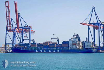
CMACGM FORT ST LOUIS
Container Ship
Current Trip
JMKIN
| Time Travelled | 1 day |
|---|---|
| Remaining Time | --- |
| Distance Travelled | 584.12 nm |
| Remaining Distance | --- |
| AVG Speed | 15.5 Knopen |
| MAX Speed | 18.7 Knopen |
| AVG Wind | 7.7 knots |
| MAX Wind | 14 knots |
| MIN Temp | 19.5°C / 67.1°F |
| MAX Temp | 28.8°C / 83.84°F |
| Diepgang | 8.9 M |
| Positie ontvangen | 5 d geleden |
Current Position
| Lengtegraad | --- |
|---|---|
| Breedtegraat | --- |
| Status | Under way using engine |
| Snelheid | 17.1 Knopen |
| Koers | 179.4° |
| Gebied | North Atlantic Ocean |
| Station | T-AIS |
| Positie ontvangen | 5 d geleden |
Info
Information
The current position of CMACGM FORT ST LOUIS is in North Atlantic Ocean with coordinates 25.40091° / -79.56980° as reported on 2025-03-01 16:34 by AIS to our vessel tracker app. The vessel's current speed is 17.1 Knopen
The vessel CMACGM FORT ST LOUIS (IMO: 9261889, MMSI: 209912000) is a Container Ship that was built in 2003 ( 22 Jaar oud ). It's sailing under the flag of [CY] Cyprus.
In this page you can find informations about the vessels current position, last detected port calls, and current voyage information. If the vessels is not in coverage by AIS you will find the latest position.
The current position of CMACGM FORT ST LOUIS is detected by our AIS receivers and we are not responsible for the reliability of the data. The last position was recorded while the vessel was in Coverage by the Ais receivers of our vessel tracking app.
The current draught of CMACGM FORT ST LOUIS as reported by AIS is 8.9 meters
Weather
| Temperature | 26°C / 78.8°F |
|---|---|
| Wind Speed | 12 knots |
| Direction | 98° E |
| Pressure | 1013.1 hPa |
| Humidity | 75.9 % |
| Cloud Coverage | 95 % |
Featured Company
Last Port Calls
| Port | Arrival | Departure | Time In Port |
|---|---|---|---|
| 2025-03-03 19:31 | 2025-03-05 11:19 | 1 d | |
| 2025-02-28 17:30 | 2025-03-01 12:39 | 19 h | |
| 2025-02-28 17:09 | 2025-02-28 17:20 | 11 m | |
| 2025-02-24 23:38 | 2025-02-25 22:19 | 22 h | |
| 2025-02-19 18:43 | 2025-02-21 03:55 | 1 d | |
| 2025-02-16 12:58 | 2025-02-17 11:13 | 22 h | |
| 2025-02-10 01:08 | 2025-02-12 18:17 | 2 d | |
| 2025-02-06 09:43 | 2025-02-07 22:59 | 1 d | |
| 2025-02-03 15:52 | 2025-02-04 06:08 | 14 h | |
| 2025-02-03 15:25 | 2025-02-03 15:36 | 11 m |
Most Visited Ports (Last year)
| Port | Arrivals | |
|---|---|---|
| 18 | ||
| 15 | ||
| 15 | ||
| 14 | ||
| 14 | ||
| 14 |
Last Trips
| Origin | Departure | Destination | Arrival | Distance | |
|---|---|---|---|---|---|
| 2025-03-01 07:39 | 2025-03-03 14:31 | 799.14 nm | |||
| 2025-02-28 12:20 | 2025-02-28 12:30 | 0.67 nm | |||
| 2025-02-25 16:19 | 2025-02-28 12:09 | 989.39 nm | |||
| 2025-02-20 21:55 | 2025-02-24 17:38 | 213.49 nm | |||
| 2025-02-17 06:13 | 2025-02-19 12:43 | 1011.35 nm | |||
| 2025-02-12 14:17 | 2025-02-16 07:58 | 825.13 nm | |||
| 2025-02-07 17:59 | 2025-02-09 21:08 | 746.59 nm | |||
| 2025-02-04 01:08 | 2025-02-06 04:43 | 785.32 nm | |||
| 2025-02-03 10:36 | 2025-02-03 10:52 | 0.88 nm | |||
| 2025-01-31 06:27 | 2025-02-03 10:25 | 1047.97 nm |
Events
| Tijd | Evenement | Details | Positie / Bestemming | Info |
|---|---|---|---|---|
| 2025-03-05 18:36 | Start beweging | 0.34 nm, West of PORT ROYAL |
17.94087 / -76.84905
JMKIN
|
Snelheid: 4 kn Koers: 198° |
| 2025-03-05 11:40 | Stop beweging | 0.43 nm, North West of PORT ROYAL |
17.94404 / -76.84931
JMKIN
|
Snelheid: 0.3 kn Koers: 113° |
| 2025-03-05 11:19 | Vertrekhaven |
|
17.96035 / -76.84647
JMKIN
|
Snelheid: 8.7 kn Koers: 242° |
| 2025-03-05 11:04 | Start beweging |
17.98091 / -76.83055
[JM] KINGSTON (JM)
|
Snelheid: 5.1 kn Koers: 133° |
|
| 2025-03-03 20:00 | Stop beweging |
17.98360 / -76.83639
[JM] KINGSTON (JM)
|
Snelheid: 0.3 kn Koers: 131° |
|
| 2025-03-03 19:31 | Aankomsthaven |
|
17.96884 / -76.83262
[JM] KINGSTON (JM)
|
Snelheid: 6.7 kn Koers: 65° |
| 2025-03-01 16:43 | Status Changed | Default Under way using engine |
25.35788 / -79.56895
JMKIN
|
Snelheid: 17.1 kn Koers: 179.4° |
| 2025-03-01 16:34 | Status Changed | Under way using engine Default |
25.40091 / -79.56980
JMKIN
|
Snelheid: 17 kn Koers: 180° |
| 2025-03-01 16:34 | Buitenbereik |
25.40091 / -79.56980
North Atlantic Ocean
JMKIN
|
Snelheid: 17.1 kn Koers: 179.4° |
|
| 2025-03-01 16:00 | Status Changed | Default Under way using engine |
25.55918 / -79.55554
JMKIN
|
Snelheid: 17.2 kn Koers: 179.9° |