
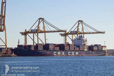
CMA CGM ISKENDERUN
Container Ship
Current Trip
| Time Travelled | 4 days |
|---|---|
| Remaining Time | --- |
| Distance Travelled | 664.55 nm |
| Remaining Distance | --- |
| AVG Speed | 10.3 Knopen |
| MAX Speed | 15.6 Knopen |
| AVG Wind | 10 knots |
| MAX Wind | 28 knots |
| MIN Temp | 12.8°C / 55.04°F |
| MAX Temp | 17.3°C / 63.14°F |
| Diepgang | 11.8 M |
| Positie ontvangen | 1 m geleden |
Current Position
| Lengtegraad | --- |
|---|---|
| Breedtegraat | --- |
| Status | Under way using engine |
| Snelheid | 0.4 Knopen |
| Koers | 209° |
| Gebied | North Atlantic Ocean |
| Station | T-AIS |
| Positie ontvangen | 1 m geleden |
Information
The current position of CMA CGM ISKENDERUN is in North Atlantic Ocean with coordinates 33.76932° / -7.66629° as reported on 2025-03-06 17:59 by AIS to our vessel tracker app. The vessel's current speed is 0.4 Knopen
The vessel CMA CGM ISKENDERUN (IMO: 9321902, MMSI: 229391000) is a Container Ship that was built in 2007 ( 18 Jaar oud ). It's sailing under the flag of [MT] Malta.
In this page you can find informations about the vessels current position, last detected port calls, and current voyage information. If the vessels is not in coverage by AIS you will find the latest position.
The current position of CMA CGM ISKENDERUN is detected by our AIS receivers and we are not responsible for the reliability of the data. The last position was recorded while the vessel was in Coverage by the Ais receivers of our vessel tracking app.
The current draught of CMA CGM ISKENDERUN as reported by AIS is 11.8 meters
Weather
| Temperature | 16.6°C / 61.88°F |
|---|---|
| Wind Speed | 11 knots |
| Direction | 264° W |
| Pressure | 1012.8 hPa |
| Humidity | 71.2 % |
| Cloud Coverage | 20 % |
Featured Company
Last Port Calls
| Port | Arrival | Departure | Time In Port |
|---|---|---|---|
| 2025-02-28 14:21 | 2025-03-01 18:35 | 1 d | |
| 2025-02-22 07:10 | 2025-02-24 09:49 | 2 d | |
| 2025-02-19 01:40 | 2025-02-19 21:07 | 19 h | |
| 2025-02-17 01:38 | 2025-02-17 20:55 | 19 h | |
| 2025-02-16 03:38 | 2025-02-16 21:25 | 17 h | |
| 2025-02-15 13:30 | 2025-02-15 22:05 | 8 h | |
| 2025-02-12 17:36 | 2025-02-14 04:25 | 1 d | |
| 2025-02-08 12:23 | 2025-02-09 20:39 | 1 d | |
| 2025-02-03 07:01 | 2025-02-04 02:59 | 19 h | |
| 2025-01-29 12:16 | 2025-01-30 15:59 | 1 d |
Most Visited Ports (Last year)
| Port | Arrivals | |
|---|---|---|
| 16 | ||
| 13 | ||
| 10 | ||
| 9 | ||
| 8 | ||
| 8 |
Last Trips
| Origin | Departure | Destination | Arrival | Distance | |
|---|---|---|---|---|---|
| 2025-02-24 10:49 | 2025-02-28 15:21 | 755.59 nm | |||
| 2025-02-20 00:07 | 2025-02-22 08:10 | 708.80 nm | |||
| 2025-02-17 23:55 | 2025-02-19 04:40 | 314.35 nm | |||
| 2025-02-17 00:25 | 2025-02-17 04:38 | 49.39 nm | |||
| 2025-02-16 01:05 | 2025-02-16 06:38 | 60.79 nm | |||
| 2025-02-14 06:25 | 2025-02-15 16:30 | 264.15 nm | |||
| 2025-02-09 22:39 | 2025-02-12 19:36 | 587.36 nm | |||
| 2025-02-04 03:59 | 2025-02-08 14:23 | 718.37 nm | |||
| 2025-01-30 16:59 | 2025-02-03 08:01 | 810.54 nm | |||
| 2025-01-27 17:59 | 2025-01-29 13:16 | 418.09 nm |
Events
| Tijd | Evenement | Details | Positie / Bestemming | Info |
|---|---|---|---|---|
| 2025-03-06 15:41 | Stop beweging | 10.75 nm, North of CASABLANCA |
33.78075 / -7.67699
MACAS
|
Snelheid: 0.3 kn Koers: 265° |
| 2025-03-06 14:21 | Start beweging | 6.89 nm, North of CASABLANCA |
33.72881 / -7.61414
MACAS
|
Snelheid: 3.2 kn Koers: 317° |
| 2025-03-06 12:40 | Draught Changed | 11.8 11.9 |
33.74188 / -7.63259
MACAS
|
Snelheid: 1 kn Koers: 333° |
| 2025-03-06 08:49 | Stop beweging | 7.67 nm, North West of CASABLANCA |
33.73140 / -7.65864
MACAS
|
Snelheid: 0.3 kn Koers: 195° |
| 2025-03-06 07:15 | Start beweging | 11.6 nm, North of CASABLANCA |
33.80835 / -7.60102
MACAS
|
Snelheid: 3.2 kn Koers: 246° |
| 2025-03-05 17:45 | Stop beweging | 11.09 nm, North of CASABLANCA |
33.79213 / -7.65885
MACAS
|
Snelheid: 0.3 kn Koers: 281° |
| 2025-03-05 15:59 | Start beweging | 7.18 nm, North of CASABLANCA |
33.72850 / -7.64084
MACAS
|
Snelheid: 3.2 kn Koers: 355° |
| 2025-03-05 11:54 | Stop beweging | 9.81 nm, North of CASABLANCA |
33.76827 / -7.66379
MACAS
|
Snelheid: 0.3 kn Koers: 289° |
| 2025-03-05 10:40 | Start beweging | 9.64 nm, North of CASABLANCA |
33.77541 / -7.58173
MACAS
|
Snelheid: 3.1 kn Koers: 223° |
| 2025-03-04 23:43 | Stop beweging | 10.15 nm, North of CASABLANCA |
33.77161 / -7.67232
MACAS
|
Snelheid: 0.3 kn Koers: 299° |