
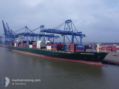
CMA CGM BARRACUDA
Container Ship
Current Trip
| Time Travelled | 5 days |
|---|---|
| Remaining Time | 4 h, 27 mins |
| Distance Travelled | 919.31 nm |
| Remaining Distance | 17.30 nm |
| AVG Speed | 8.8 Knopen |
| MAX Speed | 13.9 Knopen |
| AVG Wind | 17.5 knots |
| MAX Wind | 28.2 knots |
| MIN Temp | 15.5°C / 59.9°F |
| MAX Temp | 20.7°C / 69.26°F |
| Diepgang | 13.1 M |
| Positie ontvangen | Nu |
Current Position
| Lengtegraad | --- |
|---|---|
| Breedtegraat | --- |
| Status | Under way using engine |
| Snelheid | 10.7 Knopen |
| Koers | 296.2° |
| Gebied | Mediterranean Sea - Eastern Basin |
| Station | T-AIS |
| Positie ontvangen | Nu |
Info
Information
The current position of CMA CGM BARRACUDA is in Mediterranean Sea - Eastern Basin with coordinates 35.70613° / 14.84377° as reported on 2025-12-06 09:01 by AIS to our vessel tracker app. The vessel's current speed is 10.7 Knopen and is heading at the port of MARSAXLOKK. The estimated time of arrival as calculated by MyShipTracking vessel tracking app is 2025-12-06 14:29 LT
The vessel CMA CGM BARRACUDA (IMO: 9322475, MMSI: 229842000) is a Container Ship that was built in 2007 ( 18 Jaar oud ). It's sailing under the flag of [MT] Malta.
In this page you can find informations about the vessels current position, last detected port calls, and current voyage information. If the vessels is not in coverage by AIS you will find the latest position.
The current position of CMA CGM BARRACUDA is detected by our AIS receivers and we are not responsible for the reliability of the data. The last position was recorded while the vessel was in Coverage by the Ais receivers of our vessel tracking app.
The current draught of CMA CGM BARRACUDA as reported by AIS is 13.1 meters
Weather
| Temperature | 16.8°C / 62.24°F |
|---|---|
| Wind Speed | 17 knots |
| Direction | 346° NNW |
| Pressure | 1011.3 hPa |
| Humidity | 64.2 % |
| Cloud Coverage | --- |
Featured Company
Last Port Calls
| Port | Arrival | Departure | Time In Port |
|---|---|---|---|
| 2025-11-29 17:53 | 2025-12-01 07:45 | 1 d | |
| 2025-11-28 13:53 | 2025-11-29 03:24 | 13 h | |
| 2025-11-26 13:10 | 2025-11-27 16:09 | 1 d | |
| 2025-11-25 00:58 | 2025-11-26 02:08 | 1 d | |
| 2025-11-23 05:50 | 2025-11-24 14:14 | 1 d | |
| 2025-11-20 14:00 | 2025-11-21 20:41 | 1 d | |
| 2025-11-13 23:52 | 2025-11-14 17:47 | 17 h | |
| 2025-11-06 13:39 | 2025-11-07 18:32 | 1 d | |
| 2025-11-01 05:57 | 2025-11-02 16:56 | 1 d | |
| 2025-10-28 17:03 | 2025-10-30 03:09 | 1 d |
Most Visited Ports (Last year)
| Port | Arrivals | |
|---|---|---|
| 13 | ||
| 13 | ||
| 8 | ||
| 8 | ||
| 7 | ||
| 7 |
Last Trips
| Origin | Departure | Destination | Arrival | Distance | |
|---|---|---|---|---|---|
| 2025-11-29 03:24 | 2025-11-29 17:53 | 181.82 nm | |||
| 2025-11-27 16:09 | 2025-11-28 13:53 | 279.94 nm | |||
| 2025-11-26 02:08 | 2025-11-26 13:10 | 197.25 nm | |||
| 2025-11-24 14:14 | 2025-11-25 00:58 | 97.05 nm | |||
| 2025-11-21 20:41 | 2025-11-23 05:50 | 440.87 nm | |||
| 2025-11-14 17:47 | 2025-11-20 14:00 | 829.23 nm | |||
| 2025-11-07 18:32 | 2025-11-13 23:52 | 2264.42 nm | |||
| 2025-11-02 16:56 | 2025-11-06 13:39 | 373.41 nm | |||
| 2025-10-30 03:09 | 2025-11-01 05:57 | 136.18 nm | |||
| 2025-10-23 23:23 | 2025-10-28 17:03 | 976.31 nm |
Events
| Tijd | Evenement | Details | Positie / Bestemming | Info |
|---|---|---|---|---|
| 2025-12-06 08:48 | Start beweging | 17.67 nm, South East of MARSAXLOKK |
35.69726 / 14.87374
MTMAR
|
Snelheid: 3.1 kn Koers: 257° |
| 2025-12-06 03:46 | Stop beweging | 12.99 nm, South East of MARSAXLOKK |
35.72344 / 14.78275
MTMAR
|
Snelheid: 0.3 kn Koers: 295° |
| 2025-12-05 20:50 | Status Changed | Under way using engine Default |
35.71144 / 14.85462
MTMAR
|
Snelheid: 0.9 kn Koers: 192° |
| 2025-12-05 20:49 | Status Changed | Default Under way using engine |
35.71154 / 14.85421
MTMAR
|
Snelheid: 0.9 kn Koers: 185° |
| 2025-12-05 20:26 | Status Changed | Under way using engine Default |
35.71223 / 14.84623
MTMAR
|
Snelheid: 1.1 kn Koers: 188° |
| 2025-12-05 20:25 | Status Changed | Default Under way using engine |
35.71219 / 14.84593
MTMAR
|
Snelheid: 1.1 kn Koers: 190° |
| 2025-12-05 20:01 | Status Changed | Under way using engine Default |
35.71148 / 14.83646
MTMAR
|
Snelheid: 1.1 kn Koers: 197° |
| 2025-12-05 19:57 | Status Changed | Default Under way using engine |
35.71137 / 14.83499
MTMAR
|
Snelheid: 1 kn Koers: 197° |
| 2025-12-05 19:24 | Status Changed | Under way using engine Default |
35.71193 / 14.82546
MTMAR
|
Snelheid: 0.8 kn Koers: 209° |
| 2025-12-05 19:21 | Status Changed | Default Under way using engine |
35.71199 / 14.82438
MTMAR
|
Snelheid: 0.9 kn Koers: 214° |