
CL HUANGPU RIVER
Cargo
Current Trip
CNJTG
| Time Travelled | 1 day |
|---|---|
| Remaining Time | --- |
| Distance Travelled | 468.75 nm |
| Remaining Distance | --- |
| AVG Speed | 10.8 Knopen |
| MAX Speed | 13.1 Knopen |
| AVG Wind | 9.4 knots |
| MAX Wind | 12.5 knots |
| MIN Temp | 28.1°C / 82.58°F |
| MAX Temp | 29.1°C / 84.38°F |
| Diepgang | 18.4 M |
| Positie ontvangen | 1 d geleden |
Current Position
| Lengtegraad | --- |
|---|---|
| Breedtegraat | --- |
| Status | Under way using engine |
| Snelheid | 11 Knopen |
| Koers | 344.8° |
| Gebied | Indian Ocean |
| Station | T-AIS |
| Positie ontvangen | 1 d geleden |
Info
Information
The current position of CL HUANGPU RIVER is in Indian Ocean with coordinates -18.86564° / 118.21487° as reported on 2024-11-30 09:46 by AIS to our vessel tracker app. The vessel's current speed is 11 Knopen
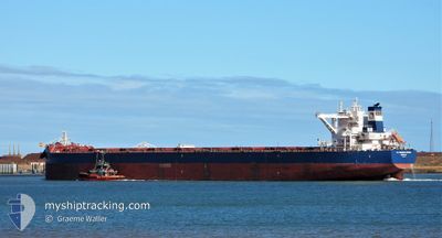
The vessel CL HUANGPU RIVER (IMO: 9844588, MMSI: 636018989) is a Cargo It's sailing under the flag of [LR] Liberia.
In this page you can find informations about the vessels current position, last detected port calls, and current voyage information. If the vessels is not in coverage by AIS you will find the latest position.
The current position of CL HUANGPU RIVER is detected by our AIS receivers and we are not responsible for the reliability of the data. The last position was recorded while the vessel was in Coverage by the Ais receivers of our vessel tracking app.
The current draught of CL HUANGPU RIVER as reported by AIS is 18.4 meters
Weather
| Temperature | 28.8°C / 83.84°F |
|---|---|
| Wind Speed | 6 knots |
| Direction | 233° SW |
| Pressure | 1004.9 hPa |
| Humidity | 68.9 % |
| Cloud Coverage | 100 % |
Featured Company
Last Port Calls
| Port | Arrival | Departure | Time In Port |
|---|---|---|---|
| 2024-11-29 04:16 | 2024-11-30 09:31 | 1 d | |
| 2024-10-22 04:17 | 2024-10-23 12:57 | 1 d | |
| 2024-10-07 07:57 | 2024-10-09 23:36 | 2 d |
Most Visited Ports (Last year)
| Port | Arrivals | |
|---|---|---|
| 11 | ||
| 2 | ||
| 1 | ||
| 1 | ||
| 1 | ||
| 1 |
Last Trips
| Origin | Departure | Destination | Arrival | Distance | |
|---|---|---|---|---|---|
| 2024-10-23 12:57 | 2024-11-29 04:16 | 6920.83 nm | |||
| 2024-10-09 23:36 | 2024-10-22 04:17 | 3637.42 nm | |||
| 2024-09-23 11:55 | 2024-10-07 07:57 | 3688.53 nm |
Events
| Tijd | Evenement | Details | Positie / Bestemming | Info |
|---|---|---|---|---|
| 2024-11-30 09:50 | Status Changed | Default Under way using engine |
-18.85432 / 118.21176
CNJTG
|
Snelheid: 11 kn Koers: 344.8° |
| 2024-11-30 09:46 | Status Changed | Under way using engine Default |
-18.86564 / 118.21487
CNJTG
|
Snelheid: 11 kn Koers: 348° |
| 2024-11-30 09:46 | Buitenbereik |
-18.86564 / 118.21487
Indian Ocean
CNJTG
|
Snelheid: 11 kn Koers: 344.8° |
|
| 2024-11-30 09:18 | Status Changed | Default Under way using engine |
-18.95056 / 118.23679
CNJTG
|
Snelheid: 11.7 kn Koers: 345.1° |
| 2024-11-30 09:16 | Status Changed | Under way using engine Default |
-18.95468 / 118.23789
CNJTG
|
Snelheid: 11.9 kn Koers: 344° |
| 2024-11-30 09:13 | Status Changed | Default Under way using engine |
-18.96430 / 118.24056
CNJTG
|
Snelheid: 12.1 kn Koers: 347.1° |
| 2024-11-30 07:17 | ETA Changed | 2024/12/13 10:00 2024/12/13 04:00 |
-19.35412 / 118.33061
CNJTG
|
Snelheid: 11.9 kn Koers: 346.7° |
| 2024-11-30 06:53 | Status Changed | Under way using engine Default |
-19.43017 / 118.35060
CNJTG
|
Snelheid: 11.9 kn Koers: 350° |
| 2024-11-30 06:32 | Status Changed | Default Under way using engine |
-19.50042 / 118.36912
CNJTG
|
Snelheid: 12 kn Koers: 346.6° |
| 2024-11-30 06:30 | Status Changed | Under way using engine Default |
-19.50422 / 118.37002
CNJTG
|
Snelheid: 12 kn Koers: 346° |