
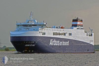
CIUDAD DE CADIZ
Ro-Ro Cargo
Current Trip
| Time Travelled | 1 day |
|---|---|
| Remaining Time | 4 days |
| Distance Travelled | 610.41 nm |
| Remaining Distance | 1227.52 nm |
| AVG Speed | 14.8 Knopen |
| MAX Speed | 17.6 Knopen |
| AVG Wind | 9.1 knots |
| MAX Wind | 19.6 knots |
| MIN Temp | 14.4°C / 57.92°F |
| MAX Temp | 17.8°C / 64.04°F |
| Diepgang | 4.8 M |
| Positie ontvangen | Nu |
Current Position
| Lengtegraad | -10.10705° |
|---|---|
| Breedtegraat | 39.98925° |
| Status | Under way using engine |
| Snelheid | 11.9 Knopen |
| Koers | 179.7° |
| Gebied | North Atlantic Ocean |
| Station | T-AIS |
| Positie ontvangen | Nu |
Info
Information
The current position of CIUDAD DE CADIZ is in North Atlantic Ocean with coordinates 39.98925° / -10.10705° as reported on 2024-05-10 10:41 by AIS to our vessel tracker app. The vessel's current speed is 11.9 Knopen and is heading at the port of RADES. The estimated time of arrival as calculated by MyShipTracking vessel tracking app is 2024-05-14 20:16 LT
The vessel CIUDAD DE CADIZ (IMO: 9383560, MMSI: 228025700) is a Ro-Ro Cargo that was built in 2008 ( 16 Jaar oud ). It's sailing under the flag of [FR] France.
In this page you can find informations about the vessels current position, last detected port calls, and current voyage information. If the vessels is not in coverage by AIS you will find the latest position.
The current position of CIUDAD DE CADIZ is detected by our AIS receivers and we are not responsible for the reliability of the data. The last position was recorded while the vessel was in Coverage by the Ais receivers of our vessel tracking app.
The current draught of CIUDAD DE CADIZ as reported by AIS is 4.8 meters
Weather
| Temperature | 17.1°C / 62.78°F |
|---|---|
| Wind Speed | 7 knots |
| Direction | 306° NW |
| Pressure | 1015.2 hPa |
| Humidity | 78 % |
| Cloud Coverage | --- |
Featured Company
Last Port Calls
| Port | Arrival | Departure | Time In Port |
|---|---|---|---|
| 2024-05-08 07:58 | 2024-05-08 18:21 | 10 h | |
| 2024-05-08 04:15 | 2024-05-08 07:53 | 3 h | |
| 2024-05-06 11:17 | 2024-05-06 16:02 | 4 h | |
| 2024-05-01 22:31 | 2024-05-02 07:59 | 9 h | |
| 2024-04-30 17:23 | 2024-05-01 00:29 | 7 h | |
| 2024-04-24 04:12 | 2024-04-24 19:39 | 15 h | |
| 2024-04-22 12:17 | 2024-04-22 16:11 | 3 h | |
| 2024-04-17 21:09 | 2024-04-18 05:57 | 8 h | |
| 2024-04-16 19:51 | 2024-04-16 23:22 | 3 h | |
| 2024-04-09 17:37 | 2024-04-10 18:32 | 1 d |
Most Visited Ports (Last year)
| Port | Arrivals | |
|---|---|---|
| 27 | ||
| 23 | ||
| 22 | ||
| 17 | ||
| 11 | ||
| 2 |
Last Trips
| Origin | Departure | Destination | Arrival | Distance | |
|---|---|---|---|---|---|
| 2024-05-08 09:53 | 2024-05-08 09:58 | 0.12 nm | |||
| 2024-05-06 17:02 | 2024-05-08 06:15 | 522.67 nm | |||
| 2024-05-02 09:59 | 2024-05-06 12:17 | 1484.32 nm | |||
| 2024-05-01 01:29 | 2024-05-02 00:31 | 306.90 nm | |||
| 2024-04-24 21:39 | 2024-04-30 18:23 | 1837.77 nm | |||
| 2024-04-22 17:11 | 2024-04-24 06:12 | 518.88 nm | |||
| 2024-04-18 07:57 | 2024-04-22 13:17 | 1492.89 nm | |||
| 2024-04-17 00:22 | 2024-04-17 23:09 | 305.28 nm | |||
| 2024-04-10 20:32 | 2024-04-16 20:51 | 1863.84 nm | |||
| 2024-04-04 00:49 | 2024-04-09 19:37 | 1993.93 nm |
Events
| Tijd | Evenement | Details | Positie / Bestemming | Info |
|---|---|---|---|---|
| 2024-05-10 02:46 | Wijzig zee gebeid | Portuguese part of the North Atlantic Ocean Spanish part of the North Atlantic Ocean |
41.75122 / -10.10630
North Atlantic Ocean
TUNIS
|
Snelheid: 15.3 kn Koers: 179.5° |
| 2024-05-10 01:43 | Status Changed | Under way using engine Default |
42.02770 / -10.09867
TUNIS
|
Snelheid: 15.6 kn Koers: 179° |
| 2024-05-10 01:43 | Binnenbereik |
42.02563 / -10.09872
North Atlantic Ocean
TUNIS
|
Snelheid: 15.6 kn Koers: 180.7° |
|
| 2024-05-09 21:30 | Status Changed | Default Under way using engine |
43.12652 / -10.08635
TUNIS
|
Snelheid: 16.2 kn Koers: 181.5° |
| 2024-05-09 21:24 | Status Changed | Under way using engine Default |
43.15433 / -10.08585
TUNIS
|
Snelheid: 16.1 kn Koers: 182° |
| 2024-05-09 21:24 | Buitenbereik |
43.15433 / -10.08585
North Atlantic Ocean
TUNIS
|
Snelheid: 16.2 kn Koers: 181.5° |
|
| 2024-05-09 21:18 | Status Changed | Default Under way using engine |
43.18173 / -10.08487
TUNIS
|
Snelheid: 16.2 kn Koers: 181° |
| 2024-05-09 21:18 | Status Changed | Under way using engine Default |
43.18392 / -10.08478
TUNIS
|
Snelheid: 16 kn Koers: 180° |
| 2024-05-09 21:10 | Status Changed | Default Under way using engine |
43.21725 / -10.08420
TUNIS
|
Snelheid: 16.1 kn Koers: 181.4° |
| 2024-05-09 21:04 | Status Changed | Under way using engine Default |
43.24687 / -10.08358
TUNIS
|
Snelheid: 15.8 kn Koers: 182° |