
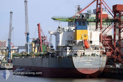
CHRISTIANA P
Bulk Carrier
Current Trip
| Time Travelled | 6 days |
|---|---|
| Remaining Time | 2 days |
| Distance Travelled | 1008.69 nm |
| Remaining Distance | 600.77 nm |
| AVG Speed | 8.8 Knopen |
| MAX Speed | 11.8 Knopen |
| AVG Wind | 9 knots |
| MAX Wind | 18 knots |
| MIN Temp | 19.4°C / 66.92°F |
| MAX Temp | 29.4°C / 84.92°F |
| Diepgang | 13.1 M |
| Positie ontvangen | 1 d geleden |
Current Position
| Lengtegraad | -40.78584° |
|---|---|
| Breedtegraat | -23.68393° |
| Status | Under way using engine |
| Snelheid | 11 Knopen |
| Koers | 101.9° |
| Gebied | South Atlantic Ocean |
| Station | T-AIS |
| Positie ontvangen | 1 d geleden |
Info
Information
The current position of CHRISTIANA P is in South Atlantic Ocean with coordinates -23.68393° / -40.78584° as reported on 2024-05-01 23:56 by AIS to our vessel tracker app. The vessel's current speed is 11 Knopen and is heading at the port of RIO DE JANEIRO. The estimated time of arrival as calculated by MyShipTracking vessel tracking app is 2024-05-06 00:47 LT
The vessel CHRISTIANA P (IMO: 9580508, MMSI: 352559000) is a Bulk Carrier that was built in 2011 ( 13 Jaar oud ). It's sailing under the flag of [PA] Panama.
In this page you can find informations about the vessels current position, last detected port calls, and current voyage information. If the vessels is not in coverage by AIS you will find the latest position.
The current position of CHRISTIANA P is detected by our AIS receivers and we are not responsible for the reliability of the data. The last position was recorded while the vessel was in Coverage by the Ais receivers of our vessel tracking app.
The current draught of CHRISTIANA P as reported by AIS is 13.1 meters
Weather
| Temperature | 25°C / 77°F |
|---|---|
| Wind Speed | 11 knots |
| Direction | 318° NW |
| Pressure | 1014.7 hPa |
| Humidity | 82 % |
| Cloud Coverage | 5 % |
Featured Company
Last Port Calls
| Port | Arrival | Departure | Time In Port |
|---|---|---|---|
| 2024-04-24 06:21 | 2024-04-27 07:56 | 3 d | |
| 2024-03-21 05:16 | 2024-03-25 08:09 | 4 d |
Most Visited Ports (Last year)
| Port | Arrivals | |
|---|---|---|
| 2 | ||
| 2 | ||
| 1 | ||
| 1 | ||
| 1 | ||
| 1 |
Last Trips
| Origin | Departure | Destination | Arrival | Distance | |
|---|---|---|---|---|---|
| 2024-03-25 13:39 | 2024-04-24 03:21 | 7912.47 nm | |||
| 2024-01-31 05:27 | 2024-03-21 10:46 | 6109.03 nm |
Events
| Tijd | Evenement | Details | Positie / Bestemming | Info |
|---|---|---|---|---|
| 2024-05-01 23:59 | Status Changed | Default Under way using engine |
-23.68548 / -40.77720
BR RIO
|
Snelheid: 11 kn Koers: 101.9° |
| 2024-05-01 23:56 | Buitenbereik |
-23.68393 / -40.78584
South Atlantic Ocean
|
Snelheid: 11 kn Koers: 101.9° |
|
| 2024-05-01 23:49 | Status Changed | Under way using engine Default |
-23.67960 / -40.80973
BR RIO
|
Snelheid: 10.9 kn Koers: 102° |
| 2024-05-01 23:42 | Status Changed | Default Under way using engine |
-23.67562 / -40.83081
BR RIO
|
Snelheid: 10.8 kn Koers: 101.6° |
| 2024-05-01 23:39 | Status Changed | Under way using engine Default |
-23.67343 / -40.84199
BR RIO
|
Snelheid: 10.9 kn Koers: 103° |
| 2024-05-01 23:24 | Binnenbereik |
-23.67416 / -40.83841
South Atlantic Ocean
|
Snelheid: 10.8 kn Koers: 101.6° |
|
| 2024-05-01 20:11 | Status Changed | Default Under way using engine |
-23.53661 / -41.47450
BR RIO
|
Snelheid: 10.7 kn Koers: 111.4° |
| 2024-05-01 20:06 | Status Changed | Under way using engine Default |
-23.53188 / -41.48932
BR RIO
|
Snelheid: 10.9 kn Koers: 111° |
| 2024-05-01 20:06 | Buitenbereik |
-23.53188 / -41.48932
South Atlantic Ocean
|
Snelheid: 10.7 kn Koers: 111.4° |
|
| 2024-05-01 19:59 | Binnenbereik |
-23.53188 / -41.48932
South Atlantic Ocean
|
Snelheid: 10.7 kn Koers: 111.4° |