

CHIOS I
Tanker

Current Trip
PASIR GUDANG
| Time Travelled | --- |
|---|---|
| Remaining Time | --- |
| Distance Travelled | 7095.63 nm |
| Remaining Distance | --- |
| AVG Speed | 10.1 Knopen |
| MAX Speed | 15.6 Knopen |
| AVG Wind | 9.6 knots |
| MAX Wind | 25 knots |
| MIN Temp | 14.7°C / 58.46°F |
| MAX Temp | 29.1°C / 84.38°F |
| Diepgang | 16.4 M |
| Positie ontvangen | 1 h, 7 m geleden |
Current Position
| Lengtegraad | --- |
|---|---|
| Breedtegraat | --- |
| Status | At anchor |
| Snelheid | 0.1 Knopen |
| Koers | 61° |
| Gebied | Singapore Strait |
| Station | T-AIS |
| Positie ontvangen | 1 h, 7 m geleden |
Information
The current position of CHIOS I is in Singapore Strait with coordinates 1.32986° / 104.26243° as reported on 2025-03-27 11:44 by AIS to our vessel tracker app. The vessel's current speed is 0.1 Knopen
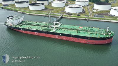
The vessel CHIOS I (IMO: 9792187, MMSI: 248109000) is a Tanker It's sailing under the flag of [MT] Malta.
In this page you can find informations about the vessels current position, last detected port calls, and current voyage information. If the vessels is not in coverage by AIS you will find the latest position.
The current position of CHIOS I is detected by our AIS receivers and we are not responsible for the reliability of the data. The last position was recorded while the vessel was in Coverage by the Ais receivers of our vessel tracking app.
The current draught of CHIOS I as reported by AIS is 16.4 meters
Weather
| Temperature | 28.3°C / 82.94°F |
|---|---|
| Wind Speed | 10 knots |
| Direction | 24° NNE |
| Pressure | 1006.3 hPa |
| Humidity | 79.2 % |
| Cloud Coverage | 3 % |


Featured Company
Last Port Calls
| Port | Arrival | Departure | Time In Port |
|---|---|---|---|
| 2025-01-16 18:19 | 2025-01-16 18:52 | 32 m | |
| 2025-01-15 11:31 | 2025-01-15 11:55 | 23 m |
Most Visited Ports (Last year)
| Port | Arrivals | |
|---|---|---|
| 2 | ||
| 2 | ||
| 2 | ||
| 1 | ||
| 1 | ||
| 1 |
Last Trips
| Origin | Departure | Destination | Arrival | Distance | |
|---|---|---|---|---|---|
| 2025-01-15 11:55 | 2025-01-16 18:19 | 2.99 nm | |||
| 2024-12-24 03:19 | 2025-01-15 11:31 | 3744.62 nm |
Events
| Tijd | Evenement | Details | Positie / Bestemming | Info |
|---|---|---|---|---|
| 2025-03-27 11:48 | Status Changed | Default At anchor |
1.32996 / 104.26247
PASIR GUDANG
|
Snelheid: 0.1 kn Koers: 61° |
| 2025-03-27 11:44 | Buitenbereik |
1.32986 / 104.26243
Singapore Strait
|
Snelheid: 0.1 kn Koers: 328.2° |
|
| 2025-03-27 11:42 | Status Changed | At anchor Default |
1.32977 / 104.26241
PASIR GUDANG
|
Snelheid: Koers: 60° |
| 2025-03-27 11:42 | Binnenbereik |
1.32977 / 104.26241
Singapore Strait
|
Snelheid: 0.1 kn Koers: 328.2° |
|
| 2025-03-27 01:36 | Status Changed | Default At anchor |
1.33022 / 104.26784
PASIR GUDANG
|
Snelheid: 0.3 kn Koers: 273° |
| 2025-03-27 01:32 | Status Changed | At anchor Default |
1.32997 / 104.26783
PASIR GUDANG
|
Snelheid: 0.4 kn Koers: 285° |
| 2025-03-27 01:32 | Binnenbereik |
1.32997 / 104.26783
Singapore Strait
|
Snelheid: 0.3 kn Koers: 12.6° |
|
| 2025-03-27 01:32 | Buitenbereik |
1.32997 / 104.26783
Singapore Strait
|
Snelheid: 0.3 kn Koers: 12.6° |
|
| 2025-03-26 18:59 | Status Changed | Default At anchor |
1.32770 / 104.26422
PASIR GUDANG
|
Snelheid: 0.1 kn Koers: 4° |
| 2025-03-26 18:56 | Buitenbereik |
1.32766 / 104.26429
Singapore Strait
|
Snelheid: 0.1 kn Koers: 356.3° |