
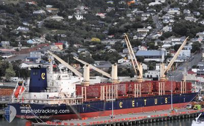
CHINA SPIRIT
Bulk Carrier
Current Trip
| Time Travelled | 32 days |
|---|---|
| Remaining Time | 6 days |
| Distance Travelled | 8085.40 nm |
| Remaining Distance | 1627.11 nm |
| AVG Speed | 11 Knopen |
| MAX Speed | 16.1 Knopen |
| AVG Wind | 12.7 knots |
| MAX Wind | 28 knots |
| MIN Temp | 15.6°C / 60.08°F |
| MAX Temp | 29.6°C / 85.28°F |
| Diepgang | 7.4 M |
| Positie ontvangen | 9 d geleden |
Current Position
| Lengtegraad | 18.23260° |
|---|---|
| Breedtegraat | -34.67583° |
| Status | Under way using engine |
| Snelheid | 12.5 Knopen |
| Koers | 289.3° |
| Gebied | South Atlantic Ocean |
| Station | T-AIS |
| Positie ontvangen | 9 d geleden |
Info
Information
The current position of CHINA SPIRIT is in South Atlantic Ocean with coordinates -34.67583° / 18.23260° as reported on 2024-04-18 00:42 by AIS to our vessel tracker app. The vessel's current speed is 12.5 Knopen and is heading at the port of LAS PALMAS. The estimated time of arrival as calculated by MyShipTracking vessel tracking app is 2024-05-03 14:38 LT
The vessel CHINA SPIRIT (IMO: 9655846, MMSI: 477464100) is a Bulk Carrier that was built in 2013 ( 11 Jaar oud ). It's sailing under the flag of [HK] Hong Kong.
In this page you can find informations about the vessels current position, last detected port calls, and current voyage information. If the vessels is not in coverage by AIS you will find the latest position.
The current position of CHINA SPIRIT is detected by our AIS receivers and we are not responsible for the reliability of the data. The last position was recorded while the vessel was in Coverage by the Ais receivers of our vessel tracking app.
The current draught of CHINA SPIRIT as reported by AIS is 7.4 meters
Weather
| Temperature | 28.9°C / 84.02°F |
|---|---|
| Wind Speed | 1 knots |
| Direction | 208° SSW |
| Pressure | 1007.9 hPa |
| Humidity | 71.4 % |
| Cloud Coverage | 38 % |
Featured Company
Last Port Calls
| Port | Arrival | Departure | Time In Port |
|---|---|---|---|
| 2024-03-17 07:23 | 2024-03-25 17:41 | 8 d | |
| 2024-03-10 15:07 | 2024-03-15 04:09 | 4 d | |
| 2024-02-08 02:13 | 2024-02-14 09:54 | 6 d |
Last Trips
| Origin | Departure | Destination | Arrival | Distance | |
|---|---|---|---|---|---|
| 2024-03-15 08:09 | 2024-03-17 11:23 | 379.69 nm | |||
| 2024-02-14 20:54 | 2024-03-10 19:07 | 6313.36 nm | |||
| 2024-01-29 20:38 | 2024-02-08 13:13 | 712.26 nm |
Events
| Tijd | Evenement | Details | Positie / Bestemming | Info |
|---|---|---|---|---|
| 2024-04-18 00:46 | Status Changed | Default Under way using engine |
-34.67149 / 18.21797
LAS PALMAS
|
Snelheid: 12.5 kn Koers: 289.3° |
| 2024-04-18 00:42 | Status Changed | Under way using engine Default |
-34.67583 / 18.23260
LAS PALMAS
|
Snelheid: 12.5 kn Koers: 290° |
| 2024-04-18 00:42 | Buitenbereik |
-34.67583 / 18.23260
South Atlantic Ocean
LAS PALMAS
|
Snelheid: 12.5 kn Koers: 289.3° |
|
| 2024-04-18 00:38 | Status Changed | Default Under way using engine |
-34.68126 / 18.25052
LAS PALMAS
|
Snelheid: 12.6 kn Koers: 288.6° |
| 2024-04-18 00:32 | Wijzig zee gebeid | South African part of the South Atlantic Ocean Omani part of the Gulf of Oman |
-34.68706 / 18.27138
South Atlantic Ocean
LAS PALMAS
|
Snelheid: 12.6 kn Koers: 288.6° |
| 2024-04-18 00:32 | Status Changed | Under way using engine Default |
-34.68706 / 18.27138
LAS PALMAS
|
Snelheid: 12 kn Koers: 295° |
| 2024-04-18 00:20 | Binnenbereik |
-34.68706 / 18.27138
South Atlantic Ocean
LAS PALMAS
|
Snelheid: 12.6 kn Koers: 288.6° |