
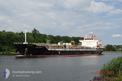
CHEM JUPITER
Oil/Chemical Tanker
Current Trip
| Time Travelled | 28 days |
|---|---|
| Remaining Time | --- |
| Distance Travelled | 8231.73 nm |
| Remaining Distance | --- |
| AVG Speed | 12.8 Knopen |
| MAX Speed | 16.5 Knopen |
| AVG Wind | 12.8 knots |
| MAX Wind | 31.8 knots |
| MIN Temp | 8.2°C / 46.76°F |
| MAX Temp | 29.6°C / 85.28°F |
| Diepgang | 8 M |
| Positie ontvangen | 6 d geleden |
Current Position
| Lengtegraad | 19.04300° |
|---|---|
| Breedtegraat | -35.17083° |
| Status | Under way using engine |
| Snelheid | 13.2 Knopen |
| Koers | 131° |
| Gebied | South Atlantic Ocean |
| Station | T-AIS |
| Positie ontvangen | 6 d geleden |
Info
Information
The current position of CHEM JUPITER is in South Atlantic Ocean with coordinates -35.17083° / 19.04300° as reported on 2024-04-29 21:27 by AIS to our vessel tracker app. The vessel's current speed is 13.2 Knopen and is heading at the port of ONSAN. The estimated time of arrival as calculated by MyShipTracking vessel tracking app is 2024-05-25 06:00 LT
The vessel CHEM JUPITER (IMO: 9508158, MMSI: 636020400) is a Oil/Chemical Tanker that was built in 2008 ( 16 Jaar oud ). It's sailing under the flag of [LR] Liberia.
In this page you can find informations about the vessels current position, last detected port calls, and current voyage information. If the vessels is not in coverage by AIS you will find the latest position.
The current position of CHEM JUPITER is detected by our AIS receivers and we are not responsible for the reliability of the data. The last position was recorded while the vessel was in Coverage by the Ais receivers of our vessel tracking app.
The current draught of CHEM JUPITER as reported by AIS is 8 meters
Weather
| Temperature | 24.5°C / 76.1°F |
|---|---|
| Wind Speed | 15 knots |
| Direction | 116° ESE |
| Pressure | 1019.7 hPa |
| Humidity | 66.5 % |
| Cloud Coverage | 21 % |
Featured Company
Last Port Calls
| Port | Arrival | Departure | Time In Port |
|---|---|---|---|
| 2024-04-07 01:18 | 2024-04-08 07:15 | 1 d | |
| 2024-03-24 12:52 | 2024-03-26 11:21 | 1 d |
Most Visited Ports (Last year)
| Port | Arrivals | |
|---|---|---|
| 4 | ||
| 3 | ||
| 3 | ||
| 3 | ||
| 2 | ||
| 2 |
Last Trips
| Origin | Departure | Destination | Arrival | Distance | |
|---|---|---|---|---|---|
| 2024-03-26 11:21 | 2024-04-07 03:18 | 1562.82 nm | |||
| 2024-02-21 19:11 | 2024-03-24 12:52 | 2948.38 nm |
Events
| Tijd | Evenement | Details | Positie / Bestemming | Info |
|---|---|---|---|---|
| 2024-04-29 21:34 | Status Changed | Default Under way using engine |
-35.17916 / 19.07283
KR USN
|
Snelheid: 13.2 kn Koers: 131° |
| 2024-04-29 21:27 | Status Changed | Under way using engine Default |
-35.17083 / 19.04300
KR USN
|
Snelheid: 13.2 kn Koers: 131° |
| 2024-04-29 21:27 | Buitenbereik |
-35.17083 / 19.04300
South Atlantic Ocean
KR USN
|
Snelheid: 13.2 kn Koers: 131° |
|
| 2024-04-29 21:18 | Binnenbereik |
-35.17083 / 19.04300
South Atlantic Ocean
KR USN
|
Snelheid: 13.2 kn Koers: 131° |
|
| 2024-04-29 20:10 | Status Changed | Default Under way using engine |
-35.01283 / 18.75983
KR USN
|
Snelheid: 13.1 kn Koers: 118° |
| 2024-04-29 20:06 | Status Changed | Under way using engine Default |
-35.00600 / 18.74517
KR USN
|
Snelheid: 13.1 kn Koers: 119° |
| 2024-04-29 20:06 | Buitenbereik |
-35.00600 / 18.74517
South Atlantic Ocean
KR USN
|
Snelheid: 13.1 kn Koers: 118° |
|
| 2024-04-29 19:46 | Binnenbereik |
-35.00600 / 18.74517
South Atlantic Ocean
KR USN
|
Snelheid: 13.1 kn Koers: 118° |
|
| 2024-04-29 18:58 | Status Changed | Default Under way using engine |
-34.88267 / 18.48233
KR USN
|
Snelheid: 13.1 kn Koers: 119° |
| 2024-04-29 18:52 | Buitenbereik |
-34.87083 / 18.45783
South Atlantic Ocean
KR USN
|
Snelheid: 13.1 kn Koers: 119° |