
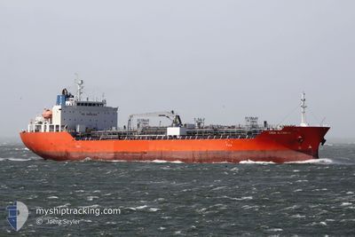
CHEM ALTAMIRA
Tanker B
Current Trip
| Time Travelled | 7 days |
|---|---|
| Remaining Time | 7 h, 4 mins |
| Distance Travelled | 856.99 nm |
| Remaining Distance | 87.61 nm |
| AVG Speed | 11.1 Knopen |
| MAX Speed | 16.2 Knopen |
| AVG Wind | 13.8 knots |
| MAX Wind | 28.3 knots |
| MIN Temp | 0.9°C / 33.62°F |
| MAX Temp | 18°C / 64.4°F |
| Diepgang | 6.1 M |
| Positie ontvangen | 10 h, 16 m geleden |
Current Position
| Lengtegraad | --- |
|---|---|
| Breedtegraat | --- |
| Status | Under way using engine |
| Snelheid | 11.4 Knopen |
| Koers | 118.8° |
| Gebied | Mediterranean Sea - Eastern Basin |
| Station | T-AIS |
| Positie ontvangen | 10 h, 16 m geleden |
Info
Information
The current position of CHEM ALTAMIRA is in Mediterranean Sea - Eastern Basin with coordinates 33.74858° / 31.35992° as reported on 2025-03-07 12:23 by AIS to our vessel tracker app. The vessel's current speed is 11.4 Knopen and is heading at the port of ASHDOD. The estimated time of arrival as calculated by MyShipTracking vessel tracking app is 2025-03-08 05:44 LT
The vessel CHEM ALTAMIRA (IMO: 9705744, MMSI: 636016362) is a Tanker B It's sailing under the flag of [LR] Liberia.
In this page you can find informations about the vessels current position, last detected port calls, and current voyage information. If the vessels is not in coverage by AIS you will find the latest position.
The current position of CHEM ALTAMIRA is detected by our AIS receivers and we are not responsible for the reliability of the data. The last position was recorded while the vessel was in Coverage by the Ais receivers of our vessel tracking app.
The current draught of CHEM ALTAMIRA as reported by AIS is 6.1 meters
Weather
| Temperature | 16.9°C / 62.42°F |
|---|---|
| Wind Speed | 5 knots |
| Direction | 266° W |
| Pressure | 1014.5 hPa |
| Humidity | 75.1 % |
| Cloud Coverage | 47 % |
Featured Company
Last Port Calls
| Port | Arrival | Departure | Time In Port |
|---|---|---|---|
| 2025-02-23 16:48 | 2025-02-28 02:22 | 4 d | |
| 2025-02-20 16:49 | |||
| 2025-02-16 14:42 | 2025-02-17 06:33 | 15 h | |
| 2025-02-12 14:29 | 2025-02-13 15:13 | 1 d | |
| 2025-02-08 12:58 | 2025-02-09 10:30 | 21 h | |
| 2025-02-01 18:46 | 2025-02-02 17:48 | 23 h | |
| 2025-01-14 03:42 | 2025-01-15 20:48 | 1 d | |
| 2025-01-12 15:40 | 2025-01-13 06:05 | 14 h | |
| 2025-01-04 06:48 |
Most Visited Ports (Last year)
| Port | Arrivals | |
|---|---|---|
| 10 | ||
| 5 | ||
| 4 | ||
| 3 | ||
| 2 | ||
| 2 |
Last Trips
| Origin | Departure | Destination | Arrival | Distance | |
|---|---|---|---|---|---|
| 2025-02-17 09:33 | 2025-02-23 19:48 | 629.96 nm | |||
| 2025-02-17 09:33 | 2025-02-20 19:49 | 629.96 nm | |||
| 2025-02-13 17:13 | 2025-02-16 17:42 | 831.00 nm | |||
| 2025-02-09 11:30 | 2025-02-12 16:29 | 956.72 nm | |||
| 2025-02-02 18:48 | 2025-02-08 13:58 | 1335.28 nm | |||
| 2025-01-15 14:48 | 2025-02-01 19:46 | 4982.42 nm | |||
| 2025-01-13 00:05 | 2025-01-13 21:42 | 58.27 nm | |||
| 2025-01-04 00:48 | 2025-01-12 09:40 | 102.61 nm |
Events
| Tijd | Evenement | Details | Positie / Bestemming | Info |
|---|---|---|---|---|
| 2025-03-07 12:32 | Status Changed | Default Under way using engine |
33.73713 / 31.38914
ILASH
|
Snelheid: 11.4 kn Koers: 118.8° |
| 2025-03-07 12:23 | Buitenbereik |
33.74858 / 31.35992
Mediterranean Sea - Eastern Basin
ILASH
|
Snelheid: 11.4 kn Koers: 118.8° |
|
| 2025-03-07 06:09 | Wijzig zee gebeid | Cypriote part of the Mediterranean Sea - Eastern Basin Greek part of the Mediterranean Sea - Eastern Basin |
34.31196 / 30.17788
Mediterranean Sea - Eastern Basin
ILASH
|
Snelheid: 11.8 kn Koers: 111.5° |
| 2025-03-07 05:36 | Status Changed | Under way using engine Default |
34.34760 / 30.05417
ILASH
|
Snelheid: 11.7 kn Koers: 108° |
| 2025-03-07 05:30 | Status Changed | Default Under way using engine |
34.35367 / 30.03095
ILASH
|
Snelheid: 11.7 kn Koers: 106.9° |
| 2025-03-07 05:27 | Status Changed | Under way using engine Default |
34.35627 / 30.02085
ILASH
|
Snelheid: 11.8 kn Koers: 106° |
| 2025-03-07 05:18 | Status Changed | Default Under way using engine |
34.36486 / 29.98613
ILASH
|
Snelheid: 11.9 kn Koers: 106.3° |
| 2025-03-07 00:37 | Status Changed | Under way using engine Default |
34.49738 / 29.71655
ILASH
|
Snelheid: 1.5 kn Koers: 234° |
| 2025-03-07 00:26 | Status Changed | Default Under way using engine |
34.50145 / 29.71876
ILASH
|
Snelheid: 1.4 kn Koers: 236° |
| 2025-03-06 07:11 | Wijzig zee gebeid | Greek part of the Mediterranean Sea - Eastern Basin Greek part of the Aegean Sea |
35.77844 / 27.55739
Mediterranean Sea - Eastern Basin
ILASH
|
Snelheid: 13.8 kn Koers: 141.8° |