
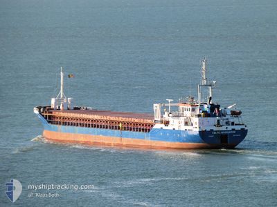
CELTIC NAVIGATOR
General Cargo
Current Trip
| Trip Time | 5 days |
|---|---|
| Trip Distance | 1160.20 nm |
| AVG Speed | 8.2 Knopen |
| MAX Speed | 10 Knopen |
| Diepgang | 5.3 M |
| AVG Wind | 16.4 knots |
| MAX Wind | 32.5 knots |
| MIN Temp | 9.8°C / 49.64°F |
| MAX Temp | 17.1°C / 62.78°F |
| Positie ontvangen | 1 m geleden |
Current Position
| Lengtegraad | --- |
|---|---|
| Breedtegraat | --- |
| Status | Under way using engine |
| Snelheid | |
| Koers | 39° |
| Gebied | Strait of Gibraltar |
| Station | T-AIS |
| Positie ontvangen | 1 m geleden |
Info
Information
The current position of CELTIC NAVIGATOR is in Strait of Gibraltar with coordinates 35.89297° / -5.50253° as reported on 2024-12-26 17:47 by AIS to our vessel tracker app. The vessel's current speed is 0 Knopen and is currently inside the port of TANGER MED.
The vessel CELTIC NAVIGATOR (IMO: 9256169, MMSI: 232020889) is a General Cargo that was built in 2003 ( 21 Jaar oud ). It's sailing under the flag of [GB] United Kingdom.
In this page you can find informations about the vessels current position, last detected port calls, and current voyage information. If the vessels is not in coverage by AIS you will find the latest position.
The current position of CELTIC NAVIGATOR is detected by our AIS receivers and we are not responsible for the reliability of the data. The last position was recorded while the vessel was in Coverage by the Ais receivers of our vessel tracking app.
The current draught of CELTIC NAVIGATOR as reported by AIS is 5.3 meters
Weather
| Temperature | 15.3°C / 59.54°F |
|---|---|
| Wind Speed | 21 knots |
| Direction | 90° E |
| Pressure | 1024.4 hPa |
| Humidity | 80.2 % |
| Cloud Coverage | 97 % |
Featured Company
Last Port Calls
| Port | Arrival | Departure | Time In Port |
|---|---|---|---|
| 2024-12-26 18:15 | |||
| 2024-12-20 06:27 | 2024-12-20 20:12 | 13 h | |
| 2024-12-14 17:59 | 2024-12-17 18:49 | 3 d | |
| 2024-12-04 23:20 | 2024-12-05 22:18 | 22 h | |
| 2024-11-29 20:54 | 2024-12-02 16:13 | 2 d | |
| 2024-11-14 07:53 | 2024-11-17 21:32 | 3 d | |
| 2024-11-11 15:13 | 2024-11-12 22:56 | 1 d | |
| 2024-10-26 16:51 | 2024-10-29 14:08 | 2 d | |
| 2024-10-23 21:22 | 2024-10-25 06:51 | 1 d | |
| 2024-10-18 21:47 | 2024-10-22 14:48 | 3 d |
Last Trips
| Origin | Departure | Destination | Arrival | Distance | |
|---|---|---|---|---|---|
| 2024-12-20 20:12 | 2024-12-26 18:15 | 1160.20 nm | |||
| 2024-12-17 18:49 | 2024-12-20 06:27 | 470.11 nm | |||
| 2024-12-05 22:18 | 2024-12-14 17:59 | 1616.72 nm | |||
| 2024-12-02 16:13 | 2024-12-04 23:20 | 567.66 nm | |||
| 2024-11-17 21:32 | 2024-11-29 20:54 | 2524.47 nm | |||
| 2024-11-12 22:56 | 2024-11-14 07:53 | 282.83 nm | |||
| 2024-10-29 14:08 | 2024-11-11 15:13 | 2985.21 nm | |||
| 2024-10-25 06:51 | 2024-10-26 16:51 | 357.97 nm | |||
| 2024-10-22 14:48 | 2024-10-23 21:22 | 223.70 nm | |||
| 2024-10-17 16:54 | 2024-10-18 21:47 | 281.54 nm |
Events
| Tijd | Evenement | Details | Positie / Bestemming | Info |
|---|---|---|---|---|
| 2024-12-26 17:34 | Stop beweging |
35.89246 / -5.50198
[MA] TANGER MED
|
Snelheid: 0.3 kn Koers: 44° |
|
| 2024-12-26 17:15 | Aankomsthaven |
|
35.90053 / -5.49285
[MA] TANGER MED
|
Snelheid: 5.5 kn Koers: 195.5° |
| 2024-12-26 17:15 | Status Changed | Under way using engine Default |
35.90143 / -5.49234
MA PTM
|
Snelheid: 7.1 kn Koers: 130° |
| 2024-12-26 17:06 | Status Changed | Default Under way using engine |
35.91462 / -5.49899
MA PTM
|
Snelheid: 7.9 kn Koers: 113° |
| 2024-12-26 16:48 | ETA Changed | 2024/12/26 18:00 2024/12/25 22:00 |
35.92203 / -5.52121
MA PTM
|
Snelheid: 5.3 kn Koers: 220.4° |
| 2024-12-26 16:14 | Status Changed | Under way using engine Default |
35.92458 / -5.53906
MA PTM
|
Snelheid: 6.4 kn Koers: 79° |
| 2024-12-26 15:43 | Status Changed | Default Under way using engine |
35.91597 / -5.62186
MA PTM
|
Snelheid: 8.9 kn Koers: 85.8° |
| 2024-12-26 15:42 | Status Changed | Under way using engine Default |
35.91597 / -5.62186
MA PTM
|
Snelheid: 8.5 kn Koers: 88° |
| 2024-12-26 15:37 | Status Changed | Default Under way using engine |
35.91570 / -5.64039
MA PTM
|
Snelheid: 8.4 kn Koers: 88.7° |
| 2024-12-26 15:25 | Status Changed | Under way using engine Default |
35.91583 / -5.67109
MA PTM
|
Snelheid: 8.9 kn Koers: 88° |