
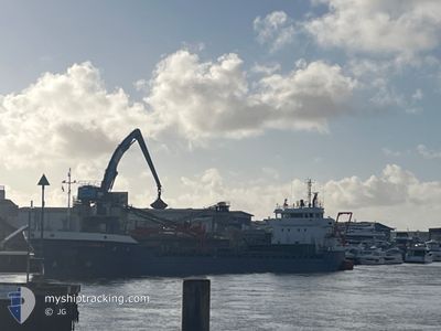
CELTIC CRUSADER
General Cargo
Current Trip
| Time Travelled | 3 days |
|---|---|
| Remaining Time | --- |
| Distance Travelled | 747.04 nm |
| Remaining Distance | --- |
| AVG Speed | 9.7 Knopen |
| MAX Speed | 11.3 Knopen |
| AVG Wind | 9.6 knots |
| MAX Wind | 21 knots |
| MIN Temp | 12.8°C / 55.04°F |
| MAX Temp | 16.7°C / 62.06°F |
| Diepgang | 5.4 M |
| Positie ontvangen | 1 m geleden |
Current Position
| Lengtegraad | --- |
|---|---|
| Breedtegraat | --- |
| Status | Under way using engine |
| Snelheid | 10.3 Knopen |
| Koers | 286.6° |
| Gebied | North Atlantic Ocean |
| Station | T-AIS |
| Positie ontvangen | 1 m geleden |
Information
The current position of CELTIC CRUSADER is in North Atlantic Ocean with coordinates 36.44045° / -7.84797° as reported on 2025-02-14 02:14 by AIS to our vessel tracker app. The vessel's current speed is 10.3 Knopen and is heading at the port of FIGUEIRA DA FOZ. The estimated time of arrival as calculated by MyShipTracking vessel tracking app is 2025-02-15 08:00 LT
The vessel CELTIC CRUSADER (IMO: 9521370, MMSI: 304872000) is a General Cargo that was built in 2012 ( 13 Jaar oud ). It's sailing under the flag of [AG] Antigua Barbuda.
In this page you can find informations about the vessels current position, last detected port calls, and current voyage information. If the vessels is not in coverage by AIS you will find the latest position.
The current position of CELTIC CRUSADER is detected by our AIS receivers and we are not responsible for the reliability of the data. The last position was recorded while the vessel was in Coverage by the Ais receivers of our vessel tracking app.
The current draught of CELTIC CRUSADER as reported by AIS is 5.4 meters
Weather
| Temperature | 14.8°C / 58.64°F |
|---|---|
| Wind Speed | 2 knots |
| Direction | 15° NNE |
| Pressure | 1019.9 hPa |
| Humidity | 68.9 % |
| Cloud Coverage | 8 % |
Featured Company
Last Port Calls
| Port | Arrival | Departure | Time In Port |
|---|---|---|---|
| 2025-02-10 19:06 | |||
| 2025-02-05 19:00 | 2025-02-06 20:46 | 1 d | |
| 2025-01-24 07:58 | 2025-02-01 17:18 | 8 d | |
| 2025-01-14 23:45 | 2025-01-16 18:40 | 1 d | |
| 2025-01-12 07:21 | 2025-01-14 22:27 | 2 d | |
| 2025-01-03 07:09 | 2025-01-03 21:41 | 14 h | |
| 2024-12-29 07:39 | 2024-12-30 16:53 | 1 d | |
| 2024-12-28 00:37 | 2024-12-28 18:46 | 18 h | |
| 2024-12-22 17:45 | 2024-12-26 19:51 | 4 d | |
| 2024-12-11 18:06 | 2024-12-11 18:45 | 38 m |
Last Trips
| Origin | Departure | Destination | Arrival | Distance | |
|---|---|---|---|---|---|
| 2025-02-01 17:18 | 2025-02-05 20:00 | 866.94 nm | |||
| 2025-01-16 18:40 | 2025-01-24 07:58 | 1320.39 nm | |||
| 2025-01-14 22:27 | 2025-01-14 23:45 | 10.45 nm | |||
| 2025-01-03 22:41 | 2025-01-12 07:21 | 1782.75 nm | |||
| 2024-12-30 17:53 | 2025-01-03 08:09 | 446.68 nm | |||
| 2024-12-28 19:46 | 2024-12-29 08:39 | 108.43 nm | |||
| 2024-12-26 20:51 | 2024-12-28 01:37 | 331.91 nm | |||
| 2024-12-11 18:45 | 2024-12-22 18:45 | 1651.24 nm | |||
| 2024-12-11 17:47 | 2024-12-11 18:06 | 2.01 nm | |||
| 2024-12-11 16:41 | 2024-12-11 17:28 | 4.50 nm |
Events
| Tijd | Evenement | Details | Positie / Bestemming | Info |
|---|---|---|---|---|
| 2025-02-14 02:14 | Status Changed | Under way using engine Default |
36.44045 / -7.84797
PTFDF
|
Snelheid: 10.8 kn Koers: 286° |
| 2025-02-14 01:55 | Status Changed | Default Under way using engine |
36.42657 / -7.78425
PTFDF
|
Snelheid: 10.3 kn Koers: 286.6° |
| 2025-02-14 01:50 | Gevonden in zee | Portuguese part of the North Atlantic Ocean |
36.42225 / -7.76558
North Atlantic Ocean
PTFDF
|
Snelheid: 10.3 kn Koers: 286.6° |
| 2025-02-14 01:50 | Status Changed | Under way using engine Default |
36.42225 / -7.76558
PTFDF
|
Snelheid: 9.9 kn Koers: 288° |
| 2025-02-14 01:39 | Binnenbereik |
36.42225 / -7.76558
North Atlantic Ocean
PTFDF
|
Snelheid: 10.3 kn Koers: 286.6° |
|
| 2025-02-13 15:07 | Status Changed | Default Under way using engine |
35.95947 / -5.70135
PTFDF
|
Snelheid: 10.2 kn Koers: 271.9° |
| 2025-02-13 15:01 | Status Changed | Under way using engine Default |
35.95918 / -5.68203
PTFDF
|
Snelheid: 10.4 kn Koers: 265° |
| 2025-02-13 15:01 | Buitenbereik |
35.95918 / -5.68203
Strait of Gibraltar
PTFDF
|
Snelheid: 10.2 kn Koers: 271.9° |
|
| 2025-02-13 14:55 | Status Changed | Default Under way using engine |
35.95892 / -5.65937
PTFDF
|
Snelheid: 9.8 kn Koers: 268.1° |
| 2025-02-13 14:48 | Status Changed | Under way using engine Default |
35.95888 / -5.63730
PTFDF
|
Snelheid: 9.7 kn Koers: 268° |