

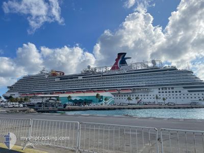
CARNIVAL VISTA
Passenger

Current Trip
| Time Travelled | 29 mins |
|---|---|
| Remaining Time | 23 h, 16 mins |
| Distance Travelled | 4.79 nm |
| Remaining Distance | 274.69 nm |
| AVG Speed | 12.3 Knopen |
| MAX Speed | 12.9 Knopen |
| AVG Wind | 7.1 knots |
| MAX Wind | 7.3 knots |
| MIN Temp | 25.6°C / 78.08°F |
| MAX Temp | 26.9°C / 80.42°F |
| Diepgang | 8.5 M |
| Positie ontvangen | 2 m geleden |
Current Position
| Lengtegraad | --- |
|---|---|
| Breedtegraat | --- |
| Status | Under way using engine |
| Snelheid | 13 Knopen |
| Koers | 84.9° |
| Gebied | North Atlantic Ocean |
| Station | T-AIS |
| Positie ontvangen | 2 m geleden |
Information
The current position of CARNIVAL VISTA is in North Atlantic Ocean with coordinates 18.52233° / -66.07053° as reported on 2025-03-11 23:12 by AIS to our vessel tracker app. The vessel's current speed is 13 Knopen and is heading at the port of PUERTO PLATA. The estimated time of arrival as calculated by MyShipTracking vessel tracking app is 2025-03-12 22:30 LT
The vessel CARNIVAL VISTA (IMO: 9692569, MMSI: 356883000) is a Passenger It's sailing under the flag of [PA] Panama.
In this page you can find informations about the vessels current position, last detected port calls, and current voyage information. If the vessels is not in coverage by AIS you will find the latest position.
The current position of CARNIVAL VISTA is detected by our AIS receivers and we are not responsible for the reliability of the data. The last position was recorded while the vessel was in Coverage by the Ais receivers of our vessel tracking app.
The current draught of CARNIVAL VISTA as reported by AIS is 8.5 meters
Weather
| Temperature | 25.3°C / 77.54°F |
|---|---|
| Wind Speed | 8 knots |
| Direction | 157° SSE |
| Pressure | 1014.4 hPa |
| Humidity | 70.5 % |
| Cloud Coverage | 1 % |


Featured Company
Last Port Calls
| Port | Arrival | Departure | Time In Port |
|---|---|---|---|
| 2025-03-11 13:05 | 2025-03-11 22:45 | 9 h | |
| 2025-03-10 13:42 | 2025-03-10 22:04 | 8 h | |
| 2025-03-08 11:09 | 2025-03-08 21:20 | 10 h | |
| 2025-03-06 11:44 | 2025-03-06 20:11 | 8 h | |
| 2025-03-05 15:31 | 2025-03-05 22:57 | 7 h | |
| 2025-03-04 12:18 | 2025-03-04 21:20 | 9 h | |
| 2025-03-02 09:47 | 2025-03-02 21:04 | 11 h | |
| 2025-02-28 12:22 | 2025-02-28 21:13 | 8 h | |
| 2025-02-26 12:07 | 2025-02-26 21:03 | 8 h | |
| 2025-02-22 11:07 | 2025-02-22 21:37 | 10 h |
Most Visited Ports (Last year)
| Port | Arrivals | |
|---|---|---|
| 52 | ||
| 38 | ||
| 37 | ||
| 23 | ||
| 14 | ||
| 14 |
Last Trips
| Origin | Departure | Destination | Arrival | Distance | |
|---|---|---|---|---|---|
| 2025-03-10 18:04 | 2025-03-11 09:05 | 281.83 nm | |||
| 2025-03-08 16:20 | 2025-03-10 09:42 | 760.49 nm | |||
| 2025-03-06 16:11 | 2025-03-08 06:09 | 762.90 nm | |||
| 2025-03-05 17:57 | 2025-03-06 07:44 | 107.97 nm | |||
| 2025-03-04 16:20 | 2025-03-05 10:31 | 331.40 nm | |||
| 2025-03-02 16:04 | 2025-03-04 07:18 | 368.67 nm | |||
| 2025-02-28 16:13 | 2025-03-02 04:47 | 667.95 nm | |||
| 2025-02-26 17:03 | 2025-02-28 07:22 | 664.66 nm | |||
| 2025-02-22 16:37 | 2025-02-26 08:07 | 1300.99 nm | |||
| 2025-02-20 16:01 | 2025-02-22 06:07 | 763.10 nm |
Events
| Tijd | Evenement | Details | Positie / Bestemming | Info |
|---|---|---|---|---|
| 2025-03-11 22:45 | Vertrekhaven |
|
18.47413 / -66.12825
DOPOP
|
Snelheid: 10.8 kn Koers: 355° |
| 2025-03-11 22:36 | Start beweging |
18.45685 / -66.11662
[PR] SAN JUAN
|
Snelheid: 3.7 kn Koers: 306° |
|
| 2025-03-11 22:11 | Status Changed | Under way using engine Moored |
18.46310 / -66.10955
[PR] SAN JUAN
|
Snelheid: Koers: 354° |
| 2025-03-11 13:59 | Status Changed | Moored Under way using engine |
18.46309 / -66.10956
[PR] SAN JUAN
|
Snelheid: Koers: 354° |
| 2025-03-11 13:28 | Stop beweging |
18.46288 / -66.10939
[PR] SAN JUAN
|
Snelheid: 0.3 kn Koers: 354° |
|
| 2025-03-11 13:05 | Aankomsthaven |
|
18.46919 / -66.12776
[PR] SAN JUAN
|
Snelheid: 12.3 kn Koers: 181.2° |
| 2025-03-11 12:05 | Status Changed | Under way using engine Default |
18.63087 / -66.28048
DOPOP
|
Snelheid: 19.9 kn Koers: 110° |
| 2025-03-11 12:01 | Status Changed | Default Under way using engine |
18.63952 / -66.30318
DOPOP
|
Snelheid: 20 kn Koers: 111.6° |
| 2025-03-11 11:52 | Wijzig zee gebeid | Puerto Rican part of the North Atlantic Ocean Dominican Republic part of the North Atlantic Ocean |
18.65633 / -66.34898
North Atlantic Ocean
|
Snelheid: 19.8 kn Koers: 110.6° |
| 2025-03-11 11:52 | Status Changed | Under way using engine Default |
18.65633 / -66.34898
DOPOP
|
Snelheid: 20.1 kn Koers: 112° |