
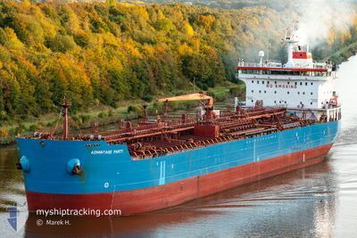
CARIA KA
Oil/Chemical Tanker
Current Trip
RKZP
| Time Travelled | 20 days |
|---|---|
| Remaining Time | --- |
| Distance Travelled | 520.74 nm |
| Remaining Distance | --- |
| AVG Speed | 8.7 Knopen |
| MAX Speed | 14.9 Knopen |
| AVG Wind | 9.9 knots |
| MAX Wind | 27.8 knots |
| MIN Temp | 9.7°C / 49.46°F |
| MAX Temp | 21.8°C / 71.24°F |
| Diepgang | 6.5 M |
| Positie ontvangen | 5 d geleden |
Current Position
| Lengtegraad | 29.75191° |
|---|---|
| Breedtegraat | 41.46483° |
| Status | Under way using engine |
| Snelheid | 14.3 Knopen |
| Koers | 100.8° |
| Gebied | Black Sea |
| Station | T-AIS |
| Positie ontvangen | 5 d geleden |
Info
Information
The current position of CARIA KA is in Black Sea with coordinates 41.46483° / 29.75191° as reported on 2024-04-24 06:42 by AIS to our vessel tracker app. The vessel's current speed is 14.3 Knopen
The vessel CARIA KA (IMO: 9327360, MMSI: 636023467) is a Oil/Chemical Tanker that was built in 2006 ( 18 Jaar oud ). It's sailing under the flag of [LR] Liberia.
In this page you can find informations about the vessels current position, last detected port calls, and current voyage information. If the vessels is not in coverage by AIS you will find the latest position.
The current position of CARIA KA is detected by our AIS receivers and we are not responsible for the reliability of the data. The last position was recorded while the vessel was in Coverage by the Ais receivers of our vessel tracking app.
The current draught of CARIA KA as reported by AIS is 6.5 meters
Weather
| Temperature | 13.6°C / 56.48°F |
|---|---|
| Wind Speed | 11 knots |
| Direction | 287° WNW |
| Pressure | 1020.3 hPa |
| Humidity | 93.6 % |
| Cloud Coverage | 100 % |
Featured Company
Events
| Tijd | Evenement | Details | Positie / Bestemming | Info |
|---|---|---|---|---|
| 2024-04-25 04:57 | Stop beweging | 3.89 nm, South of SINOP |
41.95757 / 35.13903
RKZP
|
Snelheid: 0.3 kn Koers: 39° |
| 2024-04-24 06:51 | Status Changed | Default Under way using engine |
41.45869 / 29.79424
RKZP
|
Snelheid: 14.3 kn Koers: 100.8° |
| 2024-04-24 06:42 | Status Changed | Under way using engine Default |
41.46483 / 29.75191
RKZP
|
Snelheid: 13.6 kn Koers: 43° |
| 2024-04-24 06:42 | Buitenbereik |
41.46483 / 29.75191
Black Sea
RKZP
|
Snelheid: 14.3 kn Koers: 100.8° |
|
| 2024-04-24 05:50 | Status Changed | Default Under way using engine |
41.35386 / 29.55598
RKZP
|
Snelheid: 12.7 kn Koers: 43.6° |
| 2024-04-24 05:29 | Status Changed | Under way using engine Default |
41.32062 / 29.47343
RKZP
|
Snelheid: 12.5 kn Koers: 71° |
| 2024-04-24 05:03 | Status Changed | Default Under way using engine |
41.29351 / 29.36660
RKZP
|
Snelheid: 13.8 kn Koers: 71.9° |
| 2024-04-24 04:25 | Status Changed | Under way using engine Default |
41.25050 / 29.18221
RKZP
|
Snelheid: 13.2 kn Koers: 38° |
| 2024-04-24 04:18 | Status Changed | Default Under way using engine |
41.24091 / 29.15288
RKZP
|
Snelheid: 13.2 kn Koers: 37.9° |
| 2024-04-24 04:15 | Wijzig zee gebeid | Turkish part of the Black Sea Turkish part of the Sea of Marmara |
41.23302 / 29.14467
Black Sea
RKZP
|
Snelheid: 13.2 kn Koers: 37.9° |