
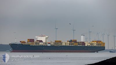
CAPE SOUNIO
Cargo
Current Trip
| Time Travelled | 1 day |
|---|---|
| Remaining Time | 1 day |
| Distance Travelled | 172.56 nm |
| Remaining Distance | 573.13 nm |
| AVG Speed | 13.6 Knopen |
| MAX Speed | 17.3 Knopen |
| AVG Wind | 5.3 knots |
| MAX Wind | 9.9 knots |
| MIN Temp | 21.7°C / 71.06°F |
| MAX Temp | 25.2°C / 77.36°F |
| Diepgang | 9.4 M |
| Positie ontvangen | 4 h, 49 m geleden |
Current Position
| Lengtegraad | -46.54086° |
|---|---|
| Breedtegraat | -24.35317° |
| Status | Under way using engine |
| Snelheid | 0.6 Knopen |
| Koers | 75° |
| Gebied | South Atlantic Ocean |
| Station | T-AIS |
| Positie ontvangen | 4 h, 49 m geleden |
Info
Information
The current position of CAPE SOUNIO is in South Atlantic Ocean with coordinates -24.35317° / -46.54086° as reported on 2024-05-04 20:26 by AIS to our vessel tracker app. The vessel's current speed is 0.6 Knopen and is heading at the port of RIO GRANDE. The estimated time of arrival as calculated by MyShipTracking vessel tracking app is 2024-05-06 18:29 LT
The vessel CAPE SOUNIO (IMO: 9727625, MMSI: 248089000) is a Cargo It's sailing under the flag of [MT] Malta.
In this page you can find informations about the vessels current position, last detected port calls, and current voyage information. If the vessels is not in coverage by AIS you will find the latest position.
The current position of CAPE SOUNIO is detected by our AIS receivers and we are not responsible for the reliability of the data. The last position was recorded while the vessel was in Coverage by the Ais receivers of our vessel tracking app.
The current draught of CAPE SOUNIO as reported by AIS is 9.4 meters
Weather
| Temperature | 24.7°C / 76.46°F |
|---|---|
| Wind Speed | 9 knots |
| Direction | 66° ENE |
| Pressure | 1015.8 hPa |
| Humidity | 87.2 % |
| Cloud Coverage | 3 % |
Featured Company
Last Port Calls
| Port | Arrival | Departure | Time In Port |
|---|---|---|---|
| 2024-05-02 20:51 | 2024-05-03 21:18 | 1 d | |
| 2024-05-02 01:10 | 2024-05-02 10:40 | 9 h | |
| 2024-04-23 10:31 | 2024-04-25 04:51 | 1 d | |
| 2024-04-11 18:34 | 2024-04-12 14:23 | 19 h | |
| 2024-04-08 20:30 | 2024-04-08 20:46 | 15 m | |
| 2024-03-17 09:34 | 2024-03-19 05:56 | 1 d | |
| 2024-03-09 22:46 | 2024-03-10 07:41 | 8 h |
Last Trips
| Origin | Departure | Destination | Arrival | Distance | |
|---|---|---|---|---|---|
| 2024-05-02 07:40 | 2024-05-02 17:51 | 108.04 nm | |||
| 2024-04-25 01:51 | 2024-05-01 22:10 | 916.57 nm | |||
| 2024-04-12 11:23 | 2024-04-23 07:31 | 1494.56 nm | |||
| 2024-04-08 17:46 | 2024-04-11 15:34 | 188.95 nm | |||
| 2024-03-19 13:56 | 2024-04-08 17:30 | 9234.66 nm | |||
| 2024-03-10 15:41 | 2024-03-17 17:34 | 1489.78 nm | |||
| 2024-02-29 04:16 | 2024-03-10 06:46 | 1487.80 nm |
Events
| Tijd | Evenement | Details | Positie / Bestemming | Info |
|---|---|---|---|---|
| 2024-05-04 23:42 | Stop beweging |
-24.50643 / -46.55316
BRRIG
|
Snelheid: 0.3 kn Koers: 186° |
|
| 2024-05-04 20:30 | Status Changed | Default Under way using engine |
-24.35259 / -46.54083
BRRIG
|
Snelheid: 0.6 kn Koers: 75° |
| 2024-05-04 20:26 | Buitenbereik |
-24.35317 / -46.54086
South Atlantic Ocean
|
Snelheid: 0.6 kn Koers: 2.6° |
|
| 2024-05-04 20:25 | Status Changed | Under way using engine Default |
-24.35320 / -46.54086
BRRIG
|
Snelheid: 0.6 kn Koers: 33° |
| 2024-05-04 20:25 | Binnenbereik |
-24.35317 / -46.54086
South Atlantic Ocean
|
Snelheid: 0.6 kn Koers: 2.6° |
|
| 2024-05-04 19:07 | Status Changed | Default Under way using engine |
-24.36740 / -46.54522
BRRIG
|
Snelheid: 0.9 kn Koers: 3° |
| 2024-05-04 19:01 | Buitenbereik |
-24.36870 / -46.54557
South Atlantic Ocean
|
Snelheid: 0.9 kn Koers: 5.8° |
|
| 2024-05-04 19:00 | Status Changed | Under way using engine Default |
-24.36887 / -46.54560
BRRIG
|
Snelheid: 1 kn Koers: 1° |
| 2024-05-04 19:00 | Binnenbereik |
-24.36870 / -46.54557
South Atlantic Ocean
|
Snelheid: 0.9 kn Koers: 5.8° |
|
| 2024-05-04 11:57 | Start beweging | 19.47 nm, South East of ITANHAEM |
-24.34978 / -46.48663
BRRIG
|
Snelheid: 3.6 kn Koers: 171° |