
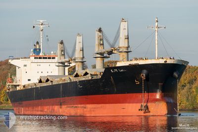
CAPE GULL
Bulk Carrier
Current Trip
BRREC
| Time Travelled | 21 days |
|---|---|
| Remaining Time | --- |
| Distance Travelled | 5770.51 nm |
| Remaining Distance | --- |
| AVG Speed | 11.1 Knopen |
| MAX Speed | 14 Knopen |
| AVG Wind | 15.4 knots |
| MAX Wind | 37.6 knots |
| MIN Temp | -4.1°C / 24.62°F |
| MAX Temp | 29.2°C / 84.56°F |
| Diepgang | 10.5 M |
| Positie ontvangen | 5 m geleden |
Current Position
| Lengtegraad | -34.81068° |
|---|---|
| Breedtegraat | -8.08834° |
| Status | At anchor |
| Snelheid | 0.5 Knopen |
| Koers | 142° |
| Gebied | South Atlantic Ocean |
| Station | T-AIS |
| Positie ontvangen | 5 m geleden |
Info
Information
The current position of CAPE GULL is in South Atlantic Ocean with coordinates -8.08834° / -34.81068° as reported on 2024-04-29 05:22 by AIS to our vessel tracker app. The vessel's current speed is 0.5 Knopen
The vessel CAPE GULL (IMO: 9674804, MMSI: 636020522) is a Bulk Carrier that was built in 2013 ( 11 Jaar oud ). It's sailing under the flag of [LR] Liberia.
In this page you can find informations about the vessels current position, last detected port calls, and current voyage information. If the vessels is not in coverage by AIS you will find the latest position.
The current position of CAPE GULL is detected by our AIS receivers and we are not responsible for the reliability of the data. The last position was recorded while the vessel was in Coverage by the Ais receivers of our vessel tracking app.
The current draught of CAPE GULL as reported by AIS is 10.5 meters
Weather
| Temperature | 27.4°C / 81.32°F |
|---|---|
| Wind Speed | 10 knots |
| Direction | 138° SE |
| Pressure | 1010.3 hPa |
| Humidity | 81.3 % |
| Cloud Coverage | 100 % |
Featured Company
Events
| Tijd | Evenement | Details | Positie / Bestemming | Info |
|---|---|---|---|---|
| 2024-04-29 05:22 | Status Changed | At anchor Default |
-8.08834 / -34.81068
BRREC
|
Snelheid: 0.3 kn Koers: 139° |
| 2024-04-29 04:46 | Status Changed | Default At anchor |
-8.08846 / -34.81070
BRREC
|
Snelheid: 0.4 kn Koers: 134° |
| 2024-04-29 04:43 | Status Changed | At anchor Default |
-8.08847 / -34.81078
BRREC
|
Snelheid: 0.4 kn Koers: 136° |
| 2024-04-29 04:31 | Status Changed | Default At anchor |
-8.08849 / -34.81084
BRREC
|
Snelheid: 0.1 kn Koers: 138° |
| 2024-04-29 04:22 | Status Changed | At anchor Default |
-8.08848 / -34.81083
BRREC
|
Snelheid: 0.3 kn Koers: 135° |
| 2024-04-29 04:16 | Status Changed | Default At anchor |
-8.08847 / -34.81083
BRREC
|
Snelheid: 0.2 kn Koers: 142° |
| 2024-04-29 01:00 | Status Changed | At anchor Default |
-8.08873 / -34.81112
BRREC
|
Snelheid: Koers: 119° |
| 2024-04-29 00:23 | Status Changed | Default At anchor |
-8.08871 / -34.81121
BRREC
|
Snelheid: 0.3 kn Koers: 127° |
| 2024-04-28 23:56 | Status Changed | At anchor Default |
-8.08861 / -34.81109
BRREC
|
Snelheid: 0.1 kn Koers: 120° |
| 2024-04-28 23:47 | Status Changed | Default At anchor |
-8.08880 / -34.81120
BRREC
|
Snelheid: 0.1 kn Koers: 130° |