

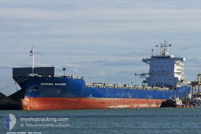
BUXMELODY
Container Ship

Current Trip
| Time Travelled | 16 h, 4 mins |
|---|---|
| Remaining Time | 2 days |
| Distance Travelled | 247.34 nm |
| Remaining Distance | 1219.19 nm |
| AVG Speed | 15.4 Knopen |
| MAX Speed | 17.5 Knopen |
| AVG Wind | 10.7 knots |
| MAX Wind | 20.7 knots |
| MIN Temp | -0.8°C / 30.56°F |
| MAX Temp | 0.2°C / 32.36°F |
| Diepgang | 10 M |
| Positie ontvangen | 16 d geleden |
Current Position
| Lengtegraad | --- |
|---|---|
| Breedtegraat | --- |
| Status | Under way using engine |
| Snelheid | 13.6 Knopen |
| Koers | 155.4° |
| Gebied | South China Sea |
| Station | T-AIS |
| Positie ontvangen | 16 d geleden |
Information
The current position of BUXMELODY is in South China Sea with coordinates 22.26650° / 114.10750° as reported on 2025-02-02 11:45 by AIS to our vessel tracker app. The vessel's current speed is 13.6 Knopen and is heading at the port of SHEKOU. The estimated time of arrival as calculated by MyShipTracking vessel tracking app is 2025-02-22 05:23 LT
The vessel BUXMELODY (IMO: 9377145, MMSI: 636018715) is a Container Ship that was built in 2008 ( 17 Jaar oud ). It's sailing under the flag of [LR] Liberia.
In this page you can find informations about the vessels current position, last detected port calls, and current voyage information. If the vessels is not in coverage by AIS you will find the latest position.
The current position of BUXMELODY is detected by our AIS receivers and we are not responsible for the reliability of the data. The last position was recorded while the vessel was in Coverage by the Ais receivers of our vessel tracking app.
The current draught of BUXMELODY as reported by AIS is 10 meters
Weather
| Temperature | 0.1°C / 32.18°F |
|---|---|
| Wind Speed | 21 knots |
| Direction | 348° NNW |
| Pressure | 1031.5 hPa |
| Humidity | 44.5 % |
| Cloud Coverage | --- |


Featured Company
Last Port Calls
| Port | Arrival | Departure | Time In Port |
|---|---|---|---|
| 2025-02-17 22:37 | 2025-02-18 13:33 | 14 h | |
| 2025-02-02 10:40 | 2025-02-02 19:26 | 8 h | |
| 2025-01-29 19:37 | 2025-01-30 11:33 | 15 h | |
| 2025-01-27 22:42 | 2025-01-28 13:37 | 14 h | |
| 2025-01-25 02:00 | 2025-01-25 17:21 | 15 h | |
| 2025-01-20 18:21 | 2025-01-21 14:17 | 19 h | |
| 2025-01-19 03:06 | 2025-01-19 16:03 | 12 h | |
| 2025-01-08 20:37 | 2025-01-09 03:21 | 6 h | |
| 2025-01-06 18:51 | 2025-01-07 07:48 | 12 h | |
| 2025-01-02 00:52 | 2025-01-02 23:53 | 23 h |
Last Trips
| Origin | Departure | Destination | Arrival | Distance | |
|---|---|---|---|---|---|
| 2025-02-02 19:26 | 2025-02-17 22:37 | 3400.74 nm | |||
| 2025-01-30 11:33 | 2025-02-02 10:40 | 1137.44 nm | |||
| 2025-01-28 13:37 | 2025-01-29 19:37 | 430.04 nm | |||
| 2025-01-25 17:21 | 2025-01-27 22:42 | 550.34 nm | |||
| 2025-01-21 14:17 | 2025-01-25 02:00 | 1253.77 nm | |||
| 2025-01-19 16:03 | 2025-01-20 18:21 | 78.63 nm | |||
| 2025-01-09 03:21 | 2025-01-19 03:06 | 2312.54 nm | |||
| 2025-01-07 07:48 | 2025-01-08 20:37 | 59.70 nm | |||
| 2025-01-02 23:53 | 2025-01-06 18:51 | 1143.43 nm | |||
| 2024-12-31 01:21 | 2025-01-02 00:52 | 436.18 nm |
Events
| Tijd | Evenement | Details | Positie / Bestemming | Info |
|---|---|---|---|---|
| 2025-02-18 05:33 | Vertrekhaven |
|
38.95600 / 117.87950
CNSHK
|
Snelheid: 9.9 kn Koers: 100° |
| 2025-02-18 05:01 | Start beweging |
38.97227 / 117.78047
[CN] TIANJIN
|
Snelheid: 3.4 kn Koers: 108° |
|
| 2025-02-17 14:37 | Stop beweging |
38.97463 / 117.78168
[CN] TIANJIN
|
Snelheid: 0.1 kn Koers: 292° |
|
| 2025-02-17 14:37 | Aankomsthaven |
|
38.97463 / 117.78168
[CN] TIANJIN
|
Snelheid: 3.9 kn Koers: 281° |
| 2025-02-16 16:37 | Start beweging | 9.42 nm, North East of DALIAN |
39.01129 / 121.87945
CNSHK
|
Snelheid: 8.2 kn Koers: 106° |
| 2025-02-16 09:07 | Stop beweging | 9.1 nm, North East of DALIAN |
39.00956 / 121.87298
CNSHK
|
Snelheid: Koers: 304° |
| 2025-02-12 15:13 | Start beweging | 7.49 nm, South of HONG KONG |
22.16517 / 114.17467
CNSHK
|
Snelheid: 4.3 kn Koers: 135° |
| 2025-02-12 10:17 | Stop beweging | 7.36 nm, South of HONG KONG |
22.16750 / 114.17200
CNSHK
|
Snelheid: 0.3 kn Koers: 122° |
| 2025-02-09 08:25 | Start beweging | 16.67 nm, North West of PHU MY |
10.75717 / 106.79250
CNSHK
|
Snelheid: 4.2 kn Koers: 239° |