
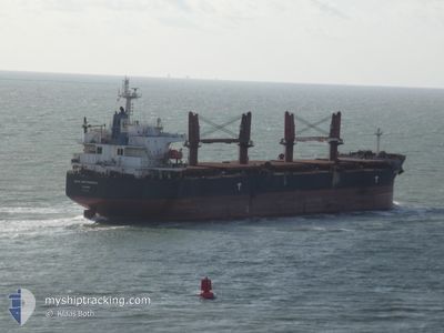
BULK INDEPENDENCE
Bulk Carrier
Current Trip
| Time Travelled | 10 days |
|---|---|
| Remaining Time | --- |
| Distance Travelled | 2535.95 nm |
| Remaining Distance | --- |
| AVG Speed | 11.1 Knopen |
| MAX Speed | 14.5 Knopen |
| AVG Wind | 12.5 knots |
| MAX Wind | 25.1 knots |
| MIN Temp | 13.2°C / 55.76°F |
| MAX Temp | 20.8°C / 69.44°F |
| Diepgang | 11.2 M |
| Positie ontvangen | 13 h, 13 m geleden |
Current Position
| Lengtegraad | -9.49407° |
|---|---|
| Breedtegraat | 43.74235° |
| Status | Under way using engine |
| Snelheid | 11.8 Knopen |
| Koers | 20° |
| Gebied | North Atlantic Ocean |
| Station | T-AIS |
| Positie ontvangen | 13 h, 13 m geleden |
Info
Information
The current position of BULK INDEPENDENCE is in North Atlantic Ocean with coordinates 43.74235° / -9.49407° as reported on 2024-05-21 13:44 by AIS to our vessel tracker app. The vessel's current speed is 11.8 Knopen
The vessel BULK INDEPENDENCE (IMO: 9374002, MMSI: 373904000) is a Bulk Carrier that was built in 2008 ( 16 Jaar oud ). It's sailing under the flag of [PA] Panama.
In this page you can find informations about the vessels current position, last detected port calls, and current voyage information. If the vessels is not in coverage by AIS you will find the latest position.
The current position of BULK INDEPENDENCE is detected by our AIS receivers and we are not responsible for the reliability of the data. The last position was recorded while the vessel was in Coverage by the Ais receivers of our vessel tracking app.
The current draught of BULK INDEPENDENCE as reported by AIS is 11.2 meters
Weather
| Temperature | 13.7°C / 56.66°F |
|---|---|
| Wind Speed | 9 knots |
| Direction | 240° WSW |
| Pressure | 1014.3 hPa |
| Humidity | 82.6 % |
| Cloud Coverage | 100 % |
Featured Company
Last Port Calls
| Port | Arrival | Departure | Time In Port |
|---|---|---|---|
| 2024-05-08 11:52 | 2024-05-11 21:56 | 3 d | |
| 2024-04-28 03:26 | 2024-04-28 12:41 | 9 h | |
| 2024-04-23 16:47 | 2024-04-27 12:18 | 3 d | |
| 2024-04-22 22:47 | 2024-04-23 13:23 | 14 h | |
| 2024-03-29 07:10 | 2024-04-03 10:42 | 5 d | |
| 2024-03-22 13:31 | 2024-03-26 16:59 | 4 d |
Most Visited Ports (Last year)
| Port | Arrivals | |
|---|---|---|
| 3 | ||
| 2 | ||
| 2 | ||
| 1 | ||
| 1 | ||
| 1 |
Last Trips
| Origin | Departure | Destination | Arrival | Distance | |
|---|---|---|---|---|---|
| 2024-04-27 14:18 | 2024-05-08 13:52 | 383.77 nm | |||
| 2024-04-27 14:18 | 2024-04-28 05:26 | 15.14 nm | |||
| 2024-04-03 07:42 | 2024-04-23 18:47 | 5154.06 nm | |||
| 2024-04-03 07:42 | 2024-04-23 00:47 | 5061.87 nm | |||
| 2024-03-26 14:29 | 2024-03-29 04:10 | 769.58 nm | |||
| 2024-02-18 22:23 | 2024-03-22 11:01 | 6046.61 nm |
Events
| Tijd | Evenement | Details | Positie / Bestemming | Info |
|---|---|---|---|---|
| 2024-05-21 13:57 | Status Changed | Default Under way using engine |
43.78072 / -9.47608
GB PTB
|
Snelheid: 11.8 kn Koers: 20° |
| 2024-05-21 13:44 | Buitenbereik |
43.74235 / -9.49407
North Atlantic Ocean
GB PTB
|
Snelheid: 11.8 kn Koers: 20° |
|
| 2024-05-21 13:32 | Status Changed | Under way using engine Default |
43.70493 / -9.51228
GB PTB
|
Snelheid: 12.3 kn Koers: 19° |
| 2024-05-21 13:10 | Status Changed | Default Under way using engine |
43.63388 / -9.54692
GB PTB
|
Snelheid: 12.4 kn Koers: 19° |
| 2024-05-21 12:45 | Status Changed | Under way using engine Default |
43.55353 / -9.58223
GB PTB
|
Snelheid: 12.3 kn Koers: 16° |
| 2024-05-21 12:10 | Status Changed | Default Under way using engine |
43.43922 / -9.63277
GB PTB
|
Snelheid: 11.7 kn Koers: 25° |
| 2024-05-21 11:56 | Wijzig zee gebeid | Spanish part of the North Atlantic Ocean Portuguese part of the North Atlantic Ocean |
43.39745 / -9.65635
North Atlantic Ocean
GB PTB
|
Snelheid: 11.7 kn Koers: 25° |
| 2024-05-21 11:54 | Status Changed | Under way using engine Default |
43.39167 / -9.66017
GB PTB
|
Snelheid: 11.9 kn Koers: 25° |
| 2024-05-21 11:38 | Binnenbereik |
43.39745 / -9.65635
North Atlantic Ocean
GB PTB
|
Snelheid: 11.7 kn Koers: 25° |
|
| 2024-05-20 18:11 | Buitenbereik |
39.98263 / -9.85417
North Atlantic Ocean
GB PTB
|
Snelheid: 11.3 kn Koers: 359° |