
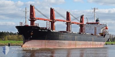
BSL CALYPSO
Bulk Carrier
Current Trip
| Time Travelled | 8 days |
|---|---|
| Remaining Time | --- |
| Distance Travelled | 587.36 nm |
| Remaining Distance | 1.83 nm |
| AVG Speed | 10.9 Knopen |
| MAX Speed | 19.5 Knopen |
| AVG Wind | 11.3 knots |
| MAX Wind | 32.7 knots |
| MIN Temp | 12.6°C / 54.68°F |
| MAX Temp | 22.8°C / 73.04°F |
| Diepgang | 5.2 M |
| Positie ontvangen | 8 d geleden |
Current Position
| Lengtegraad | 29.68284° |
|---|---|
| Breedtegraat | 41.40926° |
| Status | Under way using engine |
| Snelheid | 12 Knopen |
| Koers | 67.8° |
| Gebied | Black Sea |
| Station | T-AIS |
| Positie ontvangen | 8 d geleden |
Info
Information
The current position of BSL CALYPSO is in Black Sea with coordinates 41.40926° / 29.68284° as reported on 2024-05-07 23:26 by AIS to our vessel tracker app. The vessel's current speed is 12 Knopen and is heading at the port of POTI. The estimated time of arrival as calculated by MyShipTracking vessel tracking app is 2024-05-02 01:30 LT
The vessel BSL CALYPSO (IMO: 9191448, MMSI: 314590000) is a Bulk Carrier that was built in 1999 ( 25 Jaar oud ). It's sailing under the flag of [BB] Barbados.
In this page you can find informations about the vessels current position, last detected port calls, and current voyage information. If the vessels is not in coverage by AIS you will find the latest position.
The current position of BSL CALYPSO is detected by our AIS receivers and we are not responsible for the reliability of the data. The last position was recorded while the vessel was in Coverage by the Ais receivers of our vessel tracking app.
The current draught of BSL CALYPSO as reported by AIS is 5.2 meters
Weather
| Temperature | 13°C / 55.4°F |
|---|---|
| Wind Speed | 7 knots |
| Direction | 84° E |
| Pressure | 1020.5 hPa |
| Humidity | 83.5 % |
| Cloud Coverage | 100 % |
Featured Company
Last Port Calls
| Port | Arrival | Departure | Time In Port |
|---|---|---|---|
| 2024-05-07 19:22 | 2024-05-07 20:57 | 1 h | |
| 2024-04-23 16:00 | 2024-04-28 19:22 | 5 d | |
| 2024-04-19 16:15 | |||
| 2024-03-22 09:42 | 2024-04-10 07:30 | 18 d | |
| 2024-03-01 06:37 |
Last Trips
| Origin | Departure | Destination | Arrival | Distance | |
|---|---|---|---|---|---|
| 2024-04-28 21:22 | 2024-05-07 22:22 | 811.21 nm | |||
| 2024-04-19 18:15 | 2024-04-23 18:00 | 18.12 nm | |||
| 2024-03-01 08:37 | 2024-03-22 11:42 | 686.67 nm |
Events
| Tijd | Evenement | Details | Positie / Bestemming | Info |
|---|---|---|---|---|
| 2024-05-10 02:16 | Stop beweging | 1.95 nm, West of POTI |
42.15938 / 41.60582
GEPTI
|
Snelheid: 0.2 kn Koers: -1° |
| 2024-05-07 23:44 | Status Changed | Default Under way using engine |
41.43216 / 29.75612
GEPTI
|
Snelheid: 12 kn Koers: 67.8° |
| 2024-05-07 23:26 | Buitenbereik |
41.40926 / 29.68284
Black Sea
|
Snelheid: 12 kn Koers: 67.8° |
|
| 2024-05-07 23:05 | Status Changed | Under way using engine Default |
41.38327 / 29.60002
GEPTI
|
Snelheid: 11.8 kn Koers: 67° |
| 2024-05-07 23:03 | Status Changed | Default Under way using engine |
41.38059 / 29.59137
GEPTI
|
Snelheid: 11.8 kn Koers: 67.8° |
| 2024-05-07 21:51 | Destination Changed | GEPTI TRIST |
41.29355 / 29.29537
GEPTI
|
Snelheid: 11.5 kn Koers: 71.2° |
| 2024-05-07 21:11 | Wijzig zee gebeid | Turkish part of the Black Sea Turkish part of the Sea of Marmara |
41.23344 / 29.15372
Black Sea
|
Snelheid: 11 kn Koers: 46.3° |
| 2024-05-07 20:57 | Vertrekhaven |
|
41.20459 / 29.11571
TRIST
|
Snelheid: 10.3 kn Koers: 57.7° |
| 2024-05-07 19:22 | Aankomsthaven |
|
41.00758 / 28.99845
[TR] ISTANBUL
|
Snelheid: 8.2 kn Koers: 1.8° |
| 2024-05-07 16:46 | Status Changed | Under way using engine Not under command |
40.75878 / 29.13568
TRIST
|
Snelheid: 4.3 kn Koers: 359.5° |