
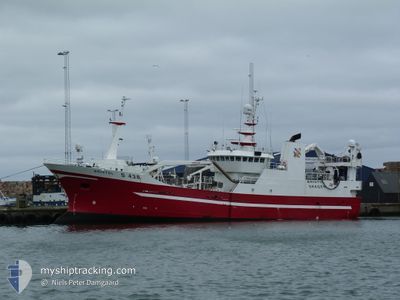
BRISTOL
Trawler
Current Trip
NORTH SEA
| Time Travelled | 8 days |
|---|---|
| Remaining Time | --- |
| Distance Travelled | 1159.52 nm |
| Remaining Distance | --- |
| AVG Speed | 7 Knopen |
| MAX Speed | 11.5 Knopen |
| AVG Wind | 15 knots |
| MAX Wind | 22.9 knots |
| MIN Temp | 10.5°C / 50.9°F |
| MAX Temp | 17.4°C / 63.32°F |
| Diepgang | 6.7 M |
| Positie ontvangen | 6 m geleden |
Current Position
| Lengtegraad | 5.70092° |
|---|---|
| Breedtegraat | 56.25611° |
| Status | Under way using engine |
| Snelheid | 5.3 Knopen |
| Koers | 33.4° |
| Gebied | North Sea |
| Station | T-AIS |
| Positie ontvangen | 6 m geleden |
Info
Information
The current position of BRISTOL is in North Sea with coordinates 56.25611° / 5.70092° as reported on 2024-05-21 02:35 by AIS to our vessel tracker app. The vessel's current speed is 5.3 Knopen
The vessel BRISTOL (IMO: 9160322, MMSI: 219022326) is a Trawler that was built in 1997 ( 27 Jaar oud ). It's sailing under the flag of [DK] Denmark.
In this page you can find informations about the vessels current position, last detected port calls, and current voyage information. If the vessels is not in coverage by AIS you will find the latest position.
The current position of BRISTOL is detected by our AIS receivers and we are not responsible for the reliability of the data. The last position was recorded while the vessel was in Coverage by the Ais receivers of our vessel tracking app.
The current draught of BRISTOL as reported by AIS is 6.7 meters
Weather
| Temperature | 13.8°C / 56.84°F |
|---|---|
| Wind Speed | 14 knots |
| Direction | 101° E |
| Pressure | 1015.1 hPa |
| Humidity | 86.4 % |
| Cloud Coverage | 3 % |
Featured Company
Last Port Calls
| Port | Arrival | Departure | Time In Port |
|---|---|---|---|
| 2024-05-11 20:49 | 2024-05-12 12:01 | 15 h | |
| 2024-04-24 04:01 | 2024-05-01 17:47 | 7 d | |
| 2024-04-12 05:05 | 2024-04-19 19:20 | 7 d | |
| 2024-04-07 20:54 | 2024-04-07 23:00 | 2 h | |
| 2024-03-22 10:45 | 2024-03-22 18:41 | 7 h | |
| 2024-03-14 23:09 | 2024-03-15 15:04 | 15 h |
Last Trips
| Origin | Departure | Destination | Arrival | Distance | |
|---|---|---|---|---|---|
| 2024-05-01 17:47 | 2024-05-11 20:49 | 998.86 nm | |||
| 2024-04-19 19:20 | 2024-04-24 04:01 | 421.22 nm | |||
| 2024-04-07 23:00 | 2024-04-12 05:05 | 565.34 nm | |||
| 2024-03-22 18:41 | 2024-04-07 20:54 | 78.82 nm | |||
| 2024-03-15 15:04 | 2024-03-22 10:45 | 78.92 nm | |||
| 2024-02-22 11:38 | 2024-03-14 23:09 | 79.01 nm |
Events
| Tijd | Evenement | Details | Positie / Bestemming | Info |
|---|---|---|---|---|
| 2024-05-20 21:04 | Gevonden in zee | Danish part of the North Sea |
55.40654 / 4.80019
North Sea
|
Snelheid: 10.8 kn Koers: 28.7° |
| 2024-05-20 19:07 | Wijzig zee gebeid | German part of the North Sea Danish part of the North Sea |
55.36085 / 4.85653
North Sea
|
Snelheid: 7.2 kn Koers: 185.2° |
| 2024-05-20 18:58 | Wijzig zee gebeid | Danish part of the North Sea German part of the North Sea |
55.35831 / 4.87143
North Sea
|
Snelheid: 6.6 kn Koers: 321.1° |
| 2024-05-20 17:31 | Wijzig zee gebeid | German part of the North Sea Danish part of the North Sea |
55.26926 / 5.08863
North Sea
|
Snelheid: 8.4 kn Koers: 186.7° |
| 2024-05-20 03:15 | Start beweging |
56.28784 / 5.75466
NORTH SEA
|
Snelheid: 5.3 kn Koers: 58.6° |
|
| 2024-05-20 01:13 | Stop beweging |
56.30390 / 5.75552
NORTH SEA
|
Snelheid: 0.3 kn Koers: 23° |
|
| 2024-05-19 20:02 | Destination Changed | NORTH SEA FISHING MIN CPA 0.7 |
56.47360 / 5.90672
NORTH SEA
|
Snelheid: 8 kn Koers: 11.5° |
| 2024-05-19 19:56 | Status Changed | Under way using engine Engaged in Fishing |
56.46130 / 5.90304
FISHING MIN CPA 0.7
|
Snelheid: 7.8 kn Koers: 10.4° |
| 2024-05-19 03:17 | Start beweging |
56.40763 / 5.73152
FISHING MIN CPA 0.7
|
Snelheid: 5 kn Koers: 89.1° |
|
| 2024-05-18 20:35 | Stop beweging |
56.41166 / 5.85218
FISHING MIN CPA 0.7
|
Snelheid: 0.3 kn Koers: 82° |